Download
3D Flyover
Add to list
More
862.0 km
~34 days
16427 m
Multi-Day
“Circling San Francisco Bay, the Bay Area Ridge Trail unveils panoramic vistas and historic sites amidst diverse terrains.”
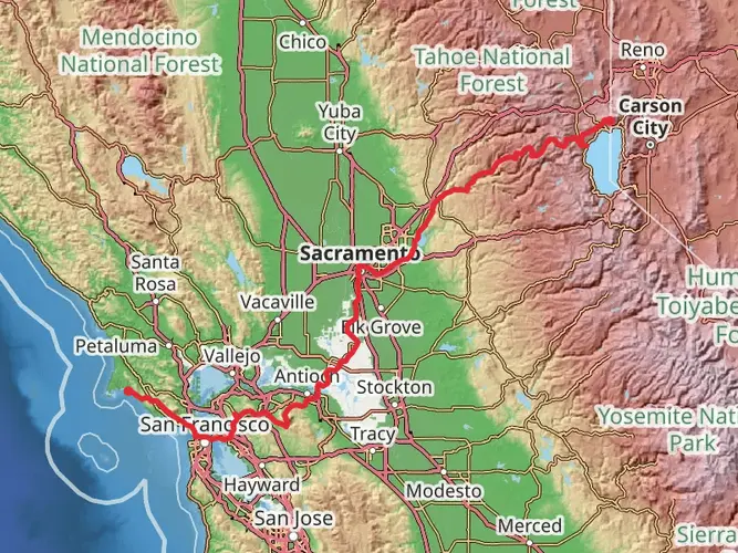
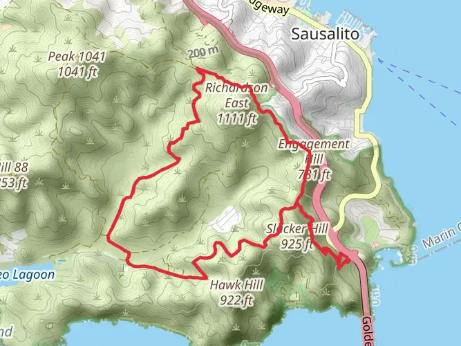
Spanning approximately 536 miles (862 kilometers) with an elevation gain of around 53,800 feet (16,400 meters), the Bay Area Ridge Trail encircles the San Francisco Bay, offering a diverse and scenic experience for hikers. This loop trail, with a medium difficulty rating, is designed to connect the ridgelines overlooking the Bay Area, providing panoramic views and a variety of landscapes.
Getting to the Trailhead
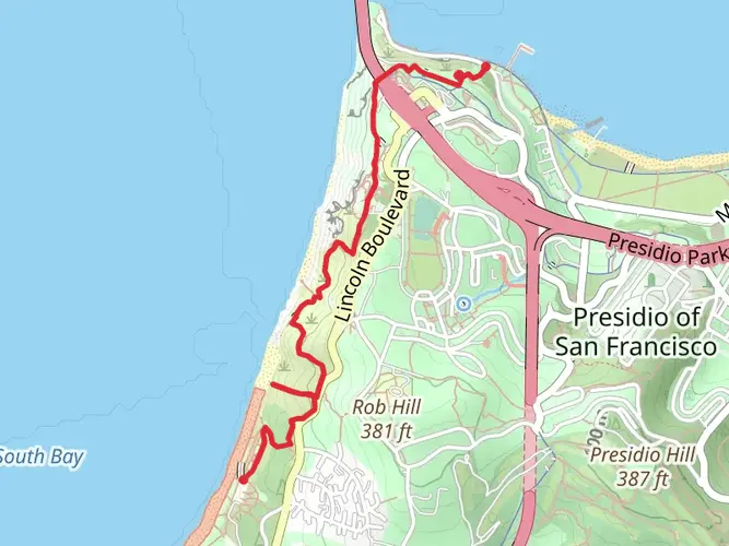
The trailhead is conveniently located near San Francisco County, California. For those opting for public transportation, various bus and train services run close to the starting points of the trail, which can be accessed from multiple locations due to its loop nature. If driving, there are several access points with parking available; the most notable being near the Golden Gate Bridge, a significant landmark and starting point for many hikers.
Navigating the Trail
Hikers can utilize the HiiKER app to navigate the trail, ensuring they stay on the correct path and can plan their journey with up-to-date maps and waypoints. The app also provides information on the various segments of the trail, as the entire loop is a commitment that typically takes weeks to complete.
Landmarks and Scenery
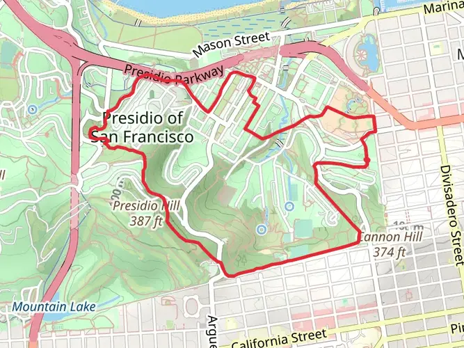
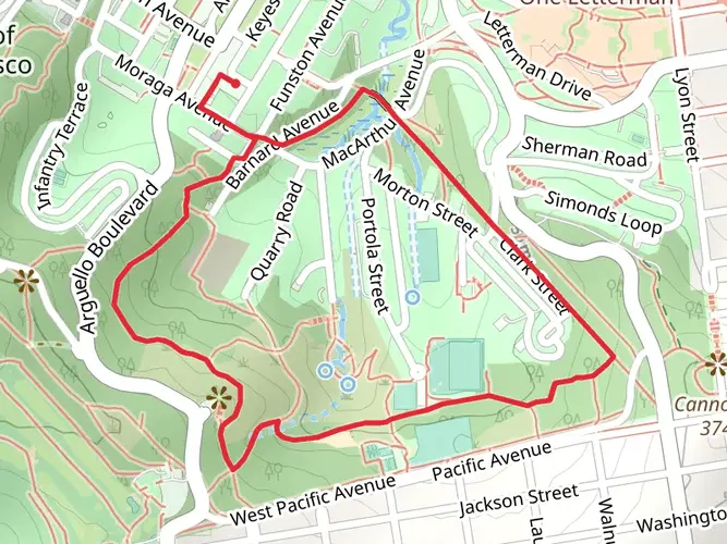
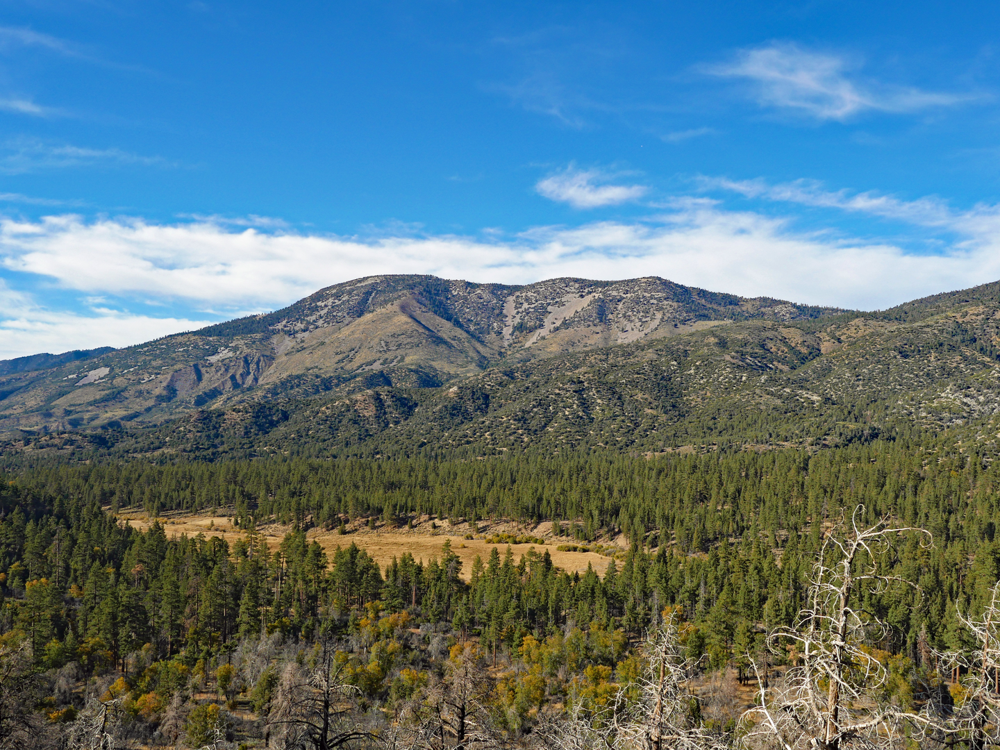
The Bay Area Ridge Trail traverses through several counties and landscapes, including redwood forests, oak woodlands, and coastal scrub. Notable landmarks along the route include Mount Tamalpais, with its breathtaking views of the Pacific Ocean, and the Presidio of San Francisco, a park with rich military history.
Wildlife and Nature
The trail offers opportunities to observe diverse wildlife, such as deer, coyotes, and a wide array of bird species. The flora along the trail is equally varied, with wildflowers blooming in the spring and the ever-present California bay laurel trees.
Historical Significance
The region is steeped in history, from Native American heritage to Spanish missions and the Gold Rush era. Hikers will encounter historical sites like the Mission San Francisco de Asís, one of the oldest surviving structures in San Francisco, and remnants of old military installations.
Trail Segments and Elevation
The trail's elevation gain is spread out across its length, with some segments being more challenging than others. For example, the section leading up to Mount Diablo includes a significant climb, contributing to the overall elevation gain. Hikers can tackle the trail in segments, choosing portions that match their fitness level and interests.
Preparation and Planning
Given the trail's length and varied terrain, hikers should plan their trip carefully, considering water sources, camping spots, and resupply points. Weather can change rapidly, so layered clothing is recommended, along with standard hiking gear.
Access and Exit Points
Due to the trail's loop design, there are numerous access and exit points, allowing hikers to customize their journey. This flexibility makes it possible to hike the entire trail or enjoy shorter, day-long segments.
Conclusion
The Bay Area Ridge Trail is a testament to the beauty and diversity of the San Francisco Bay Area, offering a unique experience for hikers of all levels. With careful planning and the right tools for navigation, such as the HiiKER app, adventurers can immerse themselves in the natural and historical richness of this extensive trail network.

What to expect?
Activity types
Comments and Reviews
User comments, reviews and discussions about the Bay Area Ridge Trail, California.
4.71
average rating out of 5
7 rating(s)