Download
Preview
Add to list
More
2624.1 km
~161 days
55222 m
Multi-Day
“Embark on a transformative 1,650-mile trek across California's diverse, history-rich terrains of the Pacific Crest Trail.”
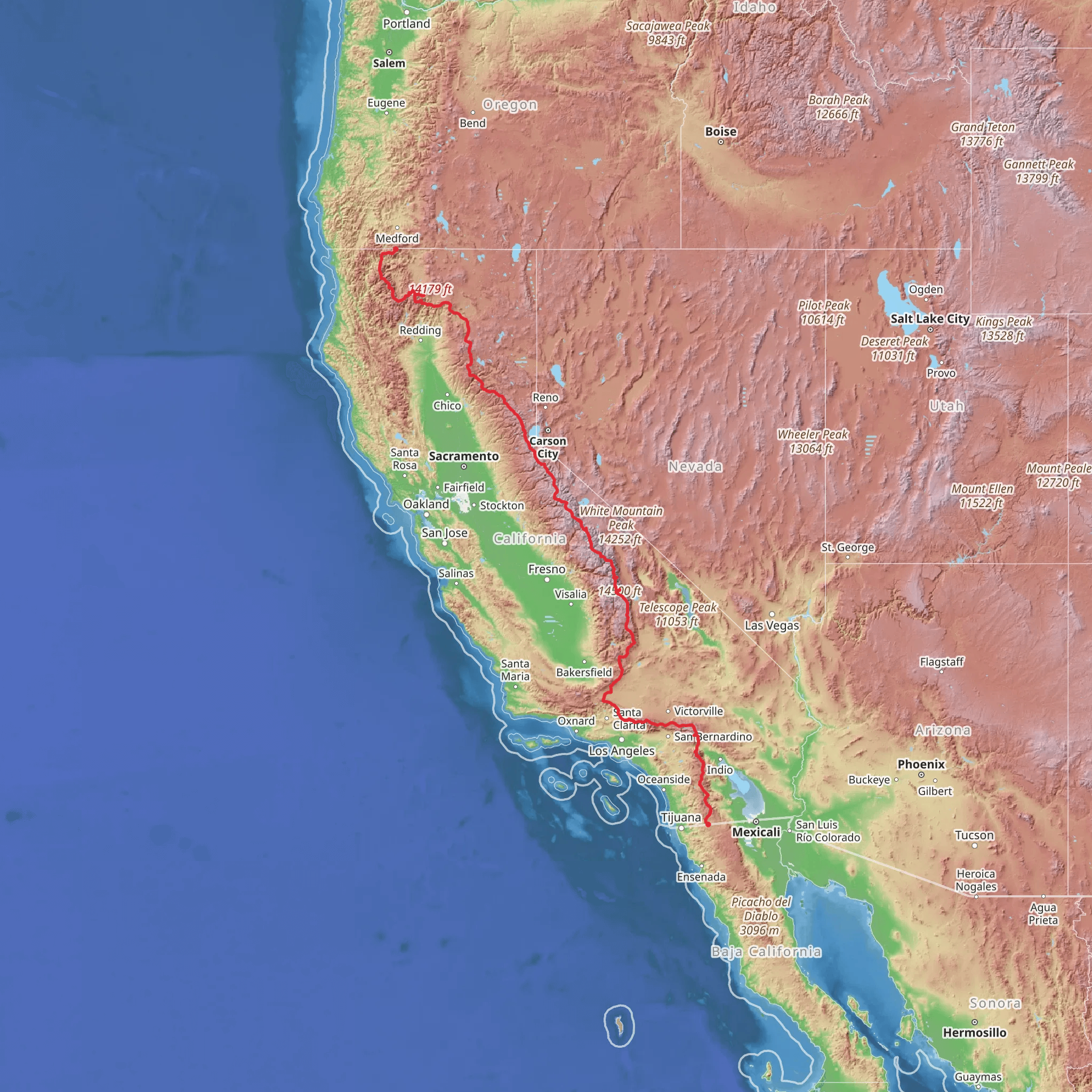
Embarking on the Pacific Crest Trail (PCT) in California presents an epic journey that spans approximately 1,650 miles (2,655 kilometers) and ascends to a cumulative elevation gain of around 181,000 feet (55,200 meters). This long-distance hike traverses diverse landscapes, from the arid deserts of Southern California to the snow-capped peaks of the Sierra Nevada, and finally through the volcanic terrain of the Cascade Range.
Getting to the Trailhead
The southern terminus of the PCT is located near the small town of Campo, in San Diego County, close to the U.S.-Mexico border. To reach the starting point, hikers can drive to Campo and park at the trailhead, or use public transportation by taking a bus from San Diego to the nearby community and then arranging a ride or walking the remaining distance to the trailhead.
Southern California: Desert and Foothills
The initial segment of the PCT winds through the arid landscapes of the Mojave and Colorado deserts, where water sources are scarce and temperatures can soar. Hikers should be well-prepared with ample water and sun protection. After approximately 700 miles (1,127 kilometers), the trail begins to ascend into the San Bernardino and San Jacinto mountain ranges, offering a reprieve from the desert heat and showcasing wildflower displays in the spring.
Sierra Nevada: High Altitude Challenges
As the trail enters the Sierra Nevada, hikers face the most physically demanding section, with significant elevation gains and losses. The trail reaches its highest point at Forester Pass, 13,153 feet (4,009 meters) above sea level. This section includes iconic landmarks such as Mount Whitney, the tallest mountain in the contiguous United States, which is accessible via a side trail. Hikers will traverse through John Muir Wilderness, Sequoia and Kings Canyon National Parks, and Yosemite National Park, experiencing some of the most breathtaking alpine scenery in the country.
Northern California: Diverse Ecosystems
Continuing north, the PCT passes through the varied ecosystems of Northern California, including the volcanic landscapes of Lassen Volcanic National Park and the lush forests of the Klamath Mountains. This region is characterized by a mix of challenging climbs and descents, with the trail often weaving through remote areas far from civilization.
Wildlife and Nature
Throughout the journey, hikers may encounter a wide array of wildlife, including black bears, mountain lions, deer, and a variety of bird species. The trail also offers a chance to see unique plant life adapted to each of the distinct biomes it crosses.
Historical Significance
The PCT traverses areas rich in history, from ancient Native American trade routes to the 19th-century gold rush trails. Hikers walking these paths are following in the footsteps of countless generations who have relied on and revered these landscapes.
Navigation and Planning
Given the trail's length and complexity, thorough planning is essential. Hikers should consider using the HiiKER app for up-to-date trail information, navigation, and locating essential waypoints such as water sources, campsites, and resupply points.
Preparation and Safety
Due to the trail's difficulty and remote nature, hikers should be experienced in backcountry skills, first aid, and be prepared for rapid weather changes, especially in the high mountains. It's crucial to leave a detailed trip plan with someone at home and to check in regularly when possible.
The Pacific Crest Trail in California is a monumental trek that offers a lifetime of memories and challenges. Hikers who undertake this journey will experience some of the most stunning and diverse landscapes that the Golden State has to offer.
What to expect?
Activity types
Comments and Reviews
User comments, reviews and discussions about the Pacific Crest Trail - California, California.
5.0
average rating out of 5
3 rating(s)

