Download
3D Flyover
Add to list
More
4136.0 km
~184 days
166033 m
Multi-Day
“Embarking on the PCT promises a transformative odyssey through diverse terrains, challenging elevations, and breathtaking vistas.”
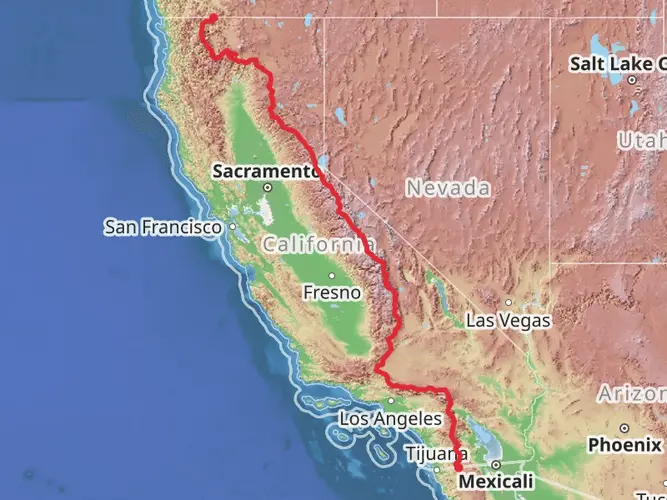
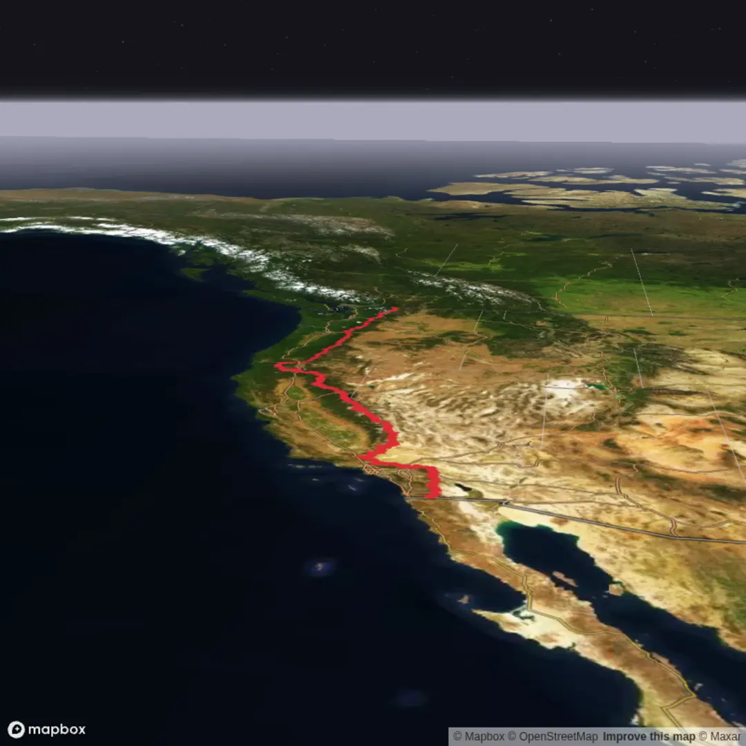
Spanning approximately 2,650 miles (4,265 kilometers) and with an elevation gain of around 264,000 feet (80,467 meters), the Pacific Crest Trail (PCT) is a monumental point-to-point trek that stretches from the U.S.-Mexico border near Campo, California, to the U.S.-Canada border at Manning Park in British Columbia. This long-distance hike traverses some of the most stunning landscapes in the United States, including 25 national forests and 7 national parks.
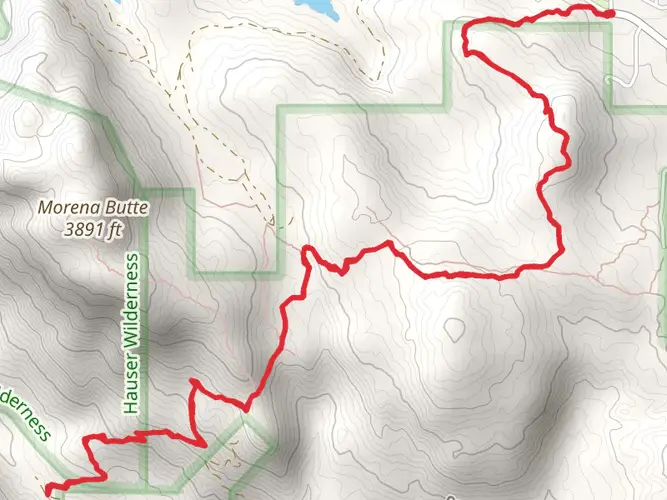
Starting the Journey The southern terminus of the PCT is located near Campo, in San Diego County, California. To reach the starting point, hikers can drive to the trailhead or use public transportation from San Diego to Campo, and then navigate the last few miles to the trailhead.
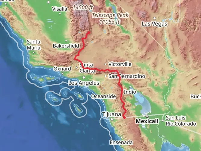
Southern California The initial segment of the PCT winds through the arid landscapes of Southern California, featuring desert terrain, chaparral, and the San Jacinto Mountains. Hikers will experience significant elevation changes as they ascend and descend various mountain passes. The trail offers a stark contrast between the desert floor and the cooler, forested highlands.
The Sierra Nevada As the trail progresses northward, it enters the Sierra Nevada, a majestic mountain range that is home to some of the most iconic sections of the PCT. This includes the John Muir Trail, which coincides with the PCT for about 160 miles (257 kilometers). Hikers will pass by landmarks such as Forester Pass, the highest point on the PCT at 13,153 feet (4,009 meters), and encounter the breathtaking beauty of Yosemite National Park.
Northern California Continuing through Northern California, the trail meanders through the Cascade Range, including the volcanic Mount Shasta and the serene beauty of Lassen Volcanic National Park. The terrain here is a mix of forested slopes and volcanic landscapes, with a rich diversity of flora and fauna.
Oregon In Oregon, the PCT's character shifts as it passes through more temperate rainforests, with a flatter profile compared to the steep climbs of the Sierra Nevada. Highlights include Crater Lake National Park, where the trail skirts the rim of the deepest lake in the United States, offering spectacular views.
Washington The final state on the PCT, Washington presents hikers with rugged wilderness, alpine meadows, and the challenging terrain of the Cascade Range. The trail culminates in the remote wilderness near the Canadian border, where hikers will find themselves surrounded by the pristine beauty of the North Cascades.
Wildlife and Nature Throughout the journey, hikers will encounter a diverse array of wildlife, including black bears, mountain lions, deer, and a variety of bird species. It's essential to be prepared for wildlife encounters and to practice Leave No Trace principles to minimize impact on these natural habitats.
Historical Significance The PCT traverses regions rich in history, from the indigenous peoples who first inhabited these lands to the early European settlers and gold prospectors. The trail itself was designated as one of the first National Scenic Trails in 1968, reflecting its cultural and natural importance.
Navigation and Planning Given the trail's length and complexity, thorough planning is crucial. Hikers should utilize tools like HiiKER to access detailed maps, waypoints, and trail information. It's also important to plan resupply points, as the trail passes through various towns and access points where hikers can restock on food and supplies.
Preparation Due to the trail's difficulty rating and the variety of terrain, hikers should be well-prepared both physically and mentally. It's recommended to carry a reliable GPS device, a physical map, and a compass as backup navigation tools. Weather can be unpredictable, so hikers must pack appropriate gear for all conditions and be prepared for rapid changes in temperature and precipitation.
Access and Transportation For those starting at the southern terminus, the nearest significant landmark is the small town of Campo, California. From San Diego, hikers can take a bus or arrange a shuttle to Campo and then make their way to the trailhead. At the northern end, Manning Park in British Columbia is the nearest significant landmark, and transportation can be arranged from Vancouver to the park.

What to expect?
Activity types
Surfaces
Unknown
Ground
Unpaved
Gravel
Dirt
Asphalt
Wood
Comments and Reviews
User comments, reviews and discussions about the Pacific Crest Trail, California.
4.79
average rating out of 5
14 rating(s)