Download
Preview
Add to list
More
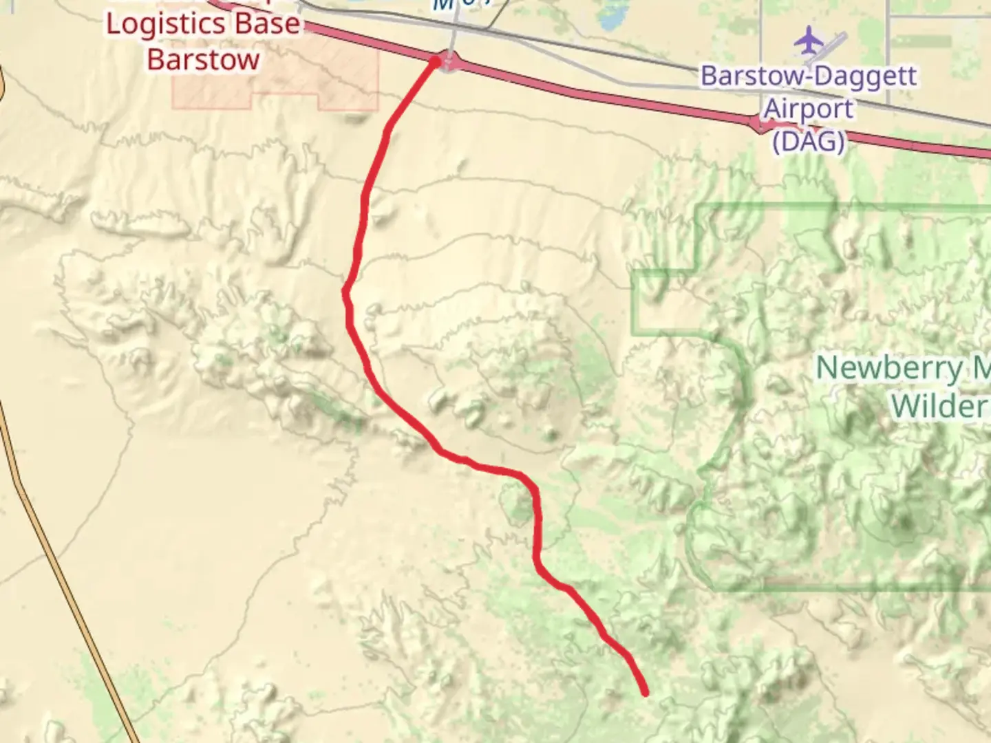
40.8 km
~1 day 4 hrs
601 m
Out and Back
“Journey through diverse landscapes and historical relics on the captivating Ord Mountain Road Trail adventure.”
Nestled in the rugged terrain of San Bernardino County, California, the Ord Mountain Road Trail offers a captivating journey through diverse landscapes. This out-and-back trail spans approximately 41 kilometers (about 25.5 miles) and features an elevation gain of around 600 meters (approximately 1,970 feet), making it a moderately challenging adventure for hikers.
Getting There
To reach the trailhead, head towards the vicinity of Lucerne Valley, a small community in San Bernardino County. If you're driving, take State Route 247, also known as Old Woman Springs Road, and look for signs directing you towards Ord Mountain Road. For those relying on public transport, the nearest major hub is Victorville, from where you can arrange a taxi or rideshare service to the trailhead.
Trail Highlights
Scenic Views and Terrain
The trail begins with a gentle ascent, gradually revealing expansive views of the Mojave Desert. As you progress, the landscape transitions from sandy desert floors to rocky outcrops, offering a unique blend of desert flora and geological formations. The trail's moderate difficulty is characterized by a steady climb, with the most significant elevation gain occurring in the first half of the hike.
Flora and Fauna
Hikers will encounter a variety of desert vegetation, including Joshua trees, creosote bushes, and yucca plants. The area is also home to diverse wildlife, such as desert tortoises, jackrabbits, and a variety of bird species. Keep an eye out for the occasional coyote or bobcat, especially during the early morning or late afternoon hours.
Historical Significance
The Ord Mountain region holds historical significance, with remnants of mining activity from the late 19th and early 20th centuries. As you hike, you may come across old mining equipment and structures, offering a glimpse into the area's past. These relics serve as a reminder of the region's role in California's mining history.
Navigation and Safety
Given the trail's remote location, it's advisable to use the HiiKER app for navigation, ensuring you stay on the correct path and are aware of any potential hazards. The trail is well-marked, but the desert environment can be unforgiving, so carry ample water, sun protection, and a map or GPS device.
Points of Interest
Ord Mountain Summit
Approximately halfway through the trail, you'll reach the summit of Ord Mountain. At an elevation of about 1,700 meters (5,577 feet), the summit offers panoramic views of the surrounding desert and distant mountain ranges. This is an ideal spot for a rest and to take in the breathtaking scenery.
Desert Vistas
Throughout the hike, you'll be treated to stunning vistas of the Mojave Desert. The interplay of light and shadow on the desert floor creates a mesmerizing landscape, particularly during sunrise and sunset.
Embarking on the Ord Mountain Road Trail promises a rewarding experience, blending natural beauty with historical intrigue. Whether you're drawn by the challenge of the hike or the allure of the desert's tranquility, this trail offers a memorable adventure for those prepared to explore its rugged paths.

What to expect?
Activity types
Comments and Reviews
User comments, reviews and discussions about the Ord Mountain Road Trail, California.
average rating out of 5
0 rating(s)