Momyer Creek, San Bernardino Peak, San Gorgonio Mountain and Vivian Creek Trail
Download
Preview
Add to list
More
40.2 km
~2 day
2570 m
Point-to-Point
“Embark on a majestic 25-mile trek through history and nature's splendor in the San Bernardino National Forest.”
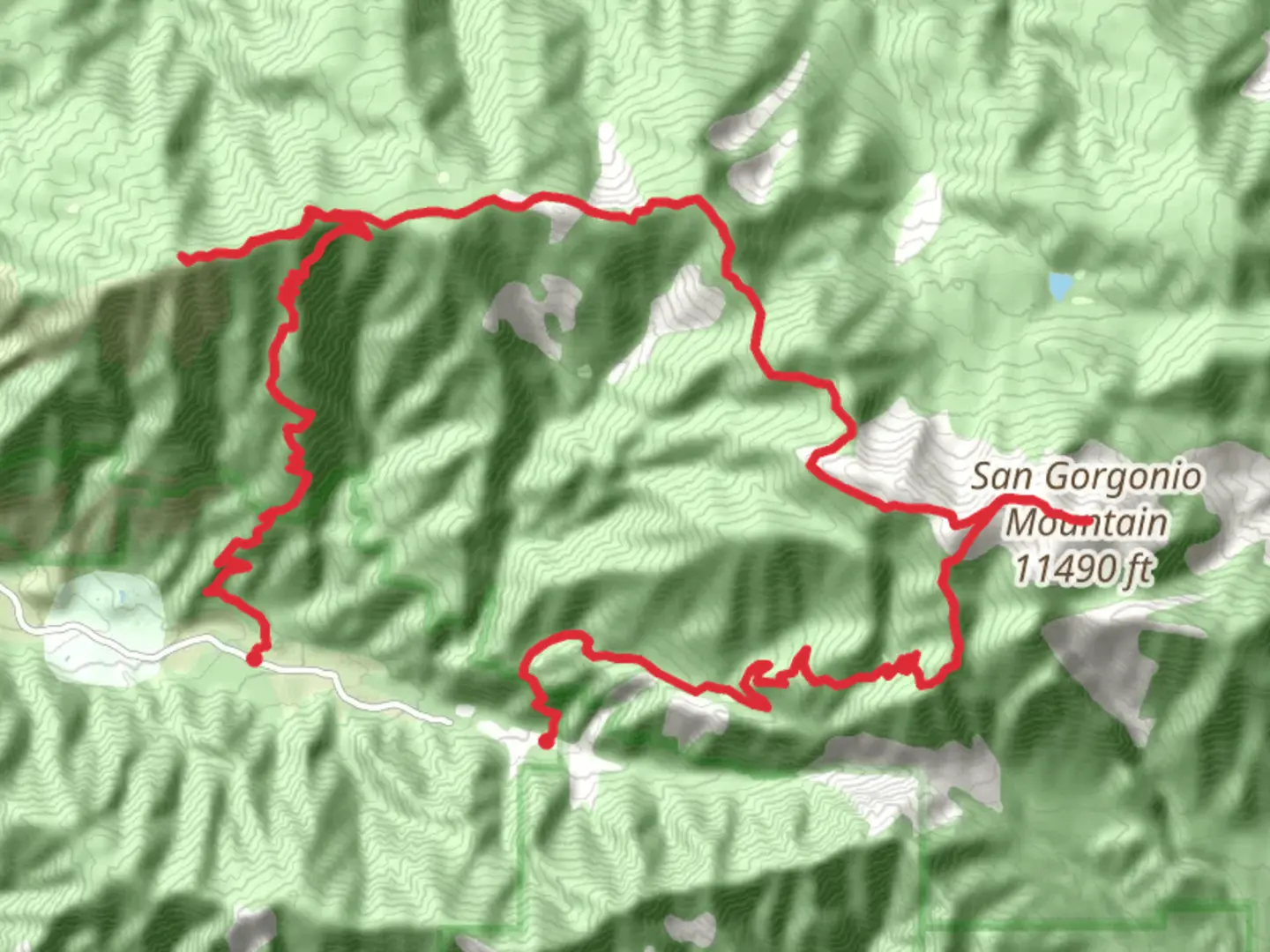
Embarking on the Momyer Creek, San Bernardino Peak, San Gorgonio Mountain, and Vivian Creek Trail, hikers will traverse a diverse and challenging landscape that spans approximately 40 kilometers (about 25 miles) with an elevation gain of roughly 2500 meters (8200 feet). This trail network weaves through the San Bernardino National Forest, offering a rich tapestry of Southern California's natural beauty and a glimpse into the region's history.
Getting to the Trailhead
The trailhead is accessible near San Bernardino County, California. For those driving, the starting point is most easily reached by taking Highway 38 to Forest Falls. Parking is available near the Momyer Creek Trailhead, which is the gateway to your adventure. If you're relying on public transportation, options are limited, but regional buses may get you close to the area, and from there, a taxi or rideshare could be used to reach the trailhead.
Momyer Creek Trail to San Bernardino Peak
The journey begins along the Momyer Creek Trail, which immediately immerses hikers in a dense forest of pine and cedar trees. The trail ascends steadily, and within the first 8 kilometers (5 miles), you'll gain approximately 1000 meters (3300 feet) in elevation. As you climb, the flora transitions to manzanita and scrub oak, with the occasional clearing offering stunning views of the valley below.
Historical Significance
As you approach San Bernardino Peak, at around 16 kilometers (10 miles) in, you're not only walking through a natural wonderland but also an area steeped in history. The peak itself was used by surveyors in the 1850s to help define the San Bernardino meridian, an important reference point for land measurements in the region.
San Bernardino Peak to San Gorgonio Mountain
Continuing from San Bernardino Peak, the trail undulates along the high ridge, providing panoramic vistas that include the Mojave Desert and the peak of San Jacinto. The path to San Gorgonio Mountain, also known as Old Greyback, is a challenging stretch with rocky terrain and switchbacks that test your endurance.
Vivian Creek Trail Descent
After reaching the summit of San Gorgonio Mountain, the highest peak in Southern California, the descent begins via the Vivian Creek Trail. This portion of the hike is steep and can be tough on the knees, dropping around 1800 meters (5900 feet) over 11 kilometers (7 miles). The trail follows Vivian Creek, and the sound of running water is a constant companion as you navigate through groves of tall pines and past cascading waterfalls.
Flora, Fauna, and Safety
Throughout the hike, keep an eye out for the diverse wildlife, including mule deer, black bears, and mountain lions. Birdwatchers will be delighted by the variety of species, from woodpeckers to birds of prey. Always keep a safe distance from wildlife and store food properly to avoid attracting bears.
Safety is paramount, and hikers should be prepared for sudden weather changes and carry adequate water, as sources along the trail can be unreliable. Navigation can be challenging, so using a tool like HiiKER to track your progress and stay on the correct path is recommended.
Preparation and Planning
Given the trail's length and elevation gain, it's essential to be in good physical condition. It's advisable to start early in the day to ensure ample daylight for the journey. A wilderness permit is required for day hikes and overnight trips, which can be obtained from the Mill Creek Visitor Center.
With proper preparation, the Momyer Creek, San Bernardino Peak, San Gorgonio Mountain, and Vivian Creek Trail offers an unforgettable experience that combines physical challenges with the serene beauty of the San Bernardino National Forest.

What to expect?
Activity types
Comments and Reviews
User comments, reviews and discussions about the Momyer Creek, San Bernardino Peak, San Gorgonio Mountain and Vivian Creek Trail, California.
average rating out of 5
0 rating(s)