Download
Preview
Add to list
More
15.5 km
~4 hrs 14 min
684 m
Loop
“Embark on a breathtaking 15km loop through the serene Forsee Basin, offering a rich tapestry of history, wildlife, and panoramic vistas.”
The Forsee Basin - John's Meadow Trail is a scenic loop that spans approximately 15 kilometers (about 9.3 miles) with an elevation gain of around 600 meters (nearly 2000 feet), nestled in the heart of the San Bernardino National Forest near San Bernardino County, California. This trail offers a medium difficulty rating, making it accessible to hikers with a moderate level of fitness and experience.
Getting to the Trailhead
To reach the trailhead, if you're driving, you'll want to head towards Angelus Oaks off of Highway 38. The trailhead is located just off the highway, and parking is available in the vicinity. For those opting for public transport, check local transit schedules for buses that service the area around Angelus Oaks, and plan for a short walk to the trailhead from the nearest bus stop.
Navigating the Trail
As you embark on your hike, you'll find that the trail is well-marked, but carrying a map or using a navigation tool like HiiKER is recommended to keep track of your progress and ensure you stay on the correct path. The loop can be tackled in either direction, but many choose to go clockwise to gradually ascend the switchbacks leading to John's Meadow.
Landmarks and Scenery
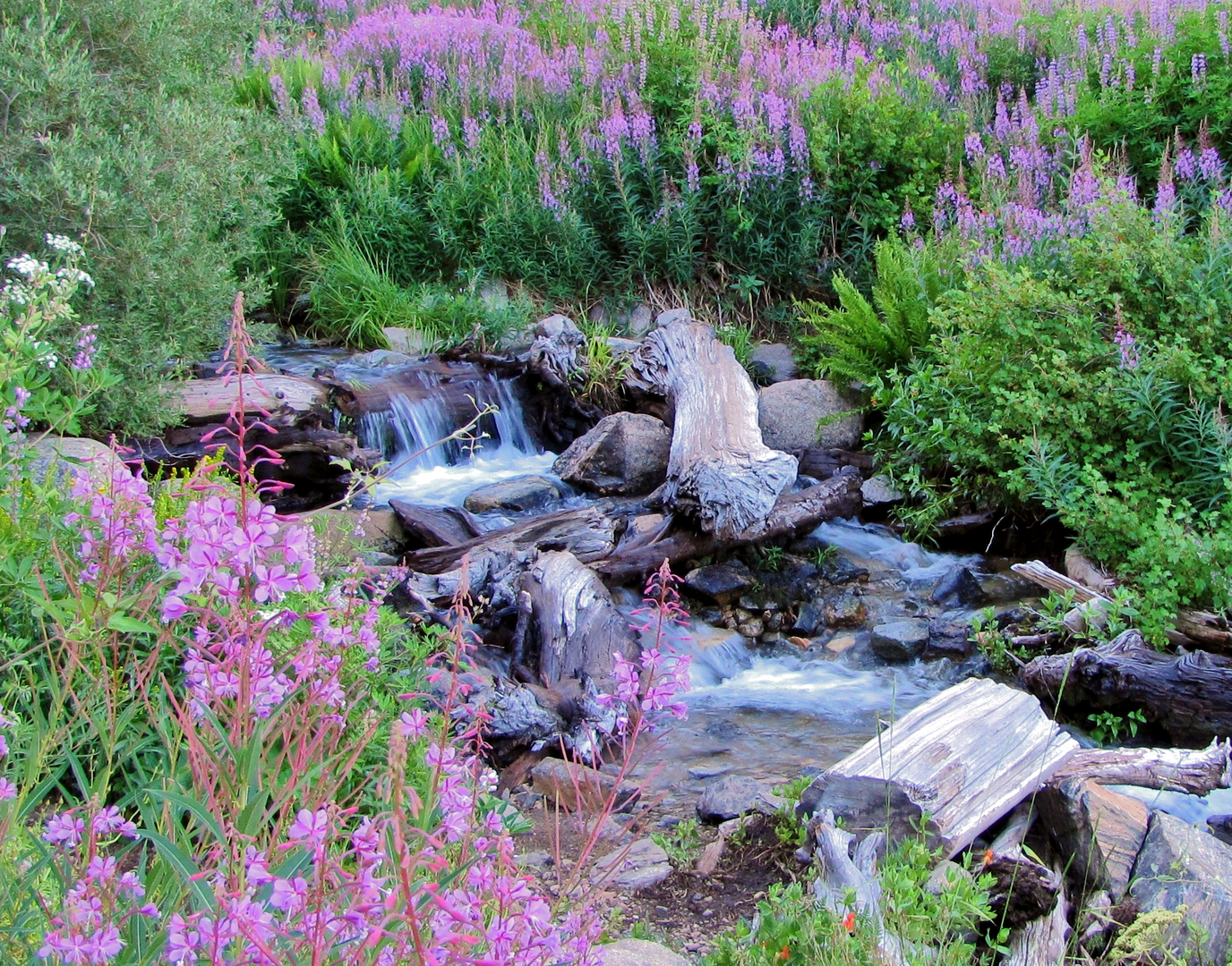
Early in the hike, you'll be greeted by the sounds of a babbling creek as you traverse through dense forest, with towering pines and cedars providing ample shade. Approximately 3 kilometers (about 1.9 miles) in, you'll reach the split that marks the beginning of the loop. Opting to go right will take you towards Forsee Creek, where the trail begins its steady climb.
As you ascend, you'll be treated to stunning vistas of Anderson Peak and Shields Peak. The trail meanders through the Forsee Basin, offering panoramic views of the surrounding wilderness. Around the halfway point, you'll find John's Meadow, a serene and picturesque spot perfect for a rest or a picnic. This area is rich in history, as it was once used by shepherds and cattle ranchers in the late 19th and early 20th centuries.
Flora and Fauna
The diverse ecosystem of the San Bernardino National Forest means you'll encounter a variety of plant and animal life. Keep an eye out for local wildlife such as mule deer, black bears, and mountain lions, and remember to maintain a safe distance. The trail also boasts a range of wildflowers, especially in the spring and early summer months.
Preparation and Safety
Before setting out, ensure you have enough water, as sources along the trail may not be reliable or safe for drinking. Weather conditions can change rapidly in the mountains, so pack layers and be prepared for cooler temperatures at higher elevations. Lastly, always let someone know your hiking plans and expected return time.
By following these guidelines and respecting the natural beauty of the Forsee Basin - John's Meadow Trail, hikers can look forward to an enjoyable and memorable outdoor adventure.

What to expect?
Activity types
Comments and Reviews
User comments, reviews and discussions about the Forsee Basin - John's Meadow Trail, California.
average rating out of 5
0 rating(s)