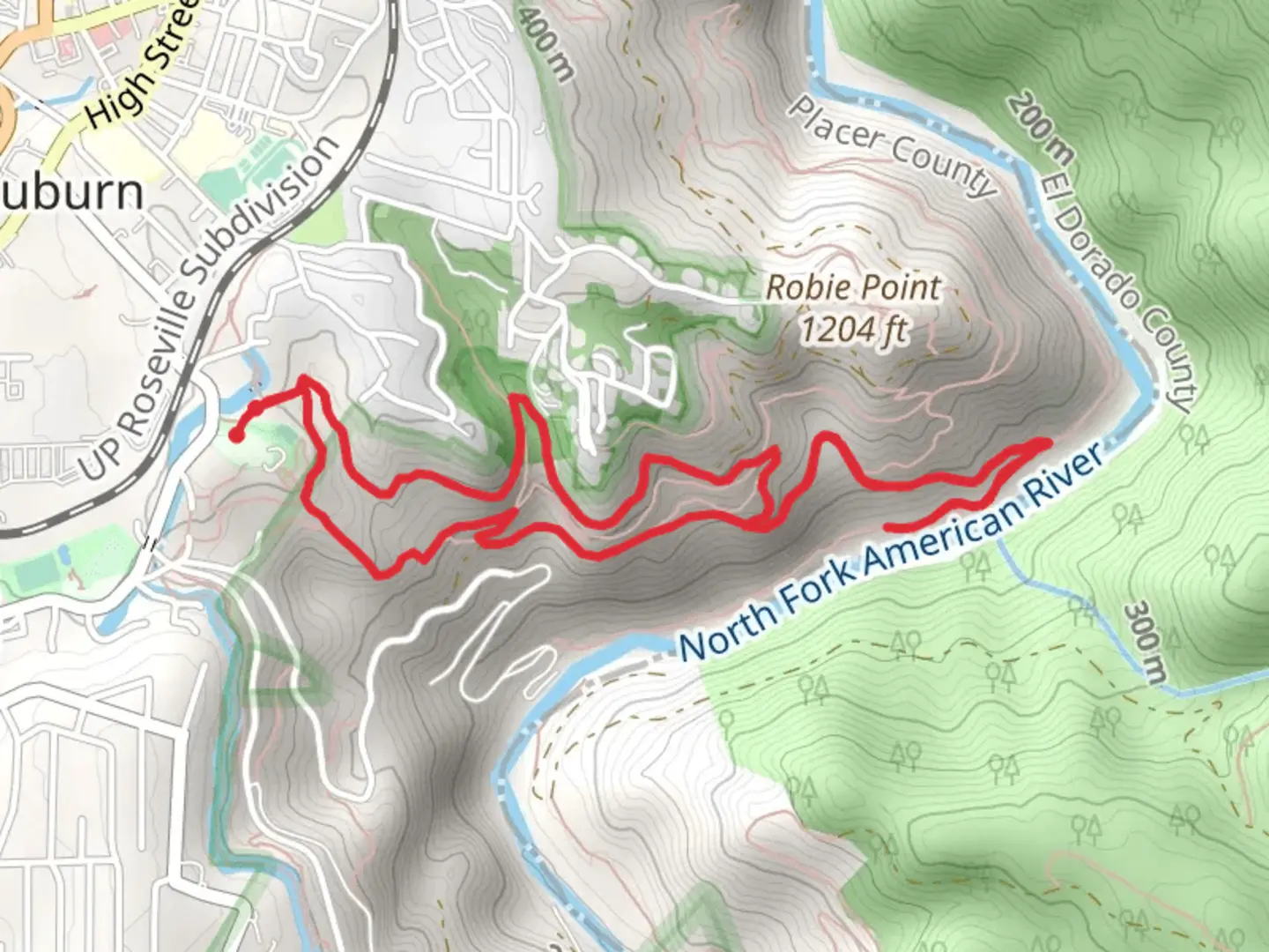
Western States, Tamaroo Bar and Robie Point Fuel Break Loop Trail
Download
Preview
Add to list
More
7.1 km
~2 hrs 22 min
571 m
Loop
“Embark on a historical and scenic 7km hike with breathtaking views and diverse wildlife at Western States Loop Trail.”
Nestled near Placer County, California, the Western States, Tamaroo Bar and Robie Point Fuel Break Loop Trail offers a moderately challenging hike that spans approximately 7 kilometers (about 4.3 miles) with an elevation gain of roughly 500 meters (approximately 1640 feet). This loop trail is a favorite among locals and visitors alike for its scenic vistas and historical significance.
Starting at the trailhead, which is easily accessible by car, hikers can find parking near the intersection of Highway 49 and Old Foresthill Road. For those opting for public transportation, the nearest bus stops are located in Auburn, from where one can take a taxi or ride-share service to reach the trailhead.
Navigating the Trail
As you embark on the trail, you'll be greeted by a mix of terrains, including rocky paths and dirt tracks that meander through the lush forest. The initial ascent is gradual, allowing hikers to warm up as they climb. HiiKER can be an invaluable tool for navigation, ensuring that you stay on the correct path throughout your journey.
The trail is well-marked, but it's always wise to keep an eye out for trail signs and markers. After about 2 kilometers (1.2 miles), you'll reach Tamaroo Bar, an area that was historically significant during the Gold Rush era. Here, the American River can be seen winding through the canyon, and it's a great spot to take a break and enjoy the surroundings.
Historical Significance and Natural Beauty
Continuing on, the trail leads to Robie Point, where hikers are treated to panoramic views of the Auburn State Recreation Area. This point holds historical importance as it is near the end of the Western States Trail, which was used during the Gold Rush and later became part of the Western States Endurance Run, a 100-mile ultramarathon.
The loop will then guide you through a series of switchbacks, where the elevation gain becomes more noticeable. The canopy of trees provides shade, making this section of the hike pleasant even on warmer days. Keep an eye out for local wildlife, including deer, birds, and occasionally, if you're lucky, a glimpse of a bobcat or coyote in the distance.
Flora and Fauna
The trail is home to a diverse range of flora, with wildflowers blooming in the spring and a variety of trees that offer a display of colors in the fall. The manzanita and oak woodlands, along with pine and cedar trees, create a serene environment that is typical of the Sierra Nevada foothills.
Preparing for the Hike
Before setting out, ensure you have enough water, as there are no water sources along the trail. The elevation gain can be taxing, so bring snacks and perhaps a light meal to keep your energy levels up. Wear sturdy hiking boots, as the terrain can be uneven, and check the weather forecast to dress appropriately. It's also advisable to carry a map or use HiiKER to track your progress on the trail.
Accessing the Trailhead
To reach the trailhead by car, take the I-80 to Auburn and exit at Highway 49 towards Placer County. Follow the signs to the designated parking area near Old Foresthill Road. If you're using public transport, Auburn is the closest city with bus services, and from there, a short taxi or ride-share trip will bring you to the starting point of your hike.
By providing a mix of natural beauty, historical context, and a good physical challenge, the Western States, Tamaroo Bar and Robie Point Fuel Break Loop Trail is a rewarding experience for hikers looking to explore the Auburn area's rich heritage and landscapes.
What to expect?
Activity types
Comments and Reviews
User comments, reviews and discussions about the Western States, Tamaroo Bar and Robie Point Fuel Break Loop Trail, California.
5.0
average rating out of 5
7 rating(s)
