Download
Preview
Add to list
More
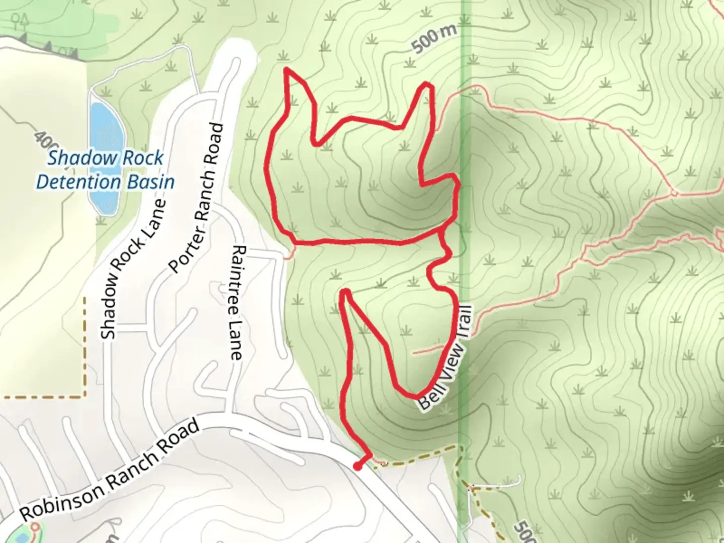
4.1 km
~1 hrs 11 min
222 m
Loop
“Embark on Bell View Trail's loop for scenic vistas and historical intrigue in Orange County's foothills.”
The Bell View Trail offers a moderately challenging hike spanning approximately 4 kilometers (about 2.5 miles) with an elevation gain of roughly 200 meters (656 feet). Nestled in the scenic foothills of the Santa Ana Mountains near Orange County, California, this loop trail is a favorite among locals and visitors looking to experience the natural beauty of the region.
Getting to the Trailhead
To reach the trailhead, if you're driving, head towards Rancho Santa Margarita and navigate to the intersection of Santiago Canyon Road and Bell View Trail Road, where you'll find parking available. For those opting for public transportation, check local bus routes that service the area closest to the trailhead and plan for a short walk from the nearest bus stop to the beginning of the trail.
Navigating the Trail
As you embark on your hike, you can use the HiiKER app to help navigate the trail. The app provides detailed maps and waypoints that are helpful for staying on track. The trail starts with a gentle incline, winding through a landscape dotted with coastal sage scrub and chaparral. The ascent becomes more pronounced as you approach the halfway point, offering panoramic views of the surrounding valleys and, on clear days, a glimpse of the Pacific Ocean.
Landmarks and Wildlife
One of the significant landmarks along the Bell View Trail is the old Bell View Mine, a relic from the region's mining history. Although the mine is no longer in operation, it serves as a reminder of the area's past economic activities. As you hike, keep an eye out for local wildlife such as mule deer, coyotes, and various bird species, including the California thrasher and the red-tailed hawk.
Flora and Historical Significance
The trail is lined with native plants, including the California poppy, which blooms vibrantly in the spring. The area is also steeped in history, with the trail running through land that was once part of the vast Mexican land grants and later became a hub for cattle ranching in the 19th century.
Preparation and Safety
Before setting out, ensure you have adequate water, sun protection, and sturdy footwear to handle the rocky sections of the trail. The trail is well-marked, but always stay aware of your surroundings to avoid straying from the path. The elevation gain is gradual but can be strenuous, so pace yourself accordingly.
Remember, the Bell View Trail is a loop, so once you reach the highest elevation point and take in the stunning vistas, you'll begin your descent back to the trailhead, completing your hike through this picturesque slice of Orange County's natural landscape.

What to expect?
Activity types
Comments and Reviews
User comments, reviews and discussions about the Bell View Trail, California.
4.67
average rating out of 5
3 rating(s)