Download
Preview
Add to list
More
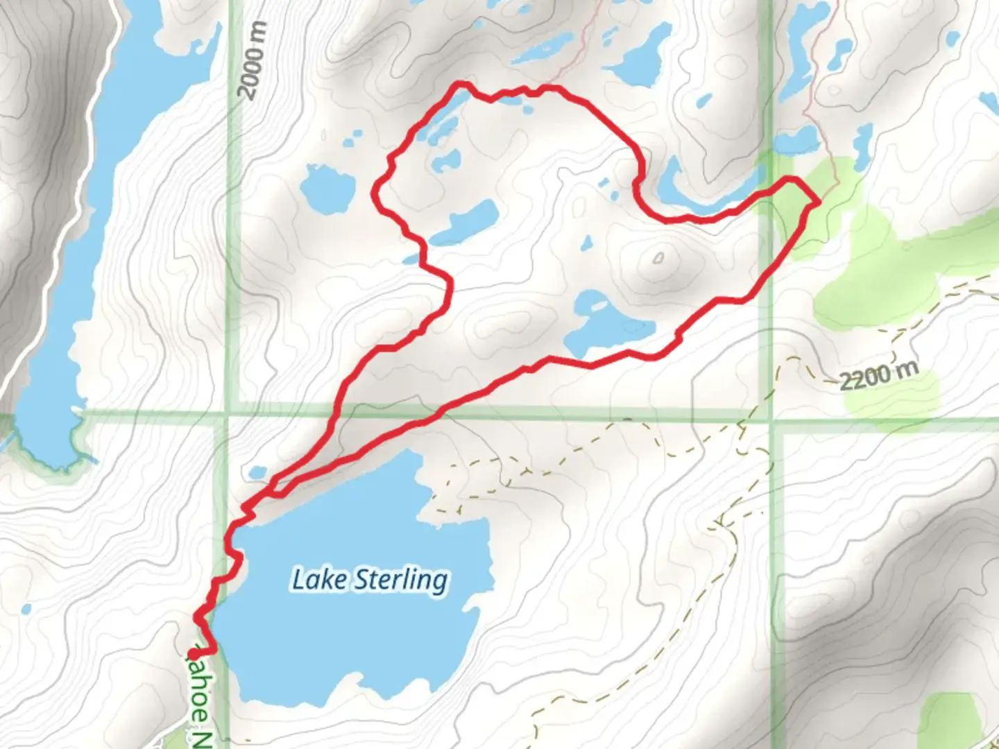
6.7 km
~1 hrs 38 min
183 m
Loop
“Embark on the Glacier Lakes Basin Trail for alpine splendor and historic whispers amidst the Sierra Nevada.”
The Glacier Lakes Basin Trail is a scenic loop that spans approximately 7 kilometers (about 4.3 miles) with an elevation gain of roughly 100 meters (328 feet), nestled in the picturesque Sierra Nevada in Nevada County, California. This trail offers a moderate challenge suitable for hikers with some experience and is known for its stunning alpine lakes and breathtaking mountain vistas.
Getting to the Trailhead
To reach the trailhead, hikers can drive to the area near Nevada County, where parking is available. For those opting for public transportation, check local transit schedules for the nearest routes and stops. From the parking area, the trailhead is accessible by a short walk, clearly marked for visitors.
The Hike Itself
As you embark on the Glacier Lakes Basin Trail, you'll be greeted by a mix of dense forest, open meadows, and the serene sounds of nature. The trail is well-maintained, with clear signage to guide you along the loop. Hikers should be prepared for a variety of terrain, including rocky paths, dirt trails, and potentially muddy sections depending on the season.
Notable Landmarks and Natural Features
A few kilometers into the hike, you'll encounter the first of several alpine lakes, each offering a unique and tranquil setting for a rest or a photo opportunity. The crystal-clear waters reflect the surrounding peaks, creating a serene atmosphere. Keep an eye out for local wildlife, such as mule deer, black bears, and a variety of bird species. Remember to keep a safe distance from any wildlife and to not feed the animals.
The trail also provides panoramic views of the Sierra Nevada mountain range. As you gain elevation, take a moment to appreciate the sweeping landscapes and the rugged beauty of the area.
Historical Significance
The region holds historical significance, with the Sierra Nevada playing a crucial role during the California Gold Rush era. As you hike, consider the rich history of the area, where, in the mid-1800s, prospectors passed through these mountains in search of fortune.
Navigation and Preparation
Before setting out, it's recommended to download the trail map onto your HiiKER app to ensure you have offline access to navigation tools. The trail is marked, but having a digital map can be invaluable in maintaining your bearings, especially at trail junctions.
Hikers should come prepared with appropriate gear, including sturdy hiking boots, layered clothing to adjust to changing temperatures, and plenty of water. The elevation gain is gradual, but the altitude can still affect some individuals, so it's important to pace yourself and stay hydrated.
Environmental Considerations
As with any natural area, it's crucial to practice Leave No Trace principles. Pack out all your trash, stay on designated trails to protect the fragile ecosystem, and be mindful of fire regulations, especially during dry seasons.
By respecting these guidelines and being prepared, your hike along the Glacier Lakes Basin Trail will be a memorable experience, filled with natural beauty and a touch of history.

What to expect?
Activity types
Comments and Reviews
User comments, reviews and discussions about the Glacier Lakes Basin Trail, California.
average rating out of 5
0 rating(s)