Download
Preview
Add to list
More
35.2 km
~3 days
2063 m
Multi-Day
“A challenging yet awe-inspiring trek through Yosemite's heart, revealing its historical depths and High Sierra splendor.”
Embarking on the Yosemite Valley to Tuolumne Meadows hike, you'll traverse approximately 35 kilometers (about 22 miles) of Yosemite National Park's most breathtaking landscapes, with an elevation gain of around 2000 meters (approximately 6,560 feet). This point-to-point trail is considered difficult due to its length and the significant elevation changes you'll encounter along the way.
Getting to the Trailhead
The trailhead is located near Mariposa County, California. If you're driving, you can reach the starting point by entering Yosemite National Park through the Arch Rock Entrance Station, following the signs to Yosemite Valley, and parking in one of the designated areas. For those preferring public transport, the YARTS (Yosemite Area Regional Transportation System) provides access to the park from various locations, and once inside, the free Yosemite Valley Shuttle can drop you off at the trailhead.
Navigating the Trail
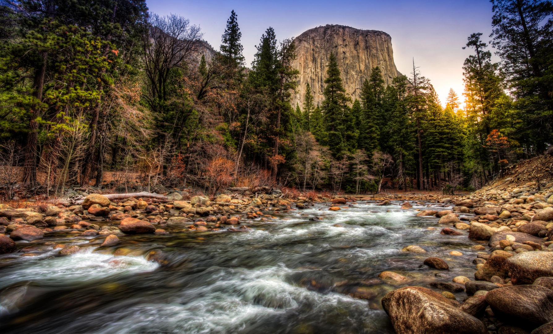
As you set out from Yosemite Valley, the trail will take you past some of the park's most iconic features. Early on, you'll be greeted by the thunderous roar of Vernal and Nevada Falls. The Mist Trail, which leads up to these waterfalls, can be slippery due to the spray, so caution is advised. After enjoying the falls, you'll continue to ascend through Little Yosemite Valley, a serene sub-alpine meadow that offers a moment of respite before the climb resumes.
High Sierra and Alpine Splendor
The trail then enters the heart of the High Sierra, where you'll be surrounded by towering granite peaks and alpine landscapes. As you gain elevation, the vegetation changes, and you'll find yourself walking among lodgepole pines and mountain hemlocks. The crisp mountain air and the potential to spot wildlife, such as mule deer or black bears, add to the experience.
One of the most remarkable sections of the hike is the ascent to the top of Half Dome. While this detour requires a permit and is not for the faint of heart due to its steep and exposed cable route, the panoramic views from the summit are unparalleled. For those who choose not to take the detour, the main trail continues towards Tuolumne Meadows, offering its own array of stunning vistas.
Historical Significance
As you hike, you're following in the footsteps of indigenous peoples, early explorers, and conservationists like John Muir, who played a pivotal role in the establishment of Yosemite National Park. The region's history is rich with stories of the Gold Rush era and the birth of the American conservation movement.
Approaching Tuolumne Meadows
The final stretch of the trail flattens out as you approach Tuolumne Meadows, one of the largest high-elevation meadows in the Sierra Nevada. This area is renowned for its wildflowers in the spring and summer, and the meandering Tuolumne River that flows through it. The meadows also serve as a habitat for a variety of wildlife, including the Great Grey Owl and the Sierra Nevada Bighorn Sheep.
Upon reaching Tuolumne Meadows, you'll find the Tioga Pass Road, which marks the end of your journey. From here, you can catch the YARTS bus back to Yosemite Valley or to other destinations outside the park.
Throughout your hike, it's essential to be prepared with adequate water, food, and layers for changing weather conditions. The use of navigation tools like HiiKER can help you stay on track and provide additional information about the trail as you progress. Remember to practice Leave No Trace principles to preserve the beauty and integrity of this remarkable landscape for future generations.

What to expect?
Activity types
Comments and Reviews
User comments, reviews and discussions about the Yosemite Valley to Tuolumne Meadows, California.
4.83
average rating out of 5
6 rating(s)