Download
Preview
Add to list
More
24.3 km
~1 day 0 hrs
80 m
Out and Back
“Explore the Whittier Greenway Trail—historical, scenic, and accessible, it caters to all urban adventurers.”
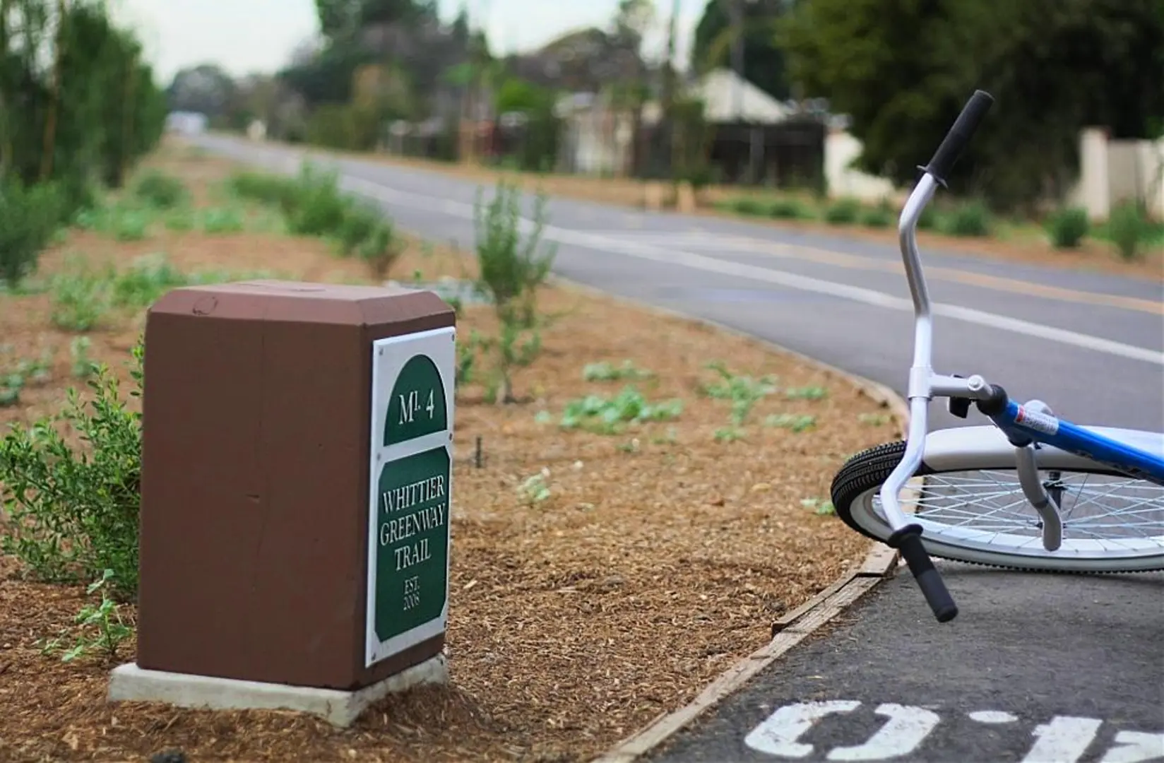
The Whittier Greenway Trail is a scenic urban path that stretches approximately 24 kilometers (about 15 miles) through the heart of Whittier, California. With virtually no elevation gain, this flat trail offers an accessible route for hikers, cyclists, and runners alike. The trail is considered to have a medium difficulty rating, mainly due to its length rather than the terrain.Getting to the TrailheadLocated near Los Angeles County, the trailhead can be found at the intersection of Mills Avenue and Lambert Road. For those driving, parking is available near the trailhead. Public transportation users can take advantage of local bus services that stop nearby, making the trail accessible without the need for a car.Trail ExperienceAs you embark on the Whittier Greenway Trail, you'll find yourself immersed in a mix of urban and natural landscapes. The trail is well-maintained with clear signage, making navigation straightforward. Hikers can use the HiiKER app to track their progress and ensure they stay on the correct path.Historical Significance and LandmarksThe trail follows the former route of the Pacific Electric Railway, which played a crucial role in the development of the Los Angeles area in the early 20th century. Along the route, you'll encounter various historical markers and interpretive signs that provide insight into the region's past.One of the significant landmarks is the Whittier Depot, a restored train station that now serves as a symbol of the city's rich history. As you continue, you'll pass through several parks and green spaces, including Palm Park, where you can take a moment to relax by the serene setting of the San Gabriel River.Nature and WildlifeDespite its urban setting, the Whittier Greenway Trail offers opportunities to enjoy local flora and fauna. The trail is lined with native plants, and the green spaces along the route serve as habitats for various bird species. Keep an eye out for hummingbirds, hawks, and other birds that thrive in this environment.Trail AmenitiesThe trail is equipped with amenities such as benches, water fountains, and restrooms at intervals, making it a comfortable experience for those planning a longer hike or bike ride. There are also several fitness stations along the route for those looking to add some exercise variety to their outing.Safety and EtiquetteAs a shared-use path, it's important to be mindful of others. Keep to the right, pass on the left, and signal when overtaking. The trail is popular with locals and visitors, so expect some company, especially on weekends.Remember to bring sunscreen and water, as some sections of the trail have limited shade. Although the trail is relatively flat, its length can be challenging for some, so plan accordingly and consider tackling shorter segments if needed.AccessibilityThe Whittier Greenway Trail is wheelchair accessible, making it a great option for individuals of all abilities. The flat terrain and paved surface ensure a smooth experience throughout the journey.Whether you're looking for a leisurely walk, a vigorous bike ride, or a chance to delve into the history of the Whittier area, the Whittier Greenway Trail provides a unique urban adventure that caters to a variety of interests and fitness levels.

What to expect?
Activity types
Comments and Reviews
User comments, reviews and discussions about the Whittier Greenway Trail, California.
4.5
average rating out of 5
2 rating(s)