Download
Preview
Add to list
More
41.2 km
~3 days
1515 m
Multi-Day
“Embark on a 41 km Sierra Nevada odyssey, brimming with high-altitude lakes, wildlife, and historic trails.”
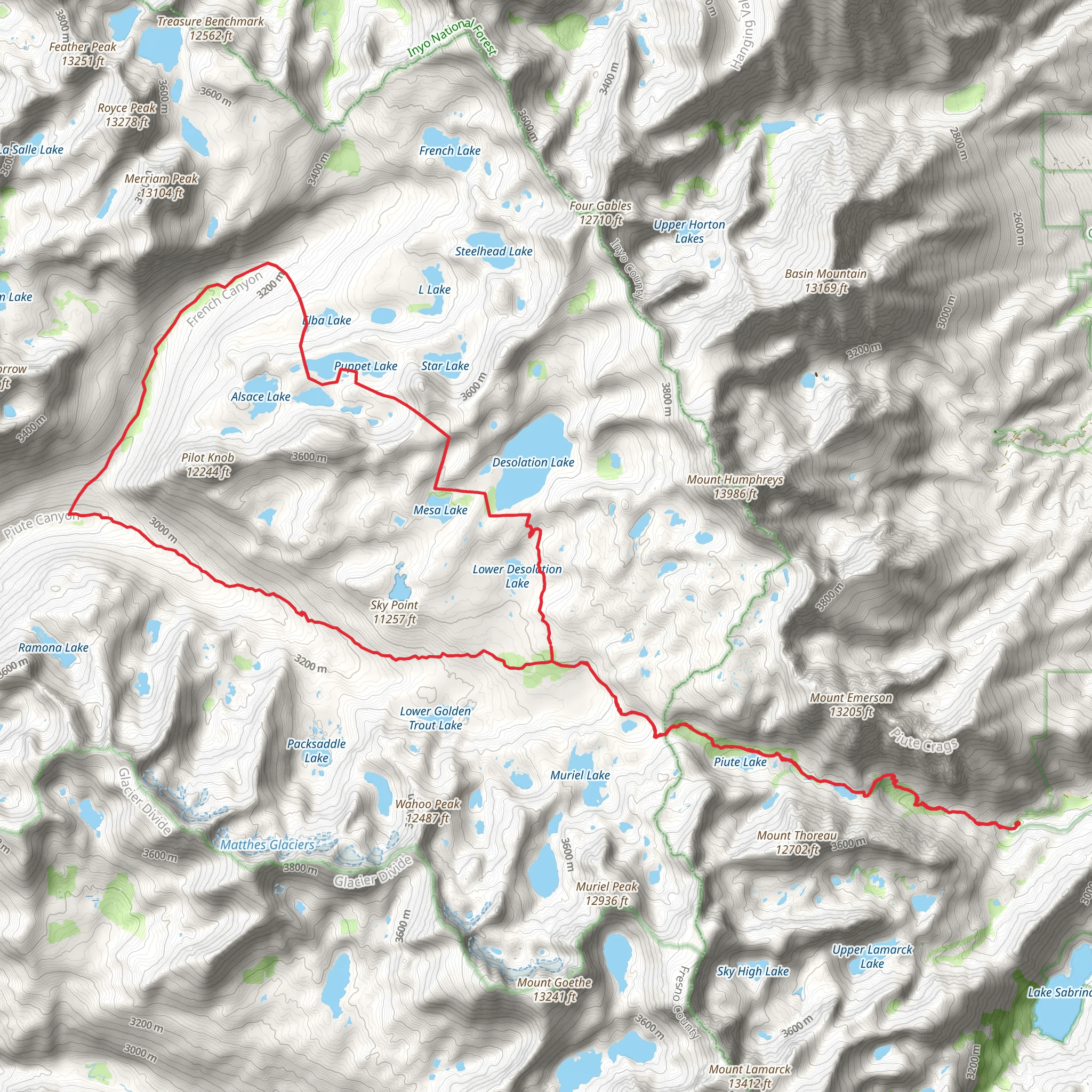
Embarking on the North Lake to Humphreys Basin Loop, you'll be traversing a challenging yet rewarding 41 km (approximately 25.5 miles) journey with an elevation gain of around 1500 meters (nearly 4921 feet). This loop, nestled in the Sierra Nevada of Inyo County, California, is a true test of endurance and offers a spectacular showcase of the High Sierra backcountry.
Getting to the Trailhead The trailhead is accessible by car, located near North Lake, west of the town of Bishop. From Bishop, take West Line Street (Highway 168) heading west. After approximately 30 km (18 miles), turn left onto North Lake Road, which will lead you to the trailhead parking area. Public transportation options are limited in this region, so driving is the most feasible option for reaching the starting point.
The Journey Begins Setting out from the trailhead, you'll initially follow the Piute Pass Trail, ascending steadily through a series of switchbacks. The path winds through a picturesque forested area, gradually opening up to reveal the grandeur of the glacially carved landscape. As you approach Piute Pass, at around 11 km (7 miles), you'll be treated to panoramic views of the surrounding peaks and the serene Piute Lake.
High Sierra Splendor Beyond Piute Pass, the trail descends into Humphreys Basin, an expansive, barren, and rocky plateau dotted with pristine alpine lakes. This section, at an elevation of over 3,500 meters (11,500 feet), is where you'll experience the majority of the elevation gain. The stark beauty of the basin, with its scattered lakes like Desolation Lake and Marmot Lake, is a highlight for many hikers.
Wildlife and Flora As you navigate the loop, keep an eye out for the diverse wildlife that inhabits the area. Mule deer, pikas, and marmots are commonly sighted, while the elusive bighorn sheep might grace you with its presence. The flora is equally fascinating, with wildflowers such as alpine lupine and columbine blooming in the short summer season.
Historical Significance The region is steeped in history, with the Sierra Nevada playing a crucial role during the California Gold Rush. Miners traversed these mountains in search of fortune, and evidence of their endeavors can still be found in the form of abandoned mines and equipment.
Navigating the Trail For navigation, HiiKER is an excellent tool to use while trekking this loop. It will help you stay on track and provide detailed information about the trail as you progress. Given the trail's remote nature and challenging terrain, it's essential to have a reliable navigation aid.
Preparation and Planning Due to the trail's difficulty and remote location, it's imperative to be well-prepared. Ensure you have a map, compass, and HiiKER app downloaded for navigation. Pack sufficient food, water, and clothing for the unpredictable mountain weather. A water filter is also recommended, as there are multiple water sources along the route.
Conclusion The North Lake to Humphreys Basin Loop is a demanding hike that rewards adventurers with its alpine lakes, rugged terrain, and breathtaking vistas. It's a journey that encapsulates the wild heart of the Sierra Nevada and leaves a lasting impression on those who undertake it.
What to expect?
Activity types
Comments and Reviews
User comments, reviews and discussions about the North Lake to Humphreys Basin Loop, California.
4.67
average rating out of 5
3 rating(s)

