Download
Preview
Add to list
More
40.5 km
~3 days
385 m
Multi-Day
“Traverse the Lost Coast Trail's rugged beauty for a challenging, tide-governed hike through California's untouched wilderness.”
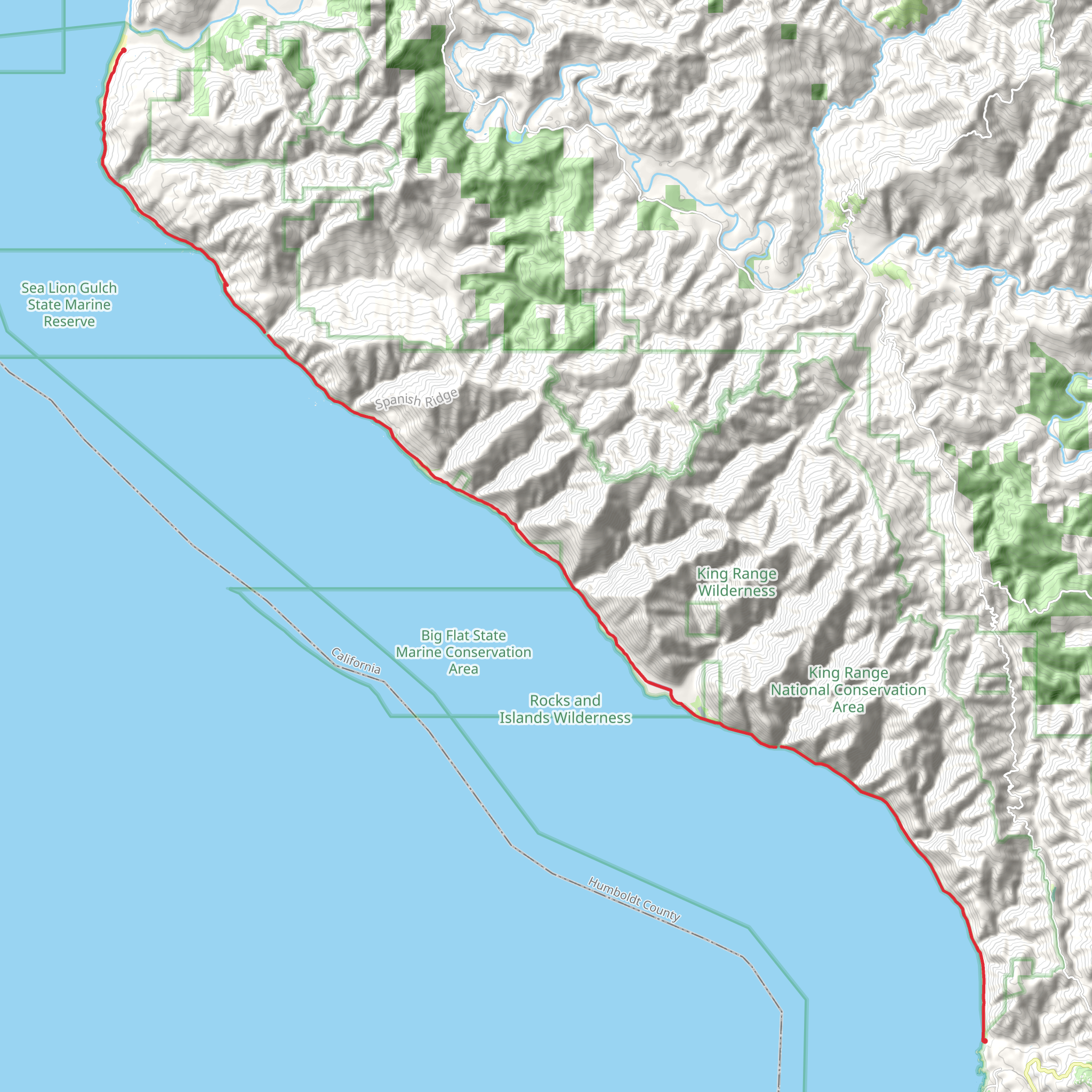
Spanning approximately 25.5 miles (41 km) along California's rugged coastline, the Lost Coast Trail offers an immersive experience in one of the state's most pristine and remote natural areas. With an elevation gain of nearly 984 feet (300 meters), this point-to-point trail is not for the faint of heart, presenting a challenging adventure for even seasoned hikers.
Getting to the Trailhead
The northern trailhead is located near Mattole Beach, which is accessible by car. If you're coming from Humboldt County, take the Lighthouse Road out of Petrolia and follow the signs to the beach. Public transportation options are limited in this remote area, so driving or arranging a shuttle with a local company is your best bet.
Navigating the Trail
Hikers can rely on the HiiKER app for detailed maps and navigation assistance throughout their journey. The trail is well-marked in places, but the changing landscape due to tides and erosion can make some sections challenging to navigate.
Trail Experience
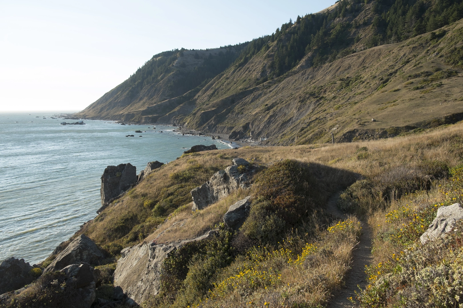
As you embark on the Lost Coast Trail, you'll traverse sandy beaches, rocky shores, and coastal bluffs. The trail can be divided into two main sections: the northern stretch from Mattole Beach to Black Sands Beach near Shelter Cove, and the southern stretch that continues from Black Sands Beach inland.
Northern Stretch
The first section of the trail is dominated by the vast expanse of the Pacific Ocean to your west and the King Range to your east. The trail meanders along the beach, which can be impassable at high tide, so it's crucial to plan your hike around the tide schedule. Approximately 4 miles (6.4 km) in, you'll encounter the Punta Gorda Lighthouse, an abandoned beacon that stands as a testament to the region's maritime history.
Continuing south, the trail offers intermittent climbs into the coastal forest, providing some respite from the sandy terrain. Around the halfway point, near Big Flat (roughly 12.5 miles or 20 km from the start), hikers can find flat areas suitable for camping, with freshwater sources nearby.
Southern Stretch
After Big Flat, the trail becomes more rugged and less defined. Hikers will navigate over rocky outcrops and through dense brush. The final stretch to Black Sands Beach is marked by steep inclines and descents, with the trail climbing up to the bluffs before descending back to sea level.
Wildlife and Nature
The Lost Coast is home to a diverse array of wildlife, including Roosevelt elk, black bears, and a variety of seabirds. Marine life such as seals and sea lions can often be spotted off the coast. The area's flora is equally rich, with coastal sagebrush, Douglas fir, and redwood trees dotting the landscape.
Historical Significance
The Lost Coast Trail traverses the Sinkyone Wilderness State Park and the King Range National Conservation Area, lands that were once inhabited by the Sinkyone and Mattole Native American tribes. The region's inaccessibility and the decline of the logging industry in the mid-20th century have left it largely undeveloped, preserving its natural and historical heritage.
Preparation and Planning
Due to the trail's difficulty and remote nature, hikers should be well-prepared with adequate supplies, including food, water, and a tide chart. Permits are required for overnight trips and can be obtained from the Bureau of Land Management. It's also advisable to arrange transportation for the end of the hike, as the trail does not loop back to the starting point.
Remember, the Lost Coast Trail is an isolated and physically demanding route. It requires thorough preparation, respect for the natural environment, and adherence to Leave No Trace principles to ensure a safe and enjoyable experience.
What to expect?
Activity types
Comments and Reviews
User comments, reviews and discussions about the Lost Coast Trail, California.
5.0
average rating out of 5
7 rating(s)

