Download
3D Flyover
Add to list
More
102.1 km
~5 days
2535 m
Multi-Day
“Trek the historic Alpannonia trail, a medium-difficulty journey through Austria's diverse terrains and rich history.”
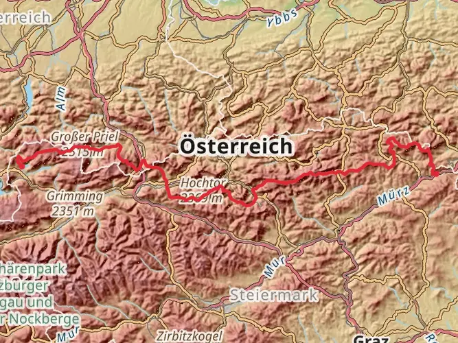
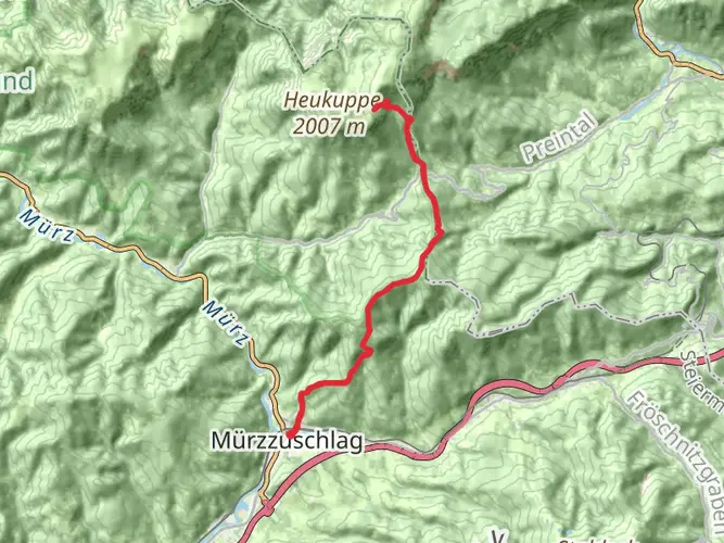
Embarking on the Alpannonia trail, hikers will traverse approximately 102 kilometers (about 63 miles) of diverse landscapes, with an elevation gain of around 2,500 meters (approximately 8,200 feet). This point-to-point trail begins near Bezirk Neunkirchen, Austria, and is considered to have a medium difficulty rating, making it accessible to hikers with a reasonable level of fitness.
Getting to the Trailhead
To reach the starting point of the Alpannonia trail, hikers can drive to the vicinity of Bezirk Neunkirchen, where parking may be available. For those preferring public transport, the area is well-serviced by buses and trains. The nearest significant landmark to the trailhead is the town of Fischbach, which is a short distance away and can serve as a reference point for navigation.
Navigating the Trail
Hikers can utilize the HiiKER app for detailed maps and navigation assistance throughout their journey. The app provides real-time location tracking and waypoints, ensuring that even in the most remote sections, hikers can stay on course.
Trail Highlights and Landmarks
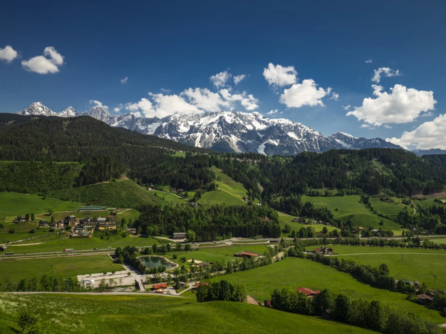
As adventurers set out, they will be greeted by the rolling hills and lush forests of eastern Austria. The trail meanders through a variety of terrains, including alpine meadows, dense woodlands, and rocky outcrops, offering panoramic views of the surrounding countryside.
Historical Significance
The region is steeped in history, with the trail occasionally crossing paths with ancient trade routes that have been used for centuries. Hikers will encounter historical landmarks along the way, such as ruins of old fortifications, which serve as a reminder of the area's past strategic importance.
Flora and Fauna
The Alpannonia trail is a haven for nature enthusiasts. The diverse habitats support a wide range of wildlife, including deer, foxes, and a variety of bird species. The changing seasons bring different flora to life, with wildflowers blooming in spring and summer, and the foliage turning to a fiery palette of colors in the fall.
Elevation and Distance Breakdown
The trail's elevation gain is gradual, with the most significant ascents occurring in the first half of the hike. Hikers will cover roughly 50 kilometers (about 31 miles) before reaching the highest point, after which the trail begins a gentle descent towards the finish.
Preparation and Planning
Hikers should prepare for varying weather conditions, as the high altitude can lead to sudden changes. It is recommended to pack layers of clothing, rain gear, and sufficient water and food supplies. Additionally, sturdy hiking boots are essential for the rocky and sometimes uneven terrain.
Safety and Etiquette
Safety is paramount on the Alpannonia trail. Hikers should inform someone of their plans and expected return time. It's also important to follow Leave No Trace principles, ensuring that the trail remains pristine for future visitors.
Conclusion
By following these guidelines and being prepared for the journey ahead, hikers can fully enjoy the natural beauty and historical richness of the Alpannonia trail. With the right planning and respect for the environment, this hiking experience can be a memorable adventure through the heart of Austria's scenic landscapes.

Frequently asked questions
How long does it take to hike the full Alpannonia trail?
Alpannonia is a 102.09 km point-to-point long-distance hike with 2,535 m of total ascent, so most hikers break it into a multi-day trip rather than attempting it in one push. The official route is commonly organized into 6 or 7 stages, which makes it a practical week-long hike across eastern Austria and onward toward the Pannonian lowlands.
Where does the Alpannonia trail start and what regions does Alpannonia cross?
Alpannonia begins in the Semmering area in Bezirk Neunkirchen, Lower Austria, then continues through Styria and Burgenland before reaching western Hungary. The route is designed as a cross-border long-distance trail linking the Eastern Alps with the Pannonian Plain, which is why it is often described as a hike from alpine terrain into gentler lowland landscapes.
Is the Alpannonia trail a difficult hike?
Alpannonia is generally rated medium difficulty. Over 102.09 km it gains 2,535 m, so the challenge comes more from sustained daily mileage and repeated climbs than from technical mountaineering. A reasonable level of fitness is usually enough for hikers who are comfortable with multi-day walking.
What is the first stage of the Alpannonia trail like from Semmering?
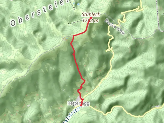
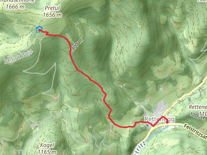
The first official Alpannonia stage runs from Semmering to Hochwechsel and is listed at 19.5 km with about 772 m of ascent. It starts around Semmering at 995 m, passes Hirschenkogel at 1,340 m, and finishes at Hochwechsel and the Wetterkoglerhaus at 1,743 m, with views toward Stuhleck and the surrounding Austrian Alps.
Can the Alpannonia trail be hiked with public transportation access?
Yes. The Semmering start is reachable by public transportation, and trains operated by ÖBB stop directly at Semmering station. From the station it is about a 10-minute walk to the Zauberberg valley station, which makes the western end of Alpannonia one of the easier Austrian long-distance trail starts to reach without a car.
Are there accommodations along the Alpannonia trail?
Yes. Alpannonia has lodging options along its stages rather than requiring wilderness camping for the full route. The trail’s official stage information specifically highlights hosts and accommodations along the Alpannonia stages, and the first stage finishes at Hochwechsel near the Wetterkoglerhaus, a well-known overnight stop on the route.
Does the Alpannonia trail go through Oststeiermark?
Yes. Alpannonia crosses Oststeiermark, or Eastern Styria, as part of its route between the Semmering and the eastern lowlands. The Styrian section includes the Fischbach Alps and the Hochwechsel area, so searches for Alpannonia Oststeiermark usually refer to this scenic middle section of the long-distance trail.
Comments and Reviews
User comments, reviews and discussions about the Alpannonia, Austria.
4.75
average rating out of 5
4 rating(s)