Download
Preview
Add to list
More
6.9 km
~1 hrs 41 min
183 m
Loop
“Embark on the Lake Sylvia and Ouachita Loop Trail for a scenic and historic Arkansas hike.”
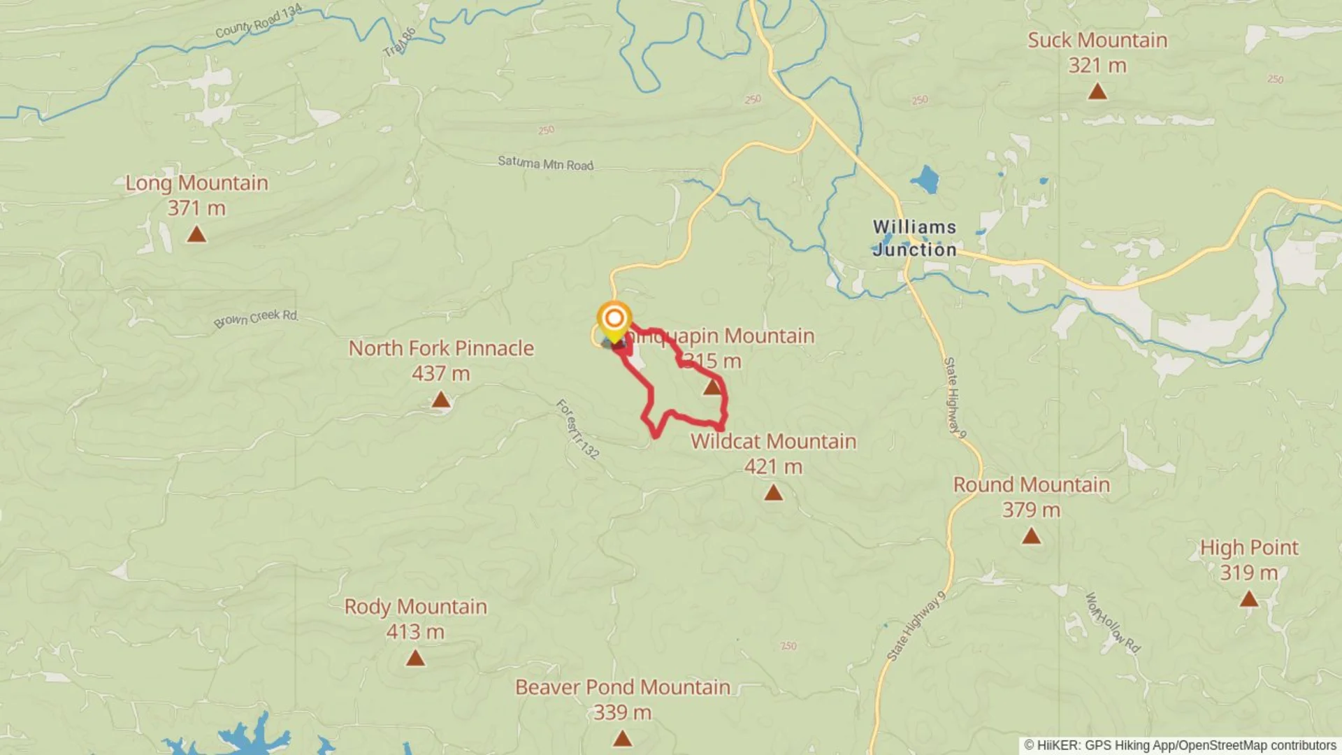
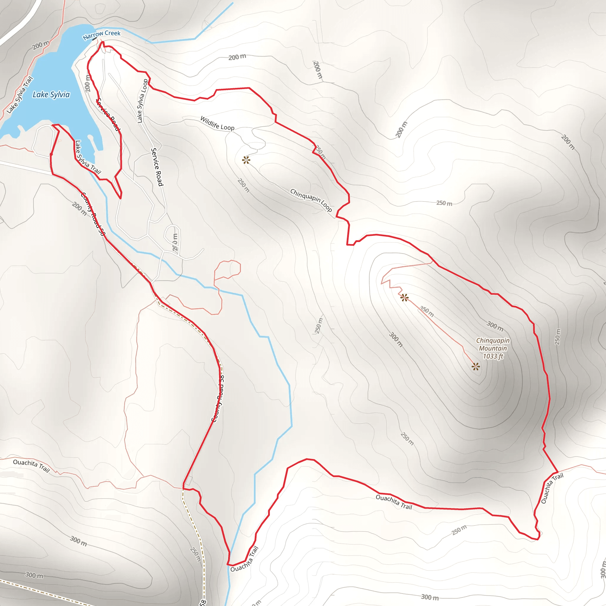
Nestled near Perry County, Arkansas, the Lake Sylvia and Ouachita Loop Trail offers an immersive experience into the natural beauty of the Ouachita National Forest. This approximately 7 km (4.3 miles) loop trail, with an elevation gain of around 100 meters (328 feet), is a medium-difficulty hike that provides a blend of scenic vistas, diverse ecosystems, and a touch of history.
Getting to the Trailhead To reach the trailhead, hikers can drive to Lake Sylvia Recreation Area, which is the nearest significant landmark. From Little Rock, take I-630 W to I-430 S. Follow I-430 S and merge onto I-30 W. Take exit 111 for AR-10 W toward Perryville. Continue on AR-10 W, then turn left onto AR-9 S. Follow AR-9 S to AR-324 W, and turn right. The recreation area will be on your right. Parking is available near the trailhead. For those relying on public transport, check local routes for the closest drop-off points to the Lake Sylvia area and plan for a taxi or rideshare for the remaining distance.
Trail Experience As you embark on the trail, the path meanders through a mixed hardwood and pine forest, with the canopy providing a dappled shade that is particularly refreshing during the warmer months. The trail is well-marked, but carrying a navigation tool like HiiKER is recommended to stay on track and to explore points of interest along the way.
The first section of the trail is relatively flat, allowing hikers to warm up as they move towards the more undulating parts of the path. Approximately 2 km (1.2 miles) in, the trail begins to ascend gently. Here, the sounds of the forest come alive with the chirping of birds and the rustling of leaves underfoot.
Natural Landmarks and Wildlife As you climb, keep an eye out for the local wildlife. The Ouachita Mountains are home to white-tailed deer, black bears, and a variety of bird species. The trail also offers several vantage points for viewing Lake Sylvia, a serene body of water that reflects the surrounding forested hills.
Around the halfway point, the trail reaches its highest elevation, providing a panoramic view of the area. The descent that follows is gradual, leading to a series of small streams that feed into the lake. These water features are particularly picturesque in the spring when wildflowers bloom along the banks.
Historical Significance The region holds historical significance as part of the Ouachita National Forest, established in 1907 as one of the oldest national forests in the southern United States. The Civilian Conservation Corps, active during the 1930s, contributed to the development of the recreational areas around Lake Sylvia, leaving behind structures and trails that are still in use today.
Preparing for the Hike Before setting out, ensure you have adequate water, as the Arkansas climate can be humid and dehydrating. Sturdy hiking boots are recommended due to the uneven terrain in certain sections. Also, pack a light rain jacket, as the weather can be unpredictable. Lastly, don't forget to bring a camera or smartphone to capture the stunning scenery and the occasional wildlife sighting.
By the time you complete the loop and find yourself back at the trailhead, you'll have experienced a rich slice of Arkansas' natural and historical heritage. Whether you're a seasoned hiker or someone looking to delve into the outdoors, the Lake Sylvia and Ouachita Loop Trail is a rewarding adventure waiting to be explored.
What to expect?
Activity types
Comments and Reviews
User comments, reviews and discussions about the Lake Sylvia and Ouachita Loop Trail, Arkansas.
4.5
average rating out of 5
109 rating(s)

