Download
Preview
Add to list
More
6.3 km
~1 hrs 42 min
264 m
Out and Back
“Embark on Glen Oaks Trail's scenic 6 km hike through Arizona's diverse landscapes and historic landmarks.”
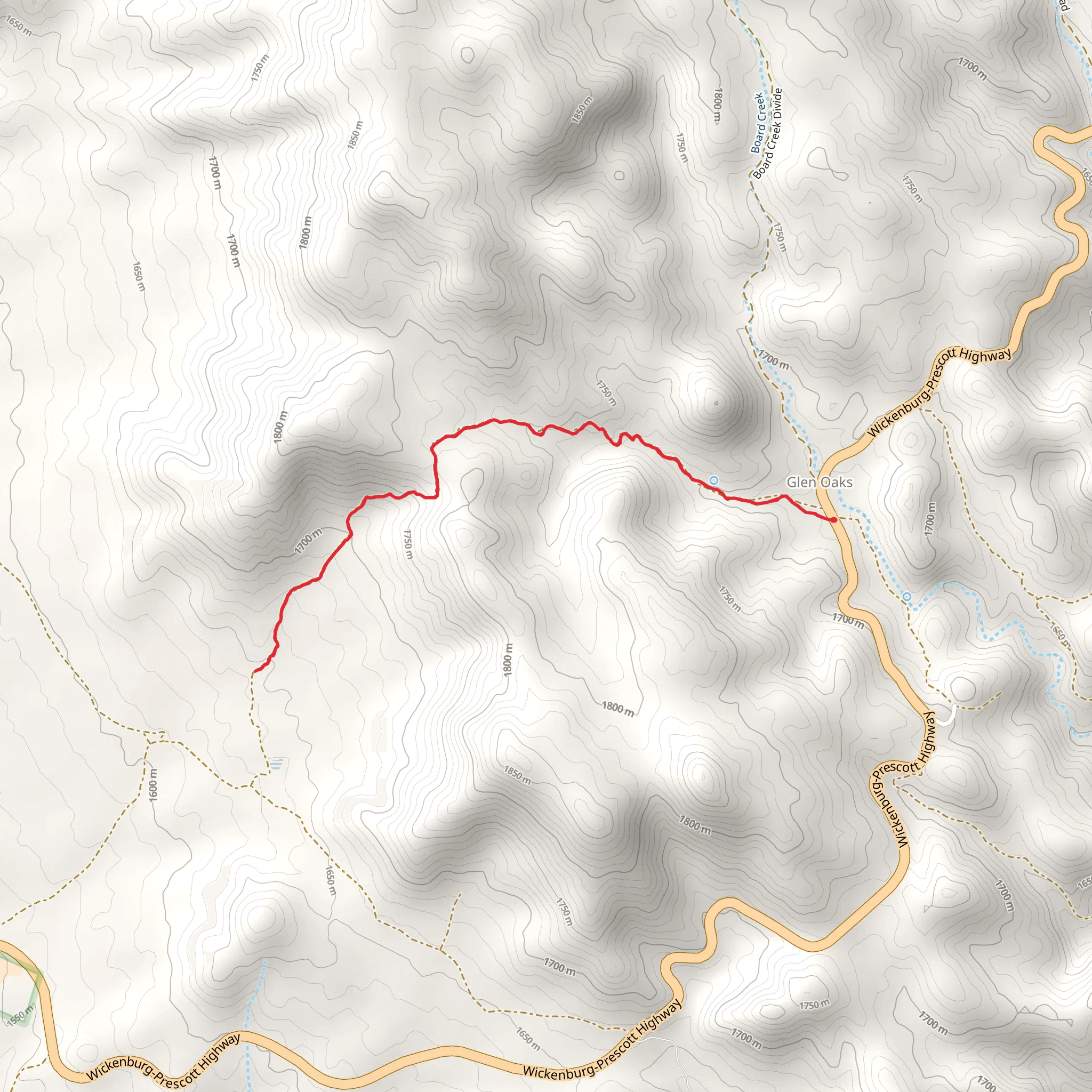
The Glen Oaks Trail offers a moderately challenging hike spanning approximately 6 km (about 3.7 miles) with an elevation gain of around 200 meters (656 feet). Nestled in the scenic region near Yavapai County, Arizona, this out-and-back trail is a delightful journey through diverse landscapes, showcasing the rugged beauty of the area.
Getting to the Trailhead
To reach the trailhead, if you're driving, navigate towards the outskirts of Yavapai County. The starting point is conveniently located near major roads, making it accessible for those with private vehicles. For those opting for public transportation, check local transit schedules for the nearest routes and stops. From the nearest stop, you may need to arrange a taxi or a ride-share to the trailhead, as direct public transport may not be available.
The Hike Experience
As you embark on the Glen Oaks Trail, you'll traverse through a variety of terrains, including rocky paths, serene meadows, and dense woodland areas. The initial segment of the trail is relatively flat, allowing hikers to warm up before encountering the gradual inclines that define the middle sections of the hike.
#### Landmarks and Scenery
Approximately 1.5 km (just under a mile) into the hike, you'll come across an old, abandoned homestead. This structure serves as a reminder of the region's historical significance, with early settlers having once tried to make a living from the rugged land. The trail continues to wind its way through the landscape, offering occasional clearings that provide panoramic views of the surrounding mountains and valleys.
#### Flora and Fauna
The area is rich in biodiversity. Keep an eye out for the local wildlife, including mule deer, coyotes, and a variety of bird species. The trail is also home to a wide array of plant life, from towering pines to delicate wildflowers that bloom in the spring and early summer, adding a splash of color to the terrain.
Navigational Tools
For those looking to navigate the trail with ease, HiiKER is an excellent tool to use. It provides detailed maps and GPS coordinates to ensure you stay on the right path. Remember to download the trail map on HiiKER before you set out, as cell service can be spotty in remote areas.
Preparing for the Hike
Given the trail's medium difficulty rating, it's important to prepare adequately. Ensure you have enough water, especially during the hotter months, and pack snacks or a light lunch to enjoy along the way. Sturdy hiking boots are recommended due to the uneven terrain, and always check the weather forecast before departing.
Elevation and Distance
As you approach the final stretch of the trail, the elevation gain becomes more pronounced, offering a bit of a challenge before reaching the turnaround point. The total elevation gain of 200 meters is spread out across the hike, but it's most noticeable during the latter half of the ascent.
Upon reaching the end of the trail, take a moment to enjoy the sense of accomplishment before heading back. The return journey allows you to experience the landscape from a new perspective, often revealing sights you may have missed on the way up.
Remember to leave no trace, respect the natural environment, and enjoy the beauty that the Glen Oaks Trail has to offer.
Comments and Reviews
User comments, reviews and discussions about the Glen Oaks Trail, Arizona.
5.0
average rating out of 5
1 rating(s)

