Download
Preview
Add to list
More
33.6 km
~3 days
1279 m
Multi-Day
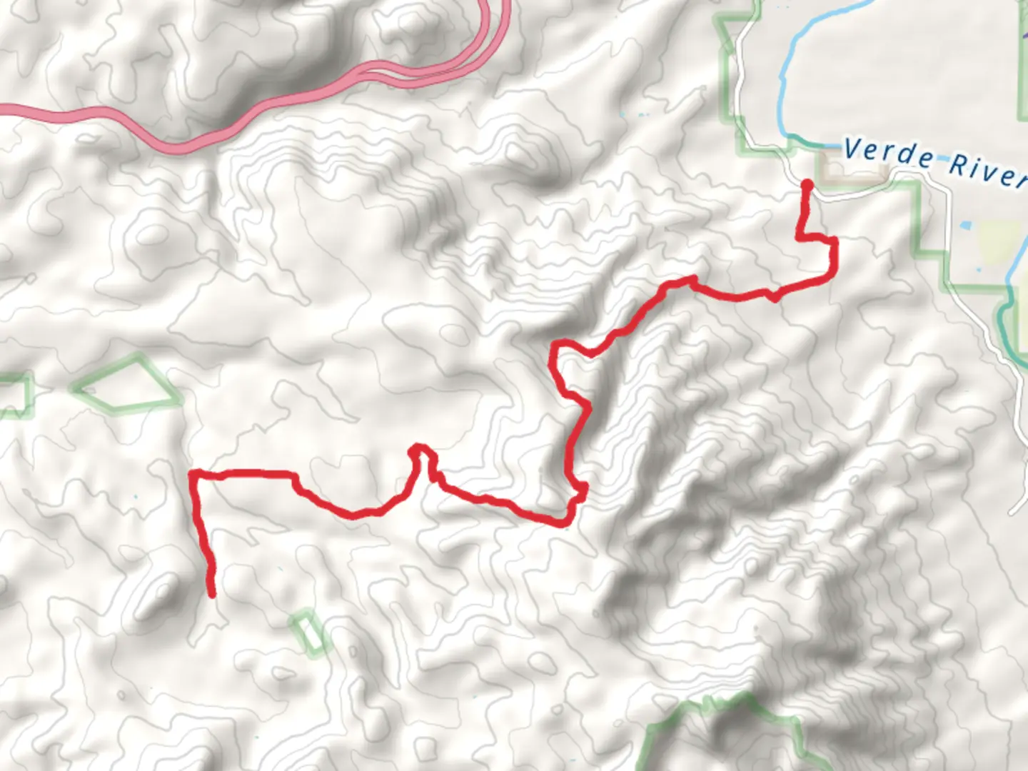
Box T Trail
Starting Point and Access The Box T Trail commences near Yavapai County, Arizona, a region known for its rugged beauty and expansive wilderness. To reach the trailhead, hikers can drive to the vicinity of the Mingus Mountain area, which is the nearest significant landmark. There is no direct public transportation to the trailhead, so access by car is the most feasible option. Upon arrival, parking is typically found along forest service roads, but it's important to ensure your vehicle is parked safely and not obstructing any paths.
Trail Overview The Box T Trail is a loop trail that spans approximately 34 kilometers (about 21 miles) with an elevation gain of around 1200 meters (nearly 3937 feet). The trail is rated as medium difficulty, offering a mix of challenging and moderate sections suitable for hikers with some experience.
Navigating the Trail Hikers can utilize the HiiKER app to navigate the trail, as it provides detailed maps and waypoints that are crucial for staying on the correct path. The trail is well-marked in most sections, but there are areas where the path may become less distinct, so having a reliable navigation tool is essential.
Landmarks and Scenery As you traverse the Box T Trail, you'll be treated to a variety of landscapes, including dense forests, open meadows, and rocky outcrops. The trail offers stunning views of the surrounding mountains and valleys, with several vantage points that are perfect for taking a break and enjoying the scenery.
Wildlife and Nature The area is home to a diverse array of wildlife, including deer, elk, and a variety of bird species. Hikers should be aware of their surroundings and keep a respectful distance from any animals they encounter. The trail also winds through areas of rich vegetation, with wildflowers in the spring and summer, and a colorful display of foliage in the fall.
Historical Significance The region around the Box T Trail is steeped in history, with Native American tribes having inhabited the area for thousands of years. There are also remnants of early pioneer life, with old mines and homesteads dotted throughout the landscape. Hikers with an interest in history will appreciate the opportunity to reflect on the past inhabitants of this rugged terrain.
Preparation and Safety Due to the trail's length and elevation gain, it's important for hikers to be well-prepared with adequate water, food, and clothing for changing weather conditions. The trail can be completed in a single long day by very fit hikers, but many choose to split the hike over two days, camping at one of the dispersed camping sites along the route. Always check the weather forecast before setting out and inform someone of your hiking plans.
Remember, the Box T Trail offers a rewarding experience for those looking to explore the natural beauty and historical richness of Yavapai County, Arizona. With the right preparation and a sense of adventure, it's a hike that showcases the best of what the area has to offer.

Comments and Reviews
User comments, reviews and discussions about the Box T Trail, Arizona.
4.5
average rating out of 5
4 rating(s)