Download
Preview
Add to list
More
44.9 km
~2 day
2049 m
Out and Back
“Embark on a challenging trek through diverse desert landscapes, promising breathtaking views and abundant wildlife.”
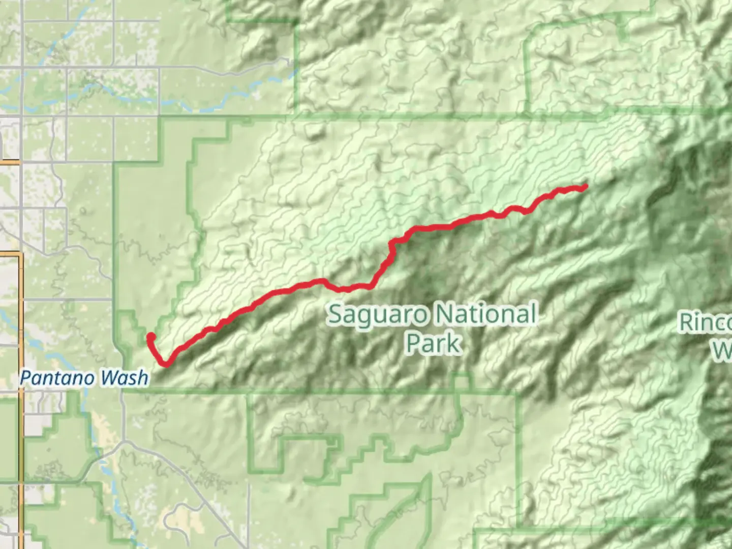
Nestled within the stunning landscape of Saguaro National Park East, the Tanque Verde Peak and Tanque Verde Ridge Trail offers a challenging yet rewarding adventure for seasoned hikers. This out-and-back trail stretches approximately 45 kilometers (about 28 miles) with an elevation gain of around 2000 meters (approximately 6560 feet), making it a demanding trek that promises breathtaking views and a deep connection with the natural world.
Getting There
The trailhead is conveniently located near Pima County, Arizona. For those traveling by car, you can reach the trailhead by heading to the Javelina Picnic Area, which is accessible via the Cactus Forest Drive within the park. If you're relying on public transport, the nearest major city is Tucson, Arizona. From Tucson, you can take a bus or taxi to the park entrance, and then proceed to the trailhead by car or bike.
Trail Overview
The journey begins at the Javelina Picnic Area, where you'll immediately be greeted by the iconic saguaro cacti that define this region. As you set off on the trail, you'll traverse through diverse desert landscapes, with the initial section offering a relatively gentle ascent. The first few kilometers (miles) provide an opportunity to acclimate to the terrain and enjoy the unique flora, including prickly pear cacti and ocotillo.
Ascending the Ridge
As you progress further, the trail becomes steeper and more rugged, demanding careful navigation and a good level of fitness. Utilizing the HiiKER app can be invaluable for staying on track, especially in areas where the path may not be clearly marked. Around the 8-kilometer (5-mile) mark, you'll begin the ascent up the Tanque Verde Ridge. This section is characterized by rocky outcrops and sweeping vistas of the surrounding desert and distant mountain ranges.
Wildlife and Nature
The trail is a haven for wildlife enthusiasts. Keep an eye out for desert dwellers such as Gila monsters, rattlesnakes, and a variety of bird species, including the vibrant cactus wren. The higher elevations may also offer sightings of mule deer and the elusive mountain lion. The flora changes as you climb, with juniper and oak trees becoming more prevalent, providing a stark contrast to the desert floor below.
Reaching Tanque Verde Peak
The final push to Tanque Verde Peak is challenging, with steep inclines and rocky terrain. However, the effort is rewarded with panoramic views from the summit, where you can see the Rincon Mountains and the vast expanse of the Sonoran Desert. This is an ideal spot to rest, refuel, and soak in the natural beauty that surrounds you.
Historical Significance
The region holds historical significance, with the Rincon Mountains serving as a backdrop to the rich cultural history of the Tohono O'odham Nation. The area was also a route for early explorers and settlers, adding a layer of historical intrigue to your hike.
Descent and Return
The return journey follows the same path, allowing you to experience the trail from a new perspective. As you descend, take the time to appreciate the changing light and shadows across the landscape, offering a different view of the desert's beauty.
This trail demands preparation, including adequate water, sun protection, and sturdy hiking boots. With its challenging terrain and stunning vistas, the Tanque Verde Peak and Tanque Verde Ridge Trail is a must-experience for those seeking adventure and a deeper connection with the natural world.

What to expect?
Activity types
Comments and Reviews
User comments, reviews and discussions about the Tanque Verde Peak and Tanque Verde Ridge Trail, Arizona.
average rating out of 5
0 rating(s)