Download
Preview
Add to list
More
24.2 km
~1 day 0 hrs
239 m
Loop
“Embark on the scenic Pemberton Loop Trail for a historic desert hike amid Arizona's diverse wildlife and rugged beauty.”
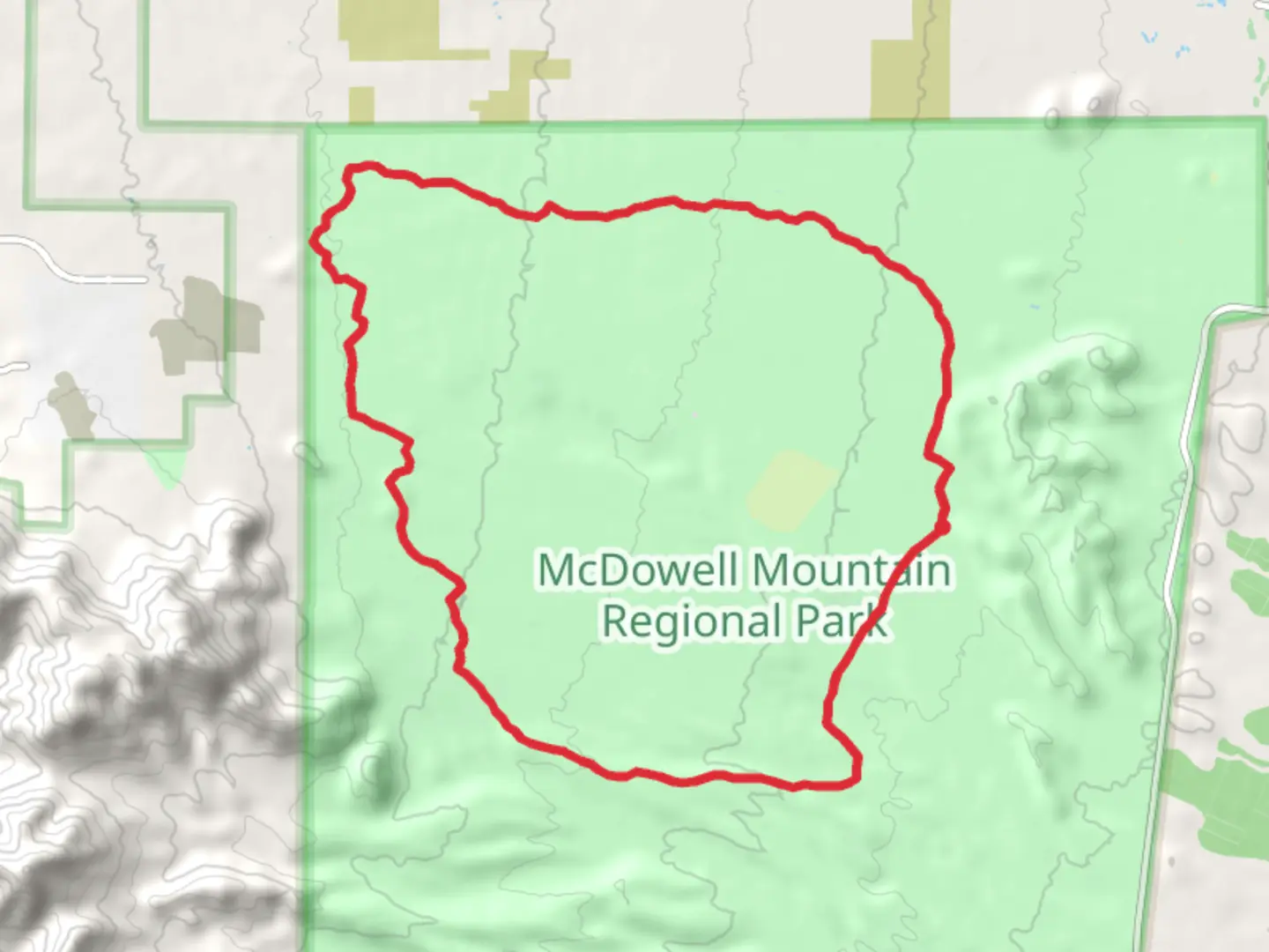
The Pemberton Loop Trail, nestled near Maricopa County, Arizona, offers a moderately challenging hike that spans approximately 24 kilometers (about 15 miles) with an elevation gain of around 200 meters (roughly 650 feet). This loop trail is a favorite among local hikers and visitors looking for a day hike that provides a blend of desert landscapes, wildlife viewing opportunities, and a touch of historical significance.
Getting to the Trailhead To reach the starting point of the Pemberton Loop Trail, hikers can drive to the McDowell Mountain Regional Park, which is the nearest significant landmark. The park is accessible by car, and there is ample parking available for those bringing their own vehicles. For those relying on public transportation, options may be limited due to the park's more remote location, so checking local transit resources for the latest information is advisable.
Navigating the Trail Once at the trailhead, hikers can utilize the HiiKER app to navigate the loop. The trail is well-marked, but having a digital tool can help keep track of progress and ensure you stay on the right path. The loop can be hiked in either direction, but many choose to go clockwise to tackle the steeper sections earlier in the hike.
Desert Flora and Fauna As you embark on the Pemberton Loop Trail, you'll be greeted by the quintessential Sonoran Desert scenery. The trail meanders through a landscape dotted with saguaro cacti, cholla, and mesquite trees. Keep an eye out for the diverse wildlife that calls this area home, including jackrabbits, roadrunners, and if you're lucky, you might spot a coyote or a javelina. Remember to keep a safe distance from wildlife and to not feed any animals you encounter.
Historical Significance The region around the Pemberton Loop Trail is steeped in history. The McDowell Mountain Regional Park area was once inhabited by the ancient Hohokam people, and evidence of their presence can be seen in the form of petroglyphs and ruins scattered throughout the park. As you hike, imagine the rich cultural history that unfolded in this very landscape.
Trail Experience The trail itself is a mix of packed dirt and loose gravel, with some rocky sections that require careful footing. The elevation gain is gradual, with no excessively steep climbs, making it a manageable hike for those with a moderate level of fitness. The highest point of the trail offers panoramic views of the surrounding mountains and desert, making it a perfect spot for a rest and a photo opportunity.
Preparation and Safety Due to the open desert environment, it's essential to prepare adequately for the hike. Bring plenty of water—at least one gallon per person—as there are no water sources along the trail. Sun protection, including a hat, sunscreen, and sunglasses, is also crucial. The best times to hike are in the cooler months from November to April. If hiking during the warmer months, start early in the morning to avoid the midday heat.
Conclusion The Pemberton Loop Trail is a rewarding experience for those looking to explore the beauty of the Arizona desert. With its moderate difficulty, historical landmarks, and stunning natural scenery, it's a hike that offers something for everyone. Remember to plan ahead, stay safe, and enjoy the journey through this unique and captivating landscape.

What to expect?
Activity types
Comments and Reviews
User comments, reviews and discussions about the Pemberton Loop Trail, Arizona.
4.33
average rating out of 5
21 rating(s)