Download
Preview
Add to list
More
38.1 km
~3 days
1508 m
Multi-Day
“Embark on a 23.6-mile trek through diverse Arizonian terrains, rich with wildlife and history, on the Strayhorse to Raspberry Trail.”
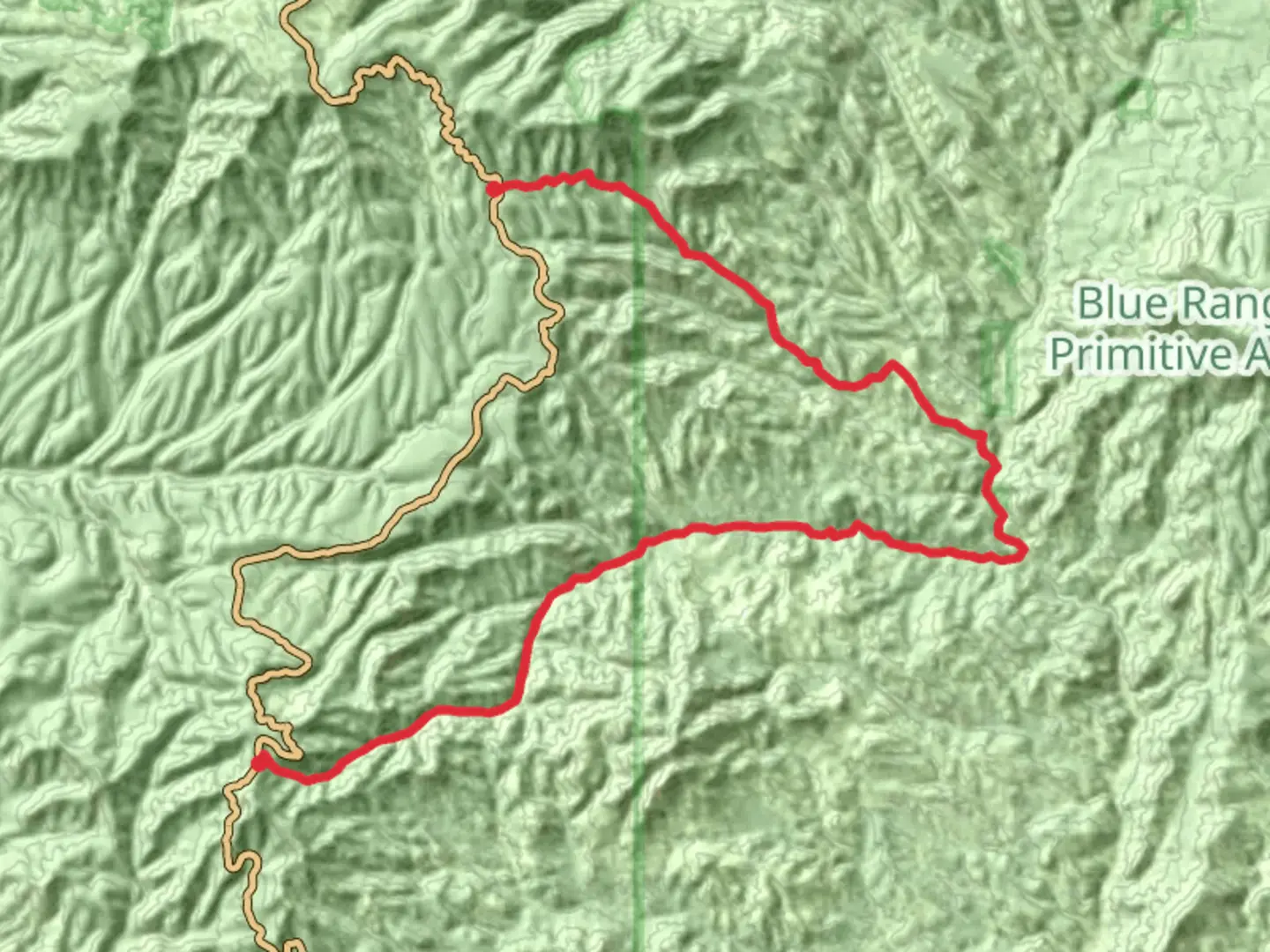
The Strayhorse Trail and Raspberry Trail combine to form a scenic and moderately challenging point-to-point hike nestled in the picturesque landscape near Greenlee County, Arizona. Spanning approximately 38 kilometers (about 23.6 miles) with an elevation gain of around 1500 meters (roughly 4921 feet), this trail offers hikers a diverse array of terrains and ecosystems to explore.
Getting to the Trailhead
To reach the trailhead, hikers can drive to the vicinity of Greenlee County, where the trail begins. There is no direct public transportation to the trailhead, so a personal vehicle or a taxi service is necessary. The starting point is accessible via well-maintained roads, and parking is available near the trailhead.
Trail Experience
As you embark on the Strayhorse Trail, you'll be greeted by a gradual ascent through a forested area, with the path lined by a mix of coniferous and deciduous trees. The first few kilometers will introduce you to the local flora and fauna, including the chance to spot mule deer, jackrabbits, and a variety of bird species.
Historical Significance
The region holds historical significance, with trails that were once used by Native Americans and later by miners during the area's mining boom. As you hike, you may come across remnants of old mining operations, including abandoned shafts and equipment, which serve as a testament to the area's rich past.
Landmarks and Scenery
Approximately 10 kilometers (6.2 miles) into the hike, you'll reach a notable landmark, the junction with the Raspberry Trail. This is a good spot to take a break and enjoy the panoramic views before continuing. The Raspberry Trail offers a change in scenery as you descend into a valley with a lush riparian zone, where the sound of running water from a nearby creek accompanies your journey.
Wildlife and Nature
The diverse habitats along these trails support an array of wildlife. Keep an eye out for signs of black bears and mountain lions, although they are typically elusive. Birdwatchers will delight in the opportunity to see species such as the Arizona woodpecker and the Mexican chickadee.
Navigation and Preparation
Navigating the trails can be done with the help of the HiiKER app, which provides detailed maps and waypoints to ensure you stay on the right path. It's advisable to download the trail maps ahead of time, as cell service can be spotty in remote areas.
Hikers should be prepared for the trail's moderate difficulty, with enough water, food, and appropriate gear for changing weather conditions. The elevation gain is steady, so pacing yourself and taking breaks as needed will make for a more enjoyable experience.
Conclusion of the Trail
As you approach the end of the point-to-point trail, the path will lead you back into a more arid environment, typical of the Arizona landscape. The final stretch may be challenging due to the accumulated elevation gain, but the sense of accomplishment upon completing the hike is well worth the effort. Upon reaching the end of the trail, hikers will need to arrange for transportation back to their starting point or have a second vehicle staged at the finish.

Comments and Reviews
User comments, reviews and discussions about the Strayhorse Trail and Raspberry Trail, Arizona.
4.5
average rating out of 5
4 rating(s)