Download
Preview
Add to list
More
21.3 km
~2 days
1445 m
Multi-Day
South Kaibab Trail
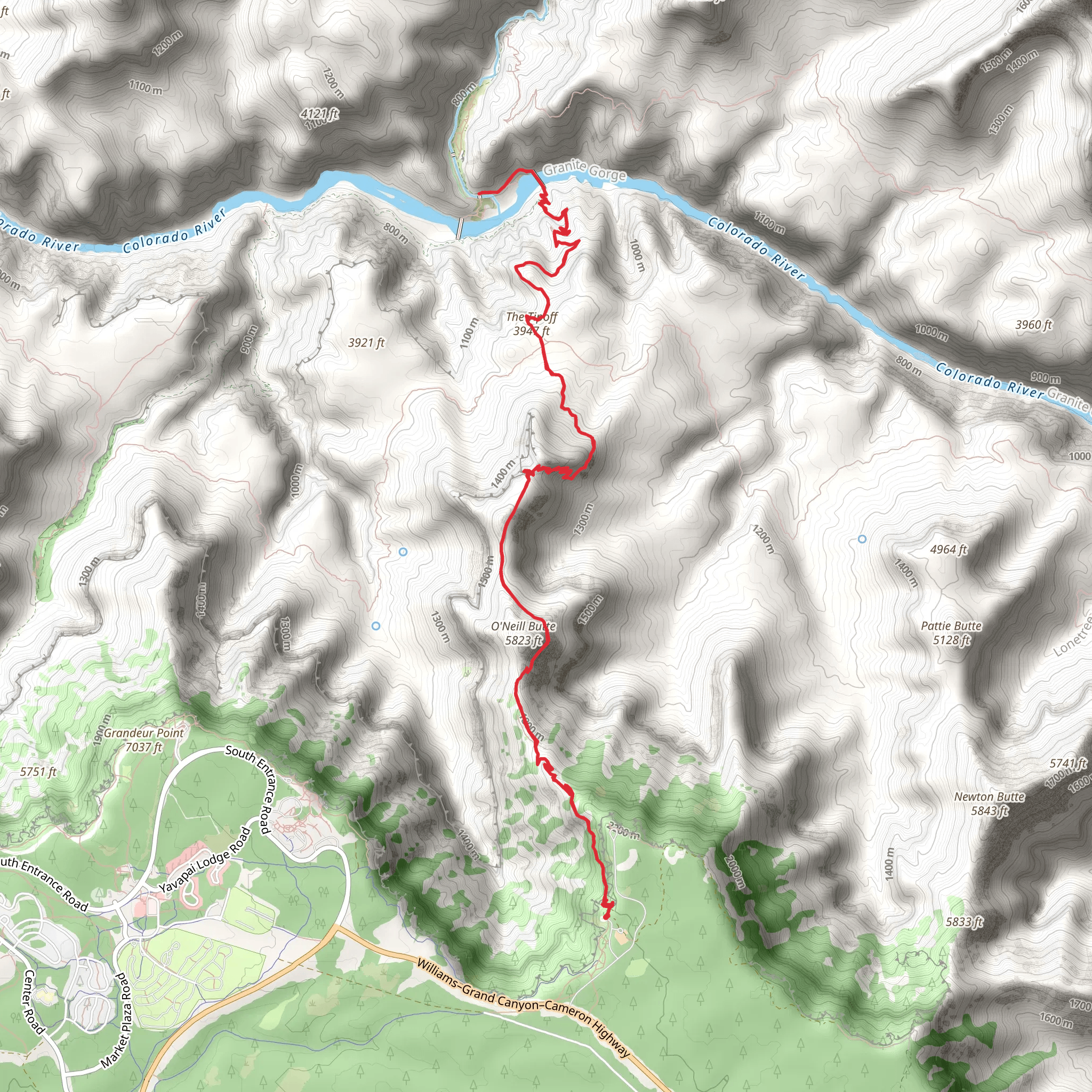
The South Kaibab Trail offers an immersive hiking experience within the Grand Canyon National Park, starting near Grand Canyon Village in Arizona. This out-and-back trail spans approximately 21 kilometers (13 miles) and features an elevation gain of around 1400 meters (4593 feet), presenting a medium difficulty level that requires a good level of fitness and preparation.
Getting to the Trailhead
To reach the trailhead, you can drive or take the park's shuttle bus system. If driving, park at the visitor center or the Backcountry Information Center and then use the park's shuttle bus to get to the Yaki Point Road, where private vehicles are not allowed. The South Kaibab Trailhead is located at the end of this road. For those relying on public transport, the nearest city with bus and train connections is Flagstaff, Arizona, from which you can take a shuttle or taxi to Grand Canyon Village.
Trail Experience
The trail begins with a series of switchbacks known as the "Chimney," which quickly descends through the Kaibab limestone and Coconino sandstone layers. As you progress, you'll be treated to panoramic views of the canyon, including sights like O'Neill Butte and the vast expanse of the inner canyon.
At approximately 2.5 kilometers (1.5 miles) in, you'll reach Ooh Aah Point, a popular spot for its breathtaking vistas. Continuing on, the trail descends to Cedar Ridge, which is about 4.8 kilometers (3 miles) from the trailhead. This area offers restrooms and some shaded areas, making it a good rest stop.
The path then leads to Skeleton Point at around 5 kilometers (3 miles), where hikers can see the Colorado River for the first time. It's important to note that beyond this point, the trail becomes more challenging, and it is recommended that day hikers turn back here to avoid the strenuous climb back up.
For those continuing, the trail descends to the Tonto Trail junction and then to the Tip Off, which is about 7.5 kilometers (4.7 miles) from the trailhead. From here, the trail becomes steeper as it makes its way down to the Colorado River and the Black Bridge, which hikers can cross to reach Bright Angel Campground and Phantom Ranch.
Nature and Wildlife
The South Kaibab Trail traverses several ecological zones, each with its unique flora and fauna. Hikers may encounter mule deer, bighorn sheep, and a variety of bird species. The trail's vegetation changes from pinyon-juniper woodlands to scrub brush and finally to riparian vegetation near the river.
Historical Significance
The Grand Canyon region is rich in human history, with Native American tribes such as the Havasupai and the Hualapai having lived in the area for thousands of years. The South Kaibab Trail itself was constructed in the 1920s as a means for visitors to access the canyon's inner reaches.
Navigation and Preparation
Hikers should be well-prepared with water, as there are no water sources along the trail until reaching Phantom Ranch. It's essential to carry plenty of water, especially during the hot summer months. For navigation, the HiiKER app can be a valuable tool, providing detailed maps and trail information to help you stay on track.
Safety Considerations
The hike back up is strenuous, and it's crucial to start early in the day to avoid the intense midday heat. Be aware of the signs of heat exhaustion and take regular breaks. It's also important to check the weather forecast and avoid hiking during extreme weather conditions.
Remember, the South Kaibab Trail offers a challenging yet rewarding experience, with stunning views and a chance to explore one of the world's most iconic natural wonders. Proper preparation and respect for the trail's difficulty will ensure a memorable and safe hiking adventure.
Comments and Reviews
User comments, reviews and discussions about the South Kaibab Trail, Arizona.
4.5
average rating out of 5
4 rating(s)

