Download
Preview
Add to list
More
6.4 km
~2 hrs 1 min
447 m
Loop
“Embark on a serene ascent through Arizona's biodiversity to Heliograph Peak's historic summit and panoramic splendor.”
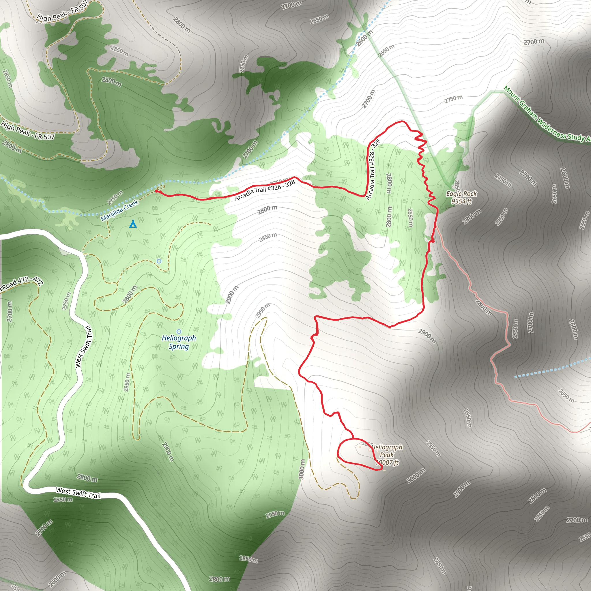
The Heliograph Peak Trail, nestled in the scenic Pinaleño Mountains near Graham County, Arizona, offers hikers a moderately challenging yet rewarding experience. Spanning approximately 6 kilometers (about 3.7 miles) with an elevation gain of roughly 400 meters (around 1,312 feet), this loop trail is a perfect day hike for those looking to immerse themselves in the beauty of southeastern Arizona's sky islands.
Getting to the Trailhead
To reach the trailhead, hikers can drive to the Shannon Campground, which is the nearest significant landmark. From Safford, Arizona, take US-191 S toward AZ-366 E/Swift Trail. Follow AZ-366 E for about 22.5 miles, winding your way up the mountain until you reach the campground. The trailhead is conveniently located near the campground, making it easily accessible for those arriving by car. Public transportation options are limited in this area, so driving is the most feasible way to access the start of the hike.
The Hike Itself
As you embark on the Heliograph Peak Trail, you'll find yourself winding through a lush forest of Douglas fir, aspen, and pine. The initial segment of the trail is a steady climb, and hikers should be prepared for switchbacks that offer a gradual ascent towards the peak. The trail is well-marked, but carrying a navigation tool like HiiKER can be helpful for staying on track and monitoring your progress.
Flora, Fauna, and Landmarks
The diverse ecosystem of the Pinaleño Mountains means you'll likely encounter a variety of wildlife, including deer, wild turkeys, and if you're lucky, you might spot some of the more elusive creatures like black bears or mountain lions from a safe distance. Birdwatchers will also enjoy the trail, as it's home to many species, including the Mexican spotted owl and several types of hummingbirds.
One of the trail's significant landmarks is the historic Heliograph Peak itself, which was once used as a military signaling point with a heliograph, a device that uses sunlight to send signals across long distances. During the late 19th century, the peak played a crucial role in the United States Army's communication network during the Apache Wars.
The Summit
Upon reaching the summit, hikers are rewarded with breathtaking panoramic views. From the peak, you can see the vast desert stretching out to the west and the rolling hills and valleys to the east. The summit area is also home to the remnants of the old heliograph station, providing a tangible connection to the region's historical significance.
Descent and Trail Completion
The descent from Heliograph Peak follows a different path, completing the loop and offering fresh scenery. The downward trail is less steep than the ascent, allowing for a more relaxed pace to take in the surroundings. As you complete the loop, the trail will lead you back to the Shannon Campground.
Preparation and Safety
Before setting out, hikers should ensure they have adequate water, as the arid climate can lead to dehydration. It's also wise to check the weather forecast, as conditions at higher elevations can change rapidly. Sturdy hiking boots, sun protection, and layered clothing are recommended to handle the varied terrain and potential temperature shifts.
Remember, while the Heliograph Peak Trail is rated as medium difficulty, it's important to assess your own fitness level and hiking experience before attempting the hike. Always let someone know your plans and expected return time when venturing into the wilderness.
Comments and Reviews
User comments, reviews and discussions about the Heliograph Peak Trail, Arizona.
4.5
average rating out of 5
4 rating(s)

