Download
Preview
Add to list
More
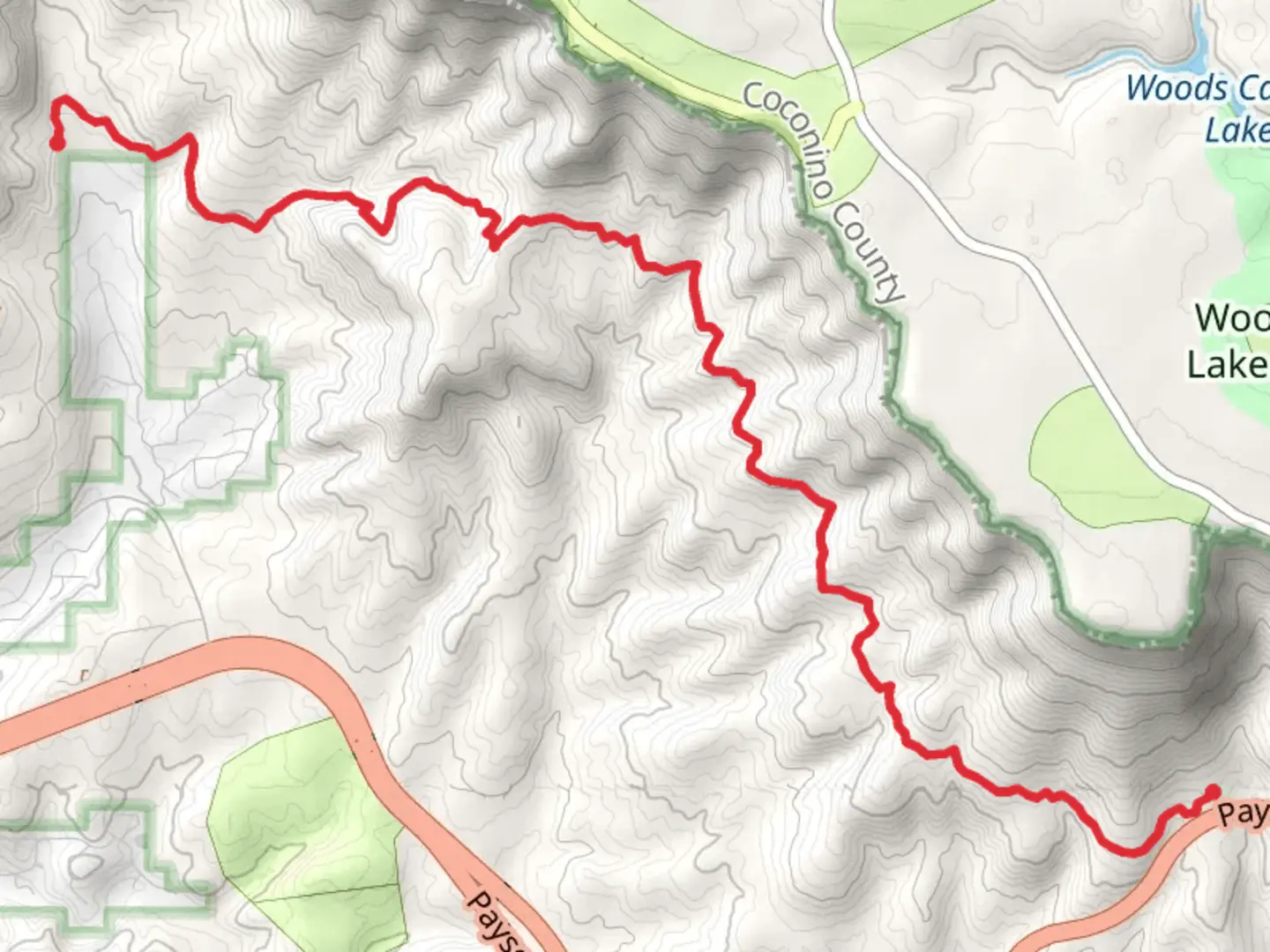
11.0 km
~2 hrs 41 min
294 m
Point-to-Point
“Explore Arizona's diverse Highline Trail, rich in history, wildlife, and breathtaking Mogollon Rim vistas.”
The Highline Trail from Payson-Heber Highway stretches approximately 11 kilometers (about 6.8 miles) and features an elevation gain of around 200 meters (approximately 656 feet). This point-to-point trail is nestled near Gila County, Arizona, and is rated as medium difficulty, making it accessible to hikers with some experience.
Getting to the Trailhead
To reach the trailhead by car, you'll want to navigate towards the Payson-Heber Highway, also known as Arizona State Route 260. The starting point is conveniently located off this highway, making it relatively easy to find. For those relying on public transportation, options may be limited due to the trail's more remote location, so it's advisable to check local resources for the latest transport links or consider arranging a shuttle service or taxi to the trailhead.
Navigating the Trail
Once on the trail, hikers can expect a well-defined path that meanders through a diverse landscape of ponderosa pine forests, mixed conifer, and oak woodlands. The trail is marked, but carrying a reliable navigation tool like HiiKER is recommended to ensure you stay on the correct path, especially at junctions or less distinct sections.
Landmarks and Scenery
As you progress along the Highline Trail, you'll be treated to stunning views of the Mogollon Rim, a significant geological feature that defines much of the topography in this part of Arizona. The Rim presents a dramatic escarpment that rises to an elevation of over 2,000 meters (6,500 feet) and offers breathtaking vistas that are especially impressive at sunrise or sunset.
Wildlife and Nature
The area is rich in wildlife, and hikers may spot elk, mule deer, and a variety of bird species, including the occasional bald eagle. The trail also winds through areas that are home to black bears and mountain lions, so it's important to be aware of your surroundings and knowledgeable about how to safely coexist with these larger mammals.
Historical Significance
The region holds historical significance as it was once the homeland of the Apache and Yavapai peoples. The trail itself follows a route that was used by these indigenous groups long before European settlers arrived. Additionally, the area was the site of significant activity during the Pleasant Valley War, a range war that took place in the late 19th century.
Preparation and Planning
Before setting out, hikers should be prepared with adequate water, as sources along the trail may be scarce or unreliable, especially during the drier months. It's also wise to pack layers of clothing, as temperatures can vary with elevation and time of day. Lastly, ensure you have a first aid kit, a map of the area, and the means to purify water if necessary.
By taking the time to plan and prepare, hikers can enjoy a rewarding experience on the Highline Trail from Payson-Heber Highway, immersed in the natural beauty and historical context of this unique Arizona landscape.

What to expect?
Activity types
Comments and Reviews
User comments, reviews and discussions about the Highline Trail from Payson-Heber Highway, Arizona.
4.2
average rating out of 5
15 rating(s)