Download
3D Flyover
Add to list
More
839.8 km
~38 days
33900 m
Multi-Day
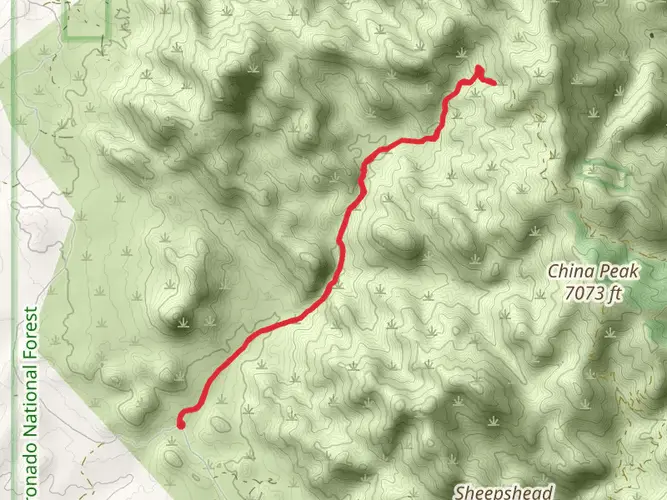
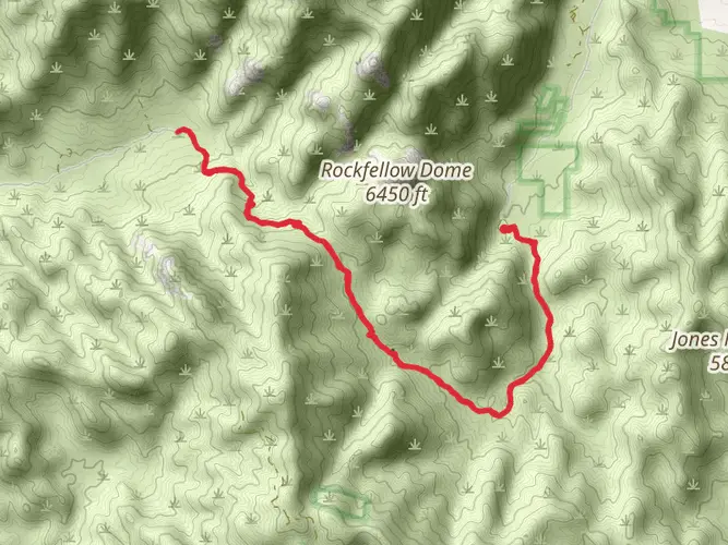
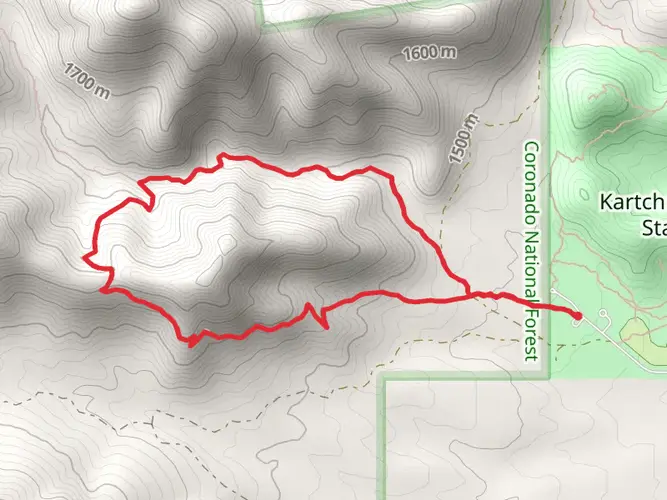
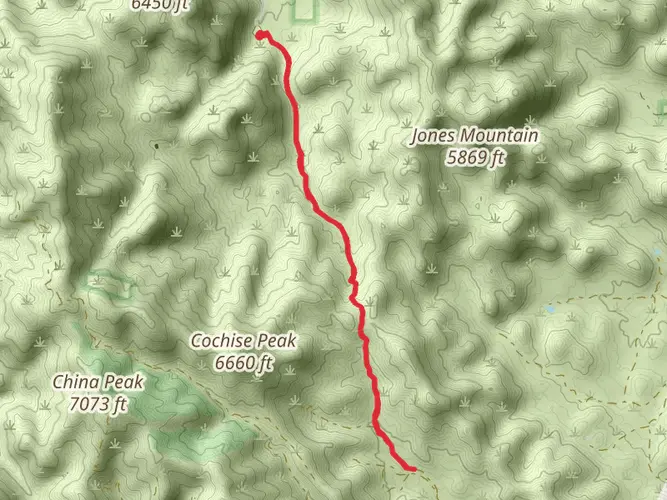
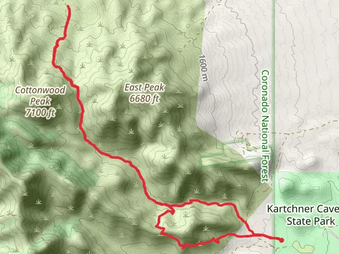
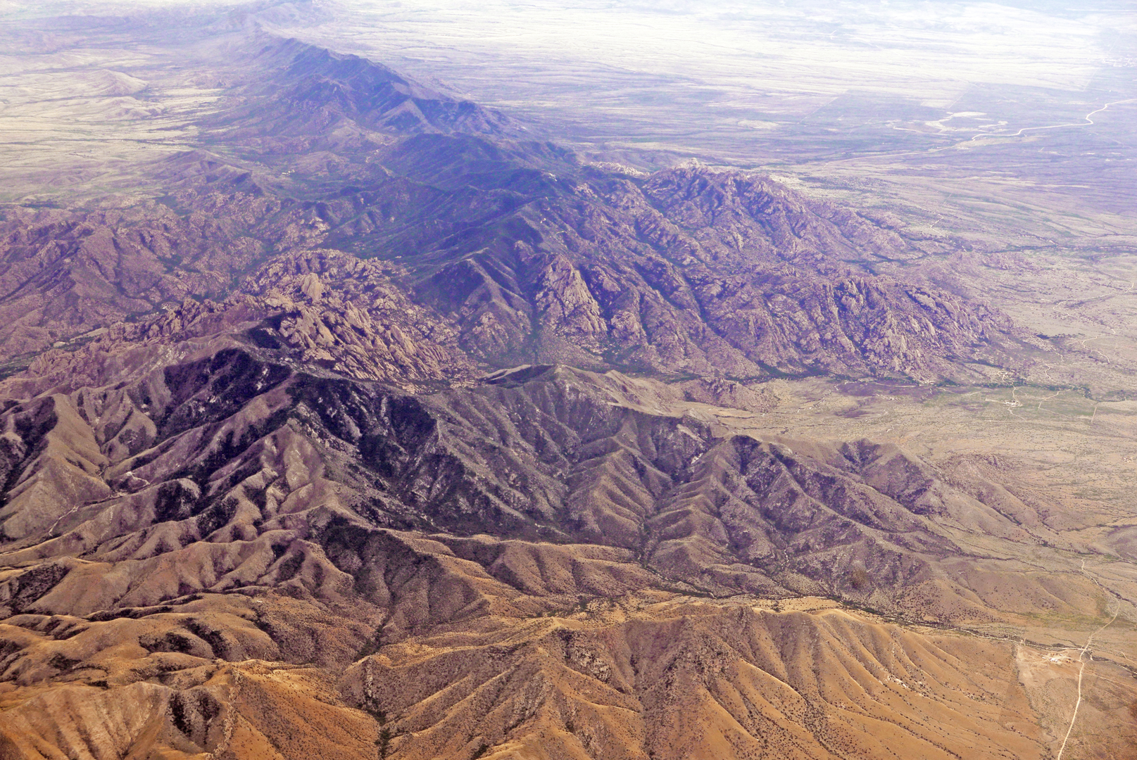
The Sky Islands Traverse is an extensive and challenging journey that spans approximately 840 kilometers (about 522 miles), with an elevation gain of around 33,900 meters (approximately 111,200 feet). This point-to-point trail begins near Cochise, Arizona, and takes hikers through a series of mountain ranges known as the Sky Islands, which are unique to the southwestern United States and northwestern Mexico.
Getting to the Trailhead
To reach the starting point of the Sky Islands Traverse, hikers can drive to the vicinity of Cochise, Arizona. For those relying on public transportation, the nearest major city with bus and train services is Tucson, Arizona. From Tucson, you can rent a car or arrange for a shuttle service to take you to the trailhead. It's important to plan this part of your trip carefully, as the trailhead is in a remote location.
Trail Overview
The trail meanders through a variety of terrains, including desert scrub, grasslands, and pine forests, offering a diverse hiking experience. The Sky Islands are named for their high mountain ranges that rise dramatically from the surrounding desert floor, creating isolated ecosystems rich with unique flora and fauna.
Wildlife and Flora
As you traverse the Sky Islands, keep an eye out for the diverse wildlife that inhabits these ranges. The area is home to over half of the bird species of North America, including the elegant trogon and various hummingbird species. Mammals such as the black bear, mountain lion, and coati also roam these lands. The flora is equally diverse, with a range of species from cacti and agaves in the lower elevations to Douglas firs and ponderosa pines at higher altitudes.
Significant Landmarks and Historical Significance
The trail passes through several notable ranges, including the Huachuca, Santa Rita, and Rincon Mountains. Each range offers unique geological features, such as the impressive rock formations in the Chiricahua National Monument, which is located near the trailhead. The region is also rich in history, with remnants of Native American and Spanish colonial presence. The Coronado National Memorial near the southern terminus commemorates the first organized expedition into the Southwest by Europeans.
Navigation and Planning
Hikers should prepare for a variety of weather conditions and carry sufficient water, as sources can be scarce, especially in the drier sections. Navigation can be challenging, so it is recommended to use a reliable GPS tool like HiiKER to track your progress and stay on the correct path. The trail is marked, but due to its length and remote nature, having a digital tool can be invaluable.
Preparation and Safety
Given the trail's length and elevation gain, hikers should be in good physical condition and have experience with long-distance backpacking. It's essential to plan resupply points and be aware of potential wildlife encounters. Safety precautions for heat and sun exposure are necessary, as well as preparation for cooler temperatures at higher elevations.
Conclusion
The Sky Islands Traverse is a unique and rewarding experience for the seasoned hiker. With its rich biodiversity, stunning landscapes, and historical landmarks, it offers an unforgettable adventure through one of the most biologically diverse regions in North America. Proper preparation and respect for the natural environment will ensure a safe and enjoyable journey along this remarkable trail.

What to expect?
Activity types
Comments and Reviews
User comments, reviews and discussions about the Sky Islands Traverse, Arizona.
4.33
average rating out of 5
6 rating(s)