Download
Preview
Add to list
More
50.4 km
~3 days
1591 m
Multi-Day
“Embark on the Chilkoot Trail for a historic trek through diverse terrains and Gold Rush relics, suited for fit hikers.”
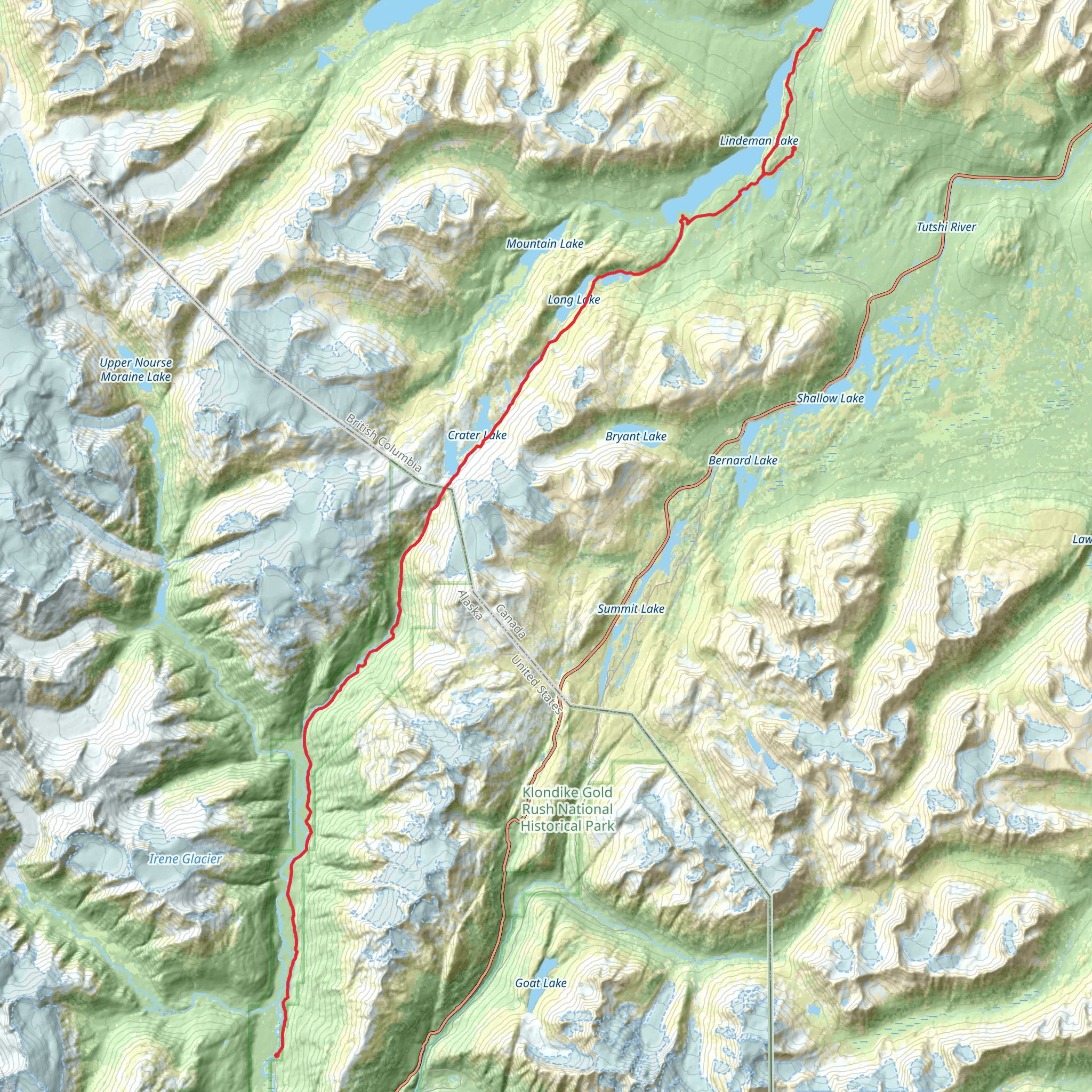
The Chilkoot Trail, a historic path that stretches approximately 50 kilometers (31 miles) from near Skagway, Alaska, to Bennett Lake in British Columbia, offers hikers a unique blend of scenic beauty, wildlife encounters, and a deep dive into the history of the Klondike Gold Rush. With an elevation gain of around 1,500 meters (4,921 feet), the trail is considered to have a medium difficulty rating, making it accessible to hikers with a reasonable level of fitness and experience.
Getting to the Trailhead
To reach the trailhead, which is situated just outside of Skagway, hikers can either drive or use public transportation. If driving, take the Alaska Highway to the Klondike Highway, which leads directly to Skagway. For those opting for public transport, there are buses and shuttles available from Whitehorse, Yukon, to Skagway, which is the nearest town to the trailhead. From Skagway, the trailhead is a short drive or taxi ride away.
Historical Significance
The Chilkoot Trail is steeped in history, once serving as a major route during the Klondike Gold Rush in the late 1890s. Thousands of stampeders braved this treacherous path, laden with a year's worth of supplies, in hopes of striking it rich in the goldfields. Today, hikers can witness remnants of this bygone era, including abandoned equipment, dilapidated buildings, and the famous Golden Stairs, where prospectors formed a human chain to climb the icy steps.
Navigating the Trail
Hikers can utilize the HiiKER app to navigate the trail, ensuring they stay on the correct path and are aware of key waypoints. The trail is well-marked, but due to its remote nature, having a reliable navigation tool is essential.
Landmarks and Terrain
The journey begins in a coastal rainforest, where towering trees and lush undergrowth create a green canopy overhead. As the trail ascends, the vegetation changes, and hikers will traverse through different ecological zones. Approximately 7.5 kilometers (4.7 miles) in, the trail reaches Finnegan's Point, a good spot for a rest and to take in the views of the Taiya River.
Continuing on, the trail becomes steeper and more rugged, leading to the Scales, around 20 kilometers (12.4 miles) from the start. This area marks the base of the Chilkoot Pass, where goods were once weighed before the climb. The ascent of the pass is the most challenging part of the hike, with steep, rocky terrain and potential for rapidly changing weather conditions.
Wildlife and Nature
Throughout the hike, be on the lookout for wildlife such as bears, mountain goats, and a variety of bird species. It's important to practice bear safety, including making noise while hiking and properly storing food.
Camping and Accommodations
There are designated campsites along the trail, which require reservations. These sites provide basic amenities such as outhouses and bear-proof food storage. It's crucial to plan your stops in advance and be prepared for backcountry camping.
Weather and Preparation
Weather on the Chilkoot Trail can be unpredictable, with the possibility of snow, even in summer. Hikers should come prepared with appropriate clothing, rain gear, and sturdy boots. It's also important to be self-sufficient, carrying enough food, water, and emergency supplies for the entire trek.
End of the Trail
Upon reaching Bennett Lake, the trail concludes with a sense of accomplishment and a wealth of historical and natural experiences. From Bennett, hikers can catch the White Pass & Yukon Route Railway back to Skagway, completing their journey through this remarkable landscape.
What to expect?
Activity types
Comments and Reviews
User comments, reviews and discussions about the Chilkoot Trail, Alaska.
4.38
average rating out of 5
21 rating(s)

