Download
3D Flyover
Add to list
More
46.1 km
~2 days
1525 m
Multi-Day
“Embark on Kesugi Ridge's scenic trek, a tapestry of Alaska's wilderness, wildlife, and the majestic Denali.”
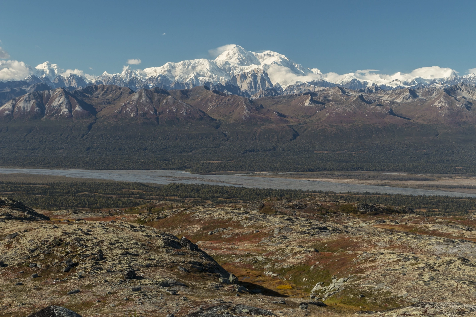
Nestled in the rugged heartland of Alaska, the Kesugi Ridge trail offers an immersive experience through the Denali State Park, presenting hikers with breathtaking views of the Alaska Range and its crowning jewel, Denali (formerly Mount McKinley). This point-to-point trail spans approximately 46 kilometers (around 29 miles) with an elevation gain of about 1500 meters (roughly 4900 feet), providing a medium difficulty challenge that appeals to hikers with a moderate level of experience.
Getting to the Trailhead
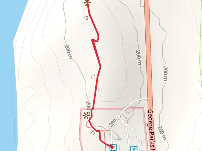
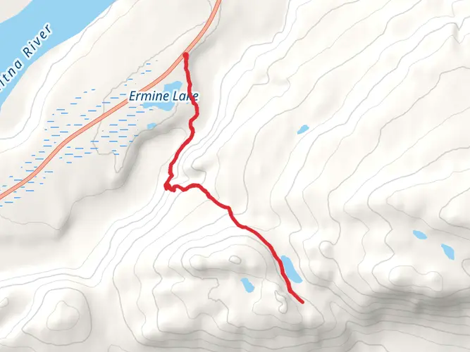
The trailhead is accessible near Matanuska-Susitna, Alaska. For those driving, the most common starting point is the Little Coal Creek Trailhead, which can be reached by taking the Parks Highway (AK-3) to mile 163.5, where you'll find the parking area. If you're relying on public transportation, options are limited, but during the summer months, some shuttle services may operate from nearby towns like Talkeetna, which cater to hikers.
The Hike Itself
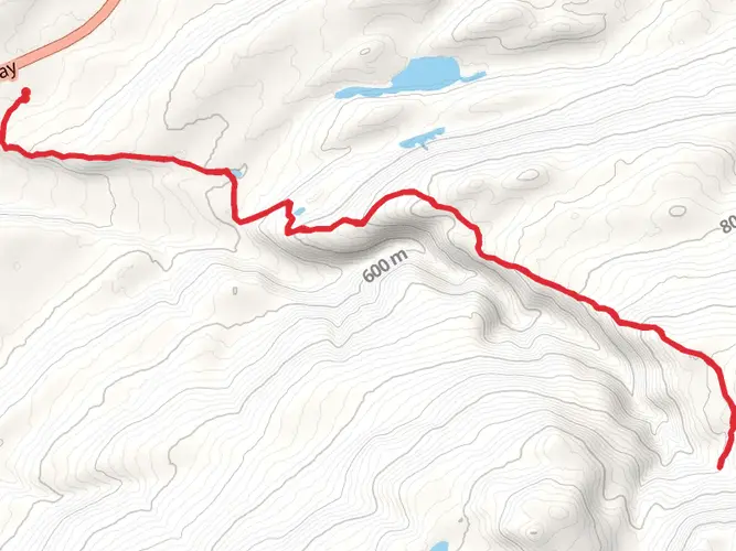
As you embark on your journey from the Little Coal Creek Trailhead, the trail begins with a steady climb, leading you through a forest of spruce and birch. The ascent is gradual but persistent, and within the first few miles, you'll gain significant elevation. The dense canopy eventually gives way to alpine tundra and sweeping vistas.
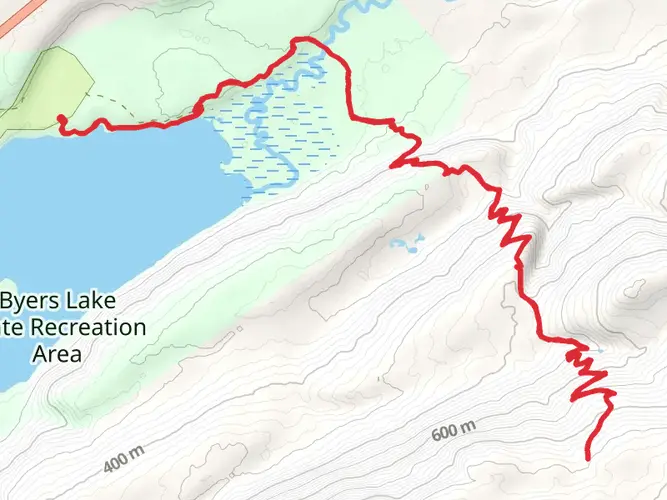
Around the 6-mile mark, you'll reach the ridge proper, where the landscape opens up to reveal panoramic views of the Alaska Range. On clear days, Denali looms in the distance, a sight that remains a highlight of the trail. The ridge walk is a mix of rolling terrain with occasional steep sections, but the expansive views are a constant companion.
Flora, Fauna, and Landmarks
The trail is rich with Alaskan wildlife; keep an eye out for moose, caribou, and even grizzly bears, maintaining a safe distance at all times. Birdwatchers will delight in the variety of species, from the majestic bald eagle to the sprightly ptarmigan. The flora is equally diverse, with wildflowers like fireweed adding splashes of color in the summer months.
Historical significance is woven into the landscape, with the region being part of the ancestral lands of the Dena'ina people. The trail itself is named after Kesugi, a term from the Dena'ina language. As you traverse the ridge, you're walking paths that have been used for centuries, connecting you to the area's rich cultural heritage.
Navigation and Preparation
When planning your hike, it's essential to be well-prepared. Weather can change rapidly, so pack layers and be ready for anything from sunshine to snow, even in summer. For navigation, HiiKER is a reliable tool that provides detailed maps and trail information to keep you on the right path.
Water sources along the trail are limited, so carry enough to sustain you between refill points, and always treat water before drinking. Camping spots are available along the route, with established sites offering the most protection from the elements.
End of the Trail
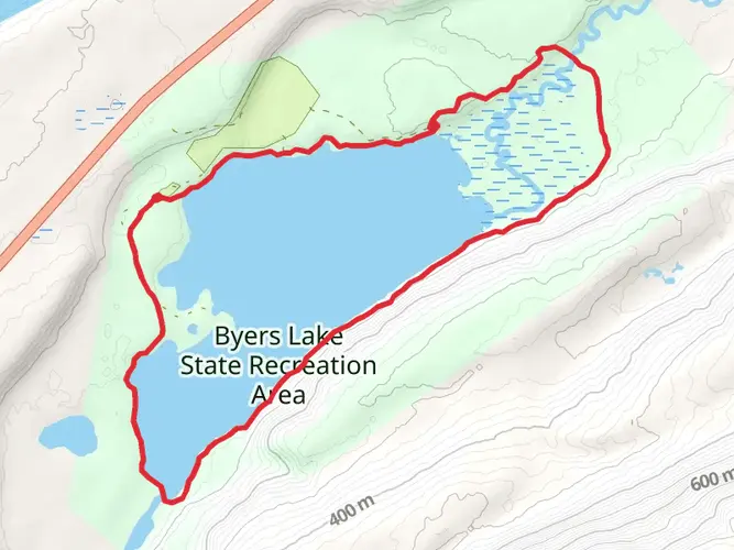
The trail concludes at the Byers Lake Campground, which is near mile 147 of the Parks Highway. Here, you can arrange for a pick-up or have a second vehicle staged if you're shuttling. The campground also offers amenities for a comfortable end to your adventure, including campsites, restrooms, and picnic areas.
Whether you're drawn by the challenge, the history, or the chance to witness Alaska's wild beauty, the Kesugi Ridge trail is a journey that encapsulates the essence of hiking in the Last Frontier.

What to expect?
Activity types
Frequently asked questions
How long does it take to hike Kesugi Ridge in Denali State Park?
Kesugi Ridge is a 46.1 km point-to-point backpacking route with 1,525 m of climbing, so most hikers take 2 to 4 days rather than attempting it in one push. The route is rated Extra Difficult, and the time needed depends heavily on weather, pack weight, and how many side stops are made along the ridge for views of Denali and the Alaska Range.
Where do you start and park for the Kesugi Ridge hike?
Kesugi Ridge is commonly hiked between the Little Coal Creek Trailhead near Parks Highway mile 163.8 and the Byers Lake area near mile 147 in Denali State Park. Parking is available at both ends, but Byers Lake has the larger staging area, while parking at Little Coal Creek and Ermine Hill is more limited.
What are the best views on the Kesugi Ridge trail?
The signature scenery on Kesugi Ridge is the long alpine ridgeline with broad views west to Denali and the Alaska Range. Once the trail climbs out of the spruce and birch forest and reaches open tundra, the ridge delivers the most consistent panoramas, especially in clear weather between the Little Coal Creek, Ermine Hill, and Byers Lake access points.
When is the best time of year to hike Kesugi Ridge?
The main hiking season for Kesugi Ridge is summer into early fall, when the ridge is more likely to be snow-free and the trailheads on the Parks Highway are fully accessible. July through early September is generally the most practical window for a multi-day trip, though conditions can still change quickly with cold rain, wind, fog, and early season snow at higher elevations.
Can you camp along the Kesugi Ridge trail?
Kesugi Ridge is a multi-day route in Denali State Park, and camping is a normal part of completing the full traverse. The trail system includes backcountry camping opportunities along the ridge, and many hikers break the route into 2 or 3 days between access points such as Little Coal Creek, Ermine Hill, and Byers Lake.
Is Kesugi Ridge a hard hike?
Kesugi Ridge is a hard backcountry hike by any standard. The route covers 46.1 km with 1,525 m of elevation gain, and the Extra Difficult rating reflects the sustained climbs, exposed alpine terrain, and the need to manage distance, weather, and overnight gear over a long point-to-point route.
Is Kesugi Ridge suitable for kids or beginner backpackers?
Kesugi Ridge is usually better suited to experienced hikers than to young kids or first-time backpackers. The combination of 46.1 km of trail, 1,525 m of climbing, and exposed ridge travel in Denali State Park makes it a serious outing that demands strong fitness, route planning, and comfort with remote Alaska conditions.
Comments and Reviews
User comments, reviews and discussions about the Kesugi Ridge, Alaska.
4.47
average rating out of 5
19 rating(s)