Download
Preview
Add to list
More
13.3 km
~4 hrs 41 min
1222 m
Out and Back
“Embark on the challenging Deer Mountain Trail for stunning views and rich history near Ketchikan, Alaska.”
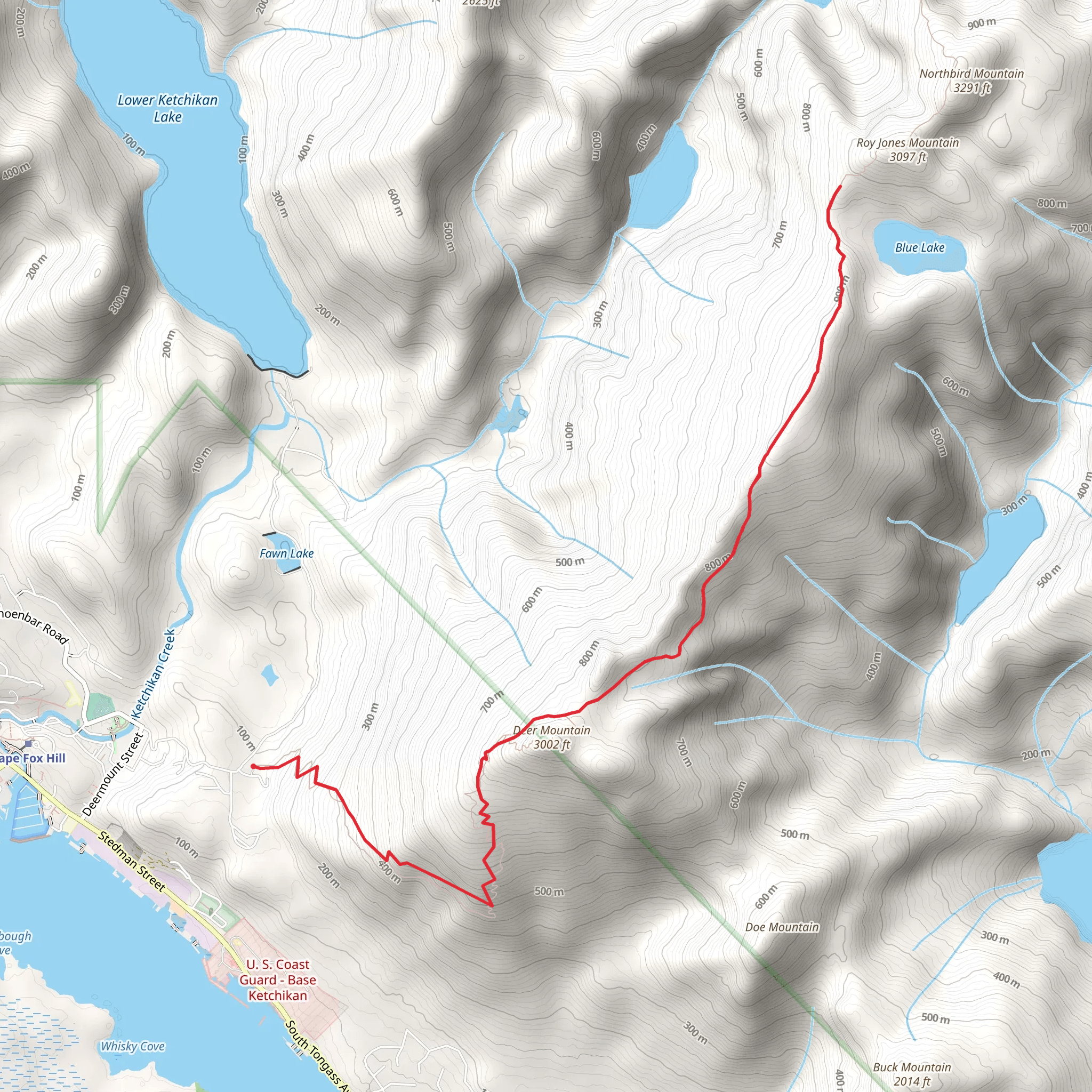
Starting your adventure near Ketchikan Gateway Borough, Alaska, the Deer Mountain Trail offers a challenging yet rewarding hike. The trailhead is conveniently located close to the Ketchikan city center, making it accessible whether you're arriving by car or public transport. If you're driving, you can park at the trailhead near the end of Ketchikan Lakes Road. For those using public transport, local buses and taxis can drop you off close to the starting point.
Trail Overview
The Deer Mountain Trail spans approximately 13 kilometers (8 miles) round trip, with an elevation gain of around 1200 meters (3937 feet). This out-and-back trail is rated as medium difficulty, making it suitable for hikers with some experience and a good level of fitness.
Initial Ascent
The first section of the trail is a steady climb through lush temperate rainforest. Expect to encounter a variety of flora, including Sitka spruce and western hemlock. The trail can be muddy and slippery, especially after rain, so sturdy hiking boots are recommended. As you ascend, you'll gain about 300 meters (984 feet) in the first 2 kilometers (1.2 miles).
Mid-Trail Highlights
Around the 3-kilometer (1.8-mile) mark, you'll reach a series of switchbacks that offer stunning views of Ketchikan and the Tongass Narrows. This is a great spot to take a break and hydrate. Continuing on, the trail becomes steeper and rockier, requiring careful footing.
Wildlife and Nature
Keep an eye out for local wildlife, including black bears, Sitka black-tailed deer, and a variety of bird species such as bald eagles and ravens. The area is rich in biodiversity, so take your time to appreciate the natural surroundings.
Historical Significance
The region around Ketchikan has a rich history, deeply rooted in the culture of the Tlingit people. The trail itself has been used for centuries, initially by indigenous peoples and later by settlers and miners. As you hike, you may come across remnants of old mining operations, adding a historical layer to your journey.
Final Ascent and Summit
The final push to the summit is the most challenging part of the hike, with an additional 600 meters (1968 feet) of elevation gain over the last 3 kilometers (1.8 miles). The terrain becomes more rugged, and you may encounter snow patches even in late spring.
Summit Views
Upon reaching the summit, you'll be rewarded with panoramic views of the surrounding mountains, the city of Ketchikan, and the Inside Passage. On clear days, you can see as far as the Misty Fjords National Monument. This is an excellent spot for photos and a well-deserved rest before beginning your descent.
Navigation
For navigation, it's highly recommended to use the HiiKER app, which provides detailed maps and real-time updates. This will help you stay on track and ensure a safe and enjoyable hike.
Descent
The descent follows the same path back to the trailhead. While it's easier on the lungs, the steep sections can be tough on the knees, so trekking poles can be very helpful.
Preparation Tips
Given the trail's length and elevation gain, it's essential to bring plenty of water, snacks, and layers of clothing to adapt to changing weather conditions. Always check the weather forecast before heading out and let someone know your plans.
By following these guidelines and being well-prepared, you'll have a memorable and enjoyable experience on the Deer Mountain Trail.
What to expect?
Activity types
Comments and Reviews
User comments, reviews and discussions about the Deer Mountain Trail, Alaska.
4.5
average rating out of 5
56 rating(s)

