Download
Preview
Add to list
More
5.4 km
~1 hrs 25 min
214 m
Out and Back
“The Sacred Rim Trail offers a moderately challenging hike with stunning views and rich historical significance.”
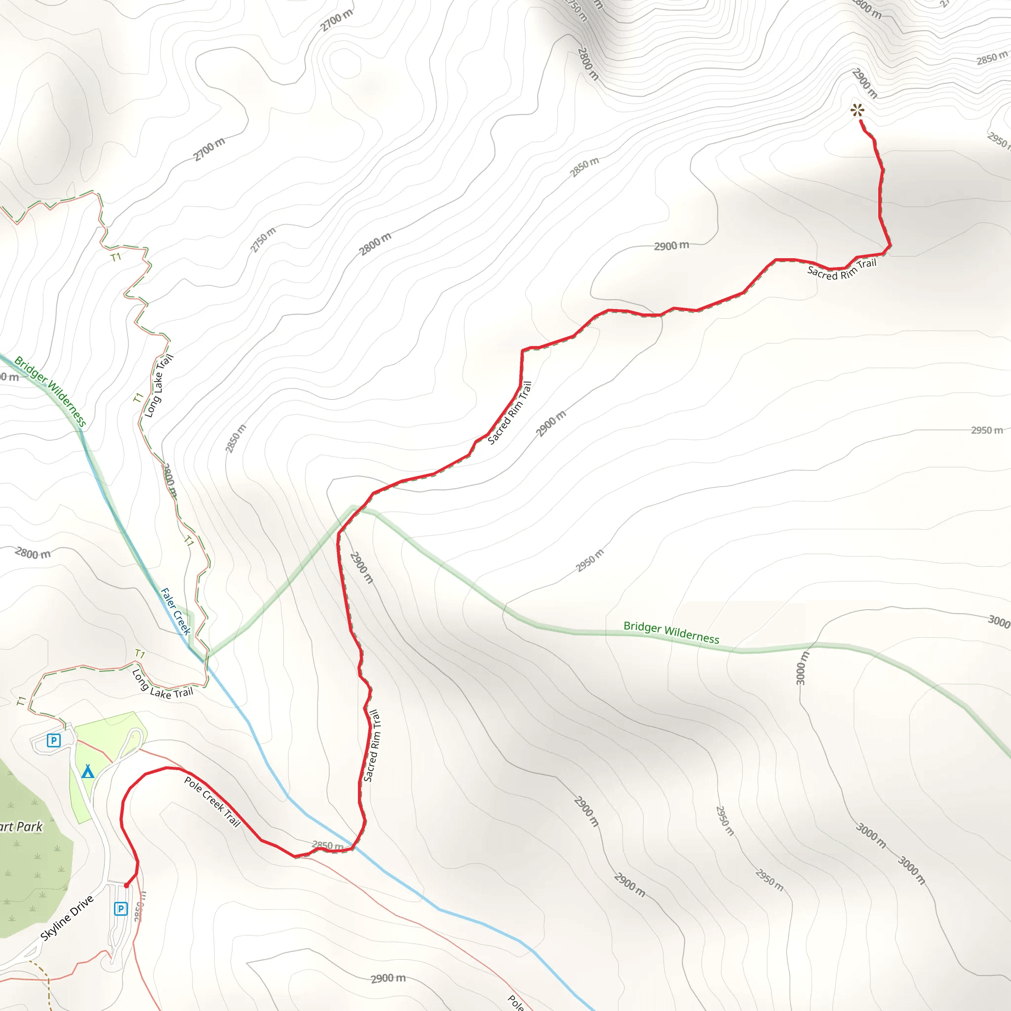
The Sacred Rim Trail, located near Sublette County, Wyoming, offers a moderately challenging hike with a total distance of around 5 km (approximately 3.1 miles) and an elevation gain of about 200 meters (656 feet). This out-and-back trail is perfect for those looking to experience the natural beauty and historical significance of the region.
Getting There To reach the trailhead, you can drive or use public transportation. If driving, head towards Pinedale, Wyoming, and follow signs to the Bridger-Teton National Forest. The nearest significant landmark is the Green River Lakes Campground, which is a good reference point for navigation. For those using public transport, the closest major town is Pinedale, where you can arrange a taxi or shuttle service to the trailhead.
Trail Overview Starting at the trailhead near Green River Lakes Campground, the Sacred Rim Trail immediately immerses you in the stunning landscapes of the Bridger-Teton National Forest. The trail begins with a gentle ascent, allowing you to acclimate to the elevation gradually. As you progress, the path becomes steeper, gaining approximately 200 meters (656 feet) in elevation over the course of the hike.
Significant Landmarks and Nature Around the 1 km (0.6 mile) mark, you'll encounter the first significant viewpoint, offering panoramic vistas of the surrounding forest and distant mountain ranges. This is an excellent spot for a short break and some photography.
Continuing along the trail, you'll pass through dense pine forests interspersed with open meadows. These meadows are often teeming with wildflowers during the spring and summer months, providing a colorful contrast to the green canopy above. Keep an eye out for local wildlife, including deer, elk, and various bird species.
Historical Significance The region around the Sacred Rim Trail is rich in history. The area was originally inhabited by Native American tribes, including the Shoshone and Ute peoples. Artifacts and remnants of their presence can still be found in the area, adding a layer of historical depth to your hike.
Navigation and Safety Given the moderate difficulty of the trail, it's advisable to use a reliable navigation tool like HiiKER to ensure you stay on course. The trail is well-marked, but having a digital map can provide additional peace of mind.
Final Stretch As you approach the 2.5 km (1.55 mile) mark, you'll reach the Sacred Rim itself. This natural rock formation offers breathtaking views of the valley below and the Wind River Range in the distance. It's a perfect spot to rest, take in the scenery, and perhaps enjoy a packed lunch before heading back the way you came.
Wildlife and Flora Throughout the hike, you'll be surrounded by a diverse array of flora and fauna. The pine forests are home to various species of trees, including lodgepole pine and Douglas fir. In the meadows, look for wildflowers such as Indian paintbrush, lupine, and columbine. Wildlife sightings are common, so keep your camera ready but maintain a respectful distance from any animals you encounter.
Return Journey The return journey follows the same path, allowing you to revisit the beautiful landscapes and perhaps notice details you missed on the way up. The descent is generally easier, but take care on the steeper sections to avoid slipping.
This hike offers a perfect blend of natural beauty, moderate physical challenge, and historical intrigue, making it a must-visit for any hiking enthusiast.
What to expect?
Activity types
Comments and Reviews
User comments, reviews and discussions about the Sacred Rim Trail, Wyoming.
4.48
average rating out of 5
69 rating(s)
