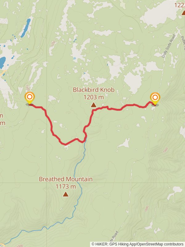
Blackbird Knob from Dolly Sods Road
9.2 km
~2 hrs 15 min
246 m
“Embark on the scenic Blackbird Knob Trail, a captivating hike through diverse Dolly Sods wilderness.”
Nestled in the rugged highlands of the Monongahela National Forest, the Blackbird Knob Trail offers an immersive experience into the unique wilderness of Dolly Sods. This approximately 9 km (5.6 miles) point-to-point hike boasts a modest elevation gain of about 200 meters (656 feet), making it a medium difficulty trek suitable for hikers with some experience.
Getting to the Trailhead
The trailhead is accessible near Grant County, West Virginia. For those driving, you can reach the starting point by taking Forest Road 75 off State Route 28/55. The road is typically navigable by most vehicles, but it can be rough and muddy after rain, so a vehicle with good clearance is recommended. There is no direct public transportation to the trailhead, so a personal vehicle or a taxi service from nearby towns is your best bet.
The Hike Itself
As you embark on your journey from the trailhead, the path will lead you through a diverse landscape characterized by open meadows, dense spruce forests, and high-altitude wetlands. The trail is well-marked, but carrying a reliable navigation tool like HiiKER is advisable to keep track of your progress and waypoints.
The first section of the trail meanders through a mix of red spruce and eastern hemlock, with the undergrowth alive with the sounds of local bird species. Keep an eye out for the vibrant warblers and the occasional sighting of a blackbird, from which the trail gets its name.
Landmarks and Natural Features
As you continue, you'll encounter the Red Creek, which can be a focal point for wildlife. The crossing can be tricky during high water, so waterproof boots and caution are essential. Approximately 3 km (1.9 miles) in, you'll reach the first significant landmark, an open meadow offering panoramic views of the surrounding peaks and valleys.
The trail's midpoint is marked by the intersection with the Upper Red Creek Trail. Here, you can choose to extend your hike or continue towards Blackbird Knob. The landscape opens up to reveal the characteristic Dolly Sods scenery: rolling plains dotted with wind-stunted trees and boggy areas rich with cranberries and sphagnum moss.
Historical Significance
Dolly Sods has a rich history, having been used as a training ground during World War II. The area was subjected to artillery and mortar testing, and while it has been cleared, hikers should remain on marked trails and be aware of the region's past.
Wildlife and Flora
The diverse habitats of Dolly Sods make it a haven for wildlife, including deer, black bears, and a variety of birds. The plant life is equally varied, with wildflowers in the spring and summer, and the famous highland blueberries and huckleberries ripe for picking in late summer.
Final Ascent and Descent
The last stretch of the trail ascends slightly before reaching the Blackbird Knob, a modest rise that offers a vantage point over the Dolly Sods Wilderness. The descent from the knob back to the trailhead is gentle and provides a different perspective on the landscape you've traversed.
Preparation and Safety
Be prepared for rapidly changing weather conditions and pack accordingly. The trail can be wet and muddy, so waterproof gear is essential. Also, be sure to bring enough water and snacks for the hike, as there are no facilities along the trail.
Remember, while the Blackbird Knob Trail is not the most strenuous, it does traverse remote and rugged terrain. It's important to leave no trace of your visit to preserve the wilderness for future hikers and the wildlife that calls it home.
Reviews
User comments, reviews and discussions about the Blackbird Knob from Dolly Sods Road, West Virginia.
4.0
average rating out of 5
58 rating(s)


