Union Creek Trail
Okanogan-Wenatchee National Forest · Yakima County, Washington
5.9 km
~1 hrs 39 min
293 m
“Immerse yourself in the rich history and stunning natural beauty of the moderately challenging Union Creek Trail.”
Starting near Yakima County, Washington, the Union Creek Trail offers a moderately challenging hike with a total distance of around 6 km (approximately 3.7 miles) and an elevation gain of about 200 meters (656 feet). This out-and-back trail is perfect for those looking to immerse themselves in the natural beauty of the Pacific Northwest.
### Getting There To reach the trailhead, you can drive or use public transportation. If driving, head towards the town of Naches, Washington. From Naches, take US-12 W for about 30 miles until you reach the turnoff for Forest Road 1500. Follow this road for approximately 10 miles until you reach the trailhead parking area. For those using public transport, the nearest major bus station is in Yakima. From Yakima, you can take a local taxi or rideshare service to the trailhead.
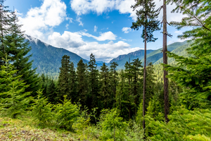
### Trail Overview The trail begins with a gentle ascent through a dense forest of Douglas fir and western hemlock. The first kilometer (0.6 miles) is relatively easy, allowing you to acclimate to the surroundings. As you continue, the trail becomes steeper, gaining about 100 meters (328 feet) in elevation over the next 2 kilometers (1.2 miles).
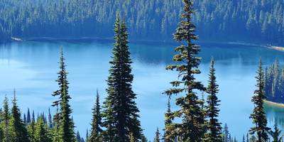
### Significant Landmarks and Nature At around the 3-kilometer (1.8-mile) mark, you'll come across Union Creek, a picturesque stream that offers a perfect spot for a short break. The creek is home to various species of fish, including rainbow trout, and the surrounding area is often frequented by deer and other wildlife.
Continuing along the trail, you'll encounter a series of switchbacks that lead you up another 100 meters (328 feet) in elevation. This section can be a bit strenuous, so take your time and enjoy the views of the surrounding forest and distant mountains.
### Historical Significance The Union Creek area has a rich history, once serving as a route for Native American tribes traveling between seasonal hunting grounds. In the early 20th century, the trail was used by loggers and miners, remnants of which can still be seen in the form of old logging roads and abandoned mining equipment scattered along the path.
### Navigation and Safety Given the moderate difficulty of the trail, it's advisable to use a reliable navigation tool like HiiKER to ensure you stay on course. The trail is well-marked, but having a digital map can provide extra peace of mind. Be sure to carry enough water, especially during the summer months, as the elevation gain can be taxing.
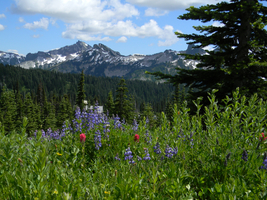
### Wildlife and Flora The Union Creek Trail is a haven for nature enthusiasts. Keep an eye out for black bears, which are occasionally spotted in the area. Birdwatchers will also find plenty to admire, including species like the northern spotted owl and the pileated woodpecker. The trail is particularly beautiful in the spring and early summer when wildflowers like lupine and Indian paintbrush are in full bloom.
### Final Stretch The final kilometer (0.6 miles) of the trail levels out, offering a more relaxed walk back to the trailhead. This section is a great opportunity to reflect on the hike and take in any sights you may have missed on the way up.
By the time you return to the trailhead, you'll have experienced a diverse range of landscapes and historical sites, making the Union Creek Trail a rewarding adventure for any hiker.
Reviews
User comments, reviews and discussions about the Union Creek Trail, Washington.
4.0
average rating out of 5
8 rating(s)


