Church Mountain Trail
Mt. Baker-Snoqualmie National Forest · Whatcom County, Washington
12.9 km
~4 hrs 40 min
1256 m
“Embark on the scenic Church Mountain Trail for a challenging hike with breathtaking summit views and rich history.”
Starting your adventure near Whatcom County, Washington, the Church Mountain Trail offers a challenging yet rewarding hike. The trailhead is accessible by car, with parking available at the end of Forest Road 3040. For those relying on public transport, the nearest significant landmark is the town of Glacier, Washington. From Glacier, you may need to arrange a taxi or rideshare to reach the trailhead.
The trail spans approximately 13 kilometers (8 miles) round trip, with an elevation gain of around 1200 meters (3937 feet). This out-and-back trail is rated as medium difficulty, making it suitable for hikers with some experience and a good level of fitness.
### Trail Overview
The initial section of the trail meanders through dense, old-growth forest. Expect to see towering Douglas firs and western red cedars, with the forest floor carpeted in ferns and moss. This section is relatively gentle, allowing you to ease into the hike. After about 2 kilometers (1.2 miles), the trail begins to ascend more steeply.
### Mid-Trail Ascent
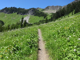
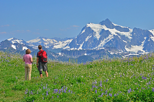
As you climb, the forest starts to thin, and you’ll encounter several switchbacks. These switchbacks are well-maintained but can be strenuous. Around the 4-kilometer (2.5-mile) mark, you’ll reach a series of meadows. In the spring and early summer, these meadows burst into color with wildflowers such as lupine, Indian paintbrush, and avalanche lilies.
### Wildlife and Nature
Keep an eye out for wildlife; black bears and deer are commonly spotted in this area. Birdwatchers will also enjoy sightings of varied thrushes, woodpeckers, and occasionally, eagles soaring overhead. Always remember to maintain a safe distance from wildlife and follow Leave No Trace principles.
### Final Ascent and Summit
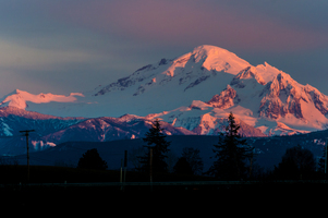
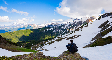
The final push to the summit is the most challenging part of the hike. The trail becomes rockier and steeper, requiring careful footing. At approximately 6.5 kilometers (4 miles) from the trailhead, you’ll reach the summit of Church Mountain. The summit offers panoramic views of the North Cascades, Mount Baker, and the surrounding valleys. On a clear day, the vistas are truly breathtaking.
### Historical Significance
Church Mountain holds historical significance as it was once the site of a fire lookout tower, operational from the 1930s to the 1960s. While the tower no longer stands, remnants of its foundation can still be found at the summit, offering a glimpse into the past and the region’s efforts in forest conservation and fire management.
### Navigation and Safety
Given the trail’s elevation gain and varying terrain, it’s advisable to use a reliable navigation tool like HiiKER to stay on track. Weather conditions can change rapidly, especially at higher elevations, so pack layers and be prepared for sudden shifts in temperature.
### Getting There
To reach the trailhead by car, drive along Mount Baker Highway (State Route 542) from Bellingham, Washington, to Glacier. From Glacier, continue east for about 3 miles (4.8 kilometers) until you reach Forest Road 3040. Follow this road to its end, where you’ll find the parking area and trailhead.
For those using public transport, the nearest bus stop is in Glacier, serviced by the Whatcom Transportation Authority (WTA) Route 72. From Glacier, you’ll need to arrange a taxi or rideshare to cover the remaining distance to the trailhead.
Prepare well, respect the natural environment, and enjoy the stunning beauty that Church Mountain Trail has to offer.
Reviews
User comments, reviews and discussions about the Church Mountain Trail, Washington.
4.0
average rating out of 5
15 rating(s)


