3.8 km
~1 hrs 1 min
162 m
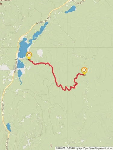
“The Springboard Loop Trail offers a scenic 4 km hike through diverse landscapes, perfect for moderate hikers.”
Starting near Stevens County, Washington, the Springboard Loop Trail offers a delightful 4 km (approximately 2.5 miles) journey through diverse landscapes with an elevation gain of around 100 meters (328 feet). This loop trail is rated as medium difficulty, making it suitable for moderately experienced hikers.
### Getting There To reach the trailhead, you can drive or use public transportation. If driving, head towards the nearest significant landmark, the town of Colville, Washington. From Colville, it's a short drive to the trailhead. For those using public transport, buses run regularly to Colville, and from there, you can take a local taxi or rideshare service to the trailhead.
### Trail Overview The trail begins with a gentle ascent through a mixed forest of pine and fir trees. The initial 1 km (0.6 miles) is relatively easy, allowing you to warm up as you navigate through the shaded canopy. Keep an eye out for deer and various bird species that frequent this area.
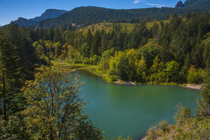
### Mid-Trail Highlights As you approach the 2 km (1.2 miles) mark, the trail starts to climb more steeply, gaining about 50 meters (164 feet) in elevation over the next 0.5 km (0.3 miles). This section offers stunning views of the surrounding hills and valleys. Here, you’ll find a small clearing with a bench, perfect for a short rest and a snack.
### Historical Significance Around the 3 km (1.9 miles) point, you’ll come across remnants of old logging equipment, a nod to the area's history in the timber industry. This section of the trail provides a fascinating glimpse into the past, where you can imagine the bustling activity that once took place here.
### Flora and Fauna The final stretch of the trail descends gently back towards the trailhead. This part of the loop is rich in wildflowers during the spring and summer months. Look out for lupines, Indian paintbrush, and various species of ferns. Wildlife is abundant, so keep your eyes peeled for squirrels, chipmunks, and the occasional black bear.
### Navigation and Safety For navigation, it’s recommended to use the HiiKER app, which provides detailed maps and real-time updates. The trail is well-marked, but having a reliable navigation tool can enhance your hiking experience and ensure you stay on track.
### Final Stretch The last 1 km (0.6 miles) of the trail is a gentle descent, bringing you back to the trailhead. This section is relatively easy and provides a nice cool-down after the more strenuous middle section.
Remember to pack plenty of water, wear sturdy hiking boots, and bring a camera to capture the beautiful scenery and wildlife. Enjoy your hike on the Springboard Loop Trail!
Reviews
User comments, reviews and discussions about the Springboard Loop Trail, Washington.
5.0
average rating out of 5
7 rating(s)


