Download
Preview
Add to list
More
10.1 km
~3 hrs 22 min
814 m
Out and Back
“Explore the lush landscapes and historical richness of the moderately challenging Bitter Creek Out and Back trail.”
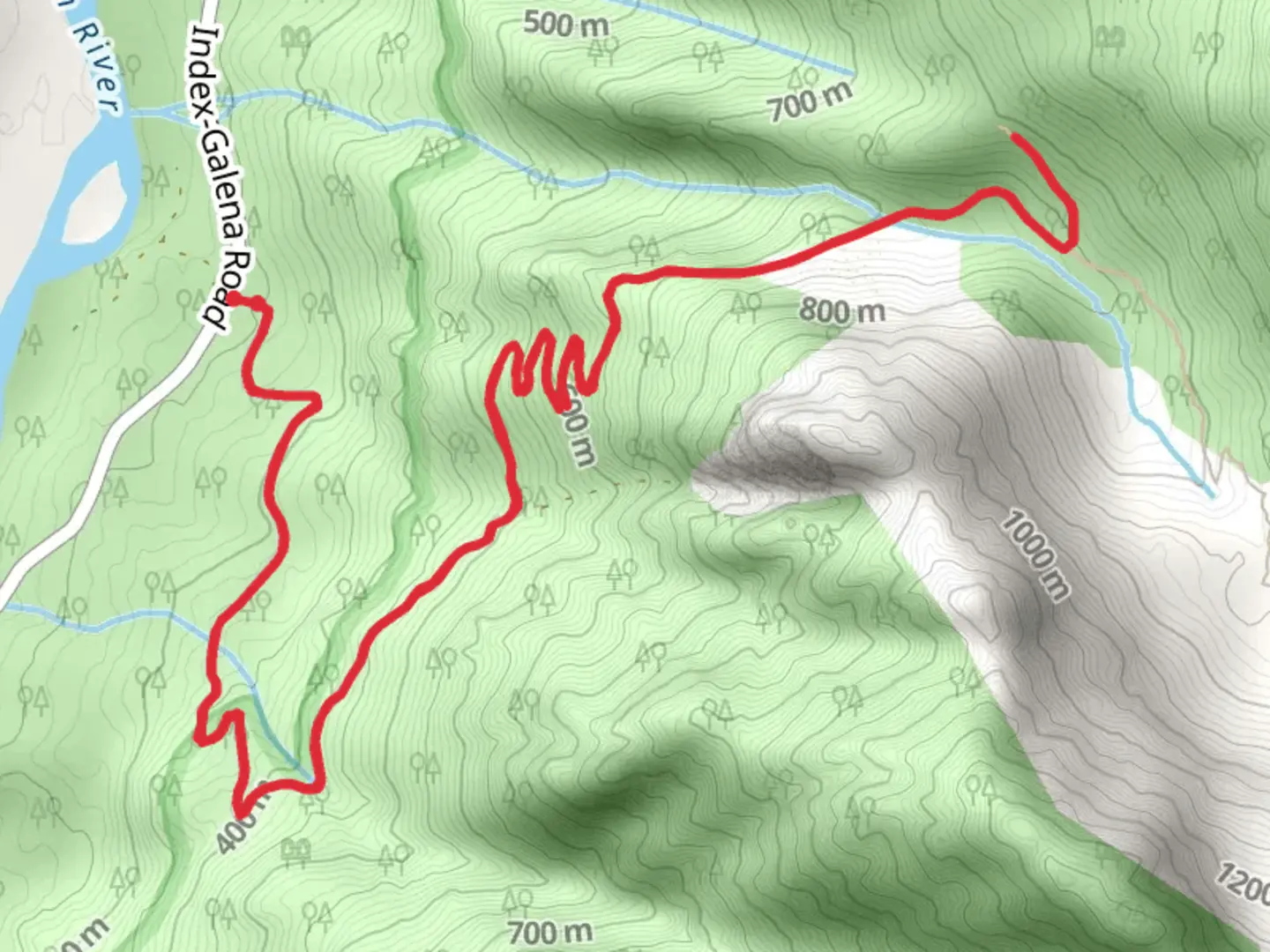
Starting near Snohomish County, Washington, the Bitter Creek Out and Back trail offers a moderately challenging hike that spans approximately 10 km (6.2 miles) with an elevation gain of around 800 meters (2,625 feet). The trailhead is conveniently located near the town of Granite Falls, making it accessible for both locals and visitors.
Getting There To reach the trailhead, you can drive or use public transportation. If driving, head towards Granite Falls, Washington. From there, follow the Mountain Loop Highway for about 16 miles until you reach the trailhead parking area. For those using public transport, take a bus to Granite Falls and then arrange for a local taxi or rideshare service to take you the remaining distance to the trailhead.
Trail Overview The Bitter Creek Out and Back trail is an out-and-back type, meaning you'll hike to a certain point and then return along the same path. The trail is well-marked and maintained, but it's always a good idea to have a reliable navigation tool like HiiKER to ensure you stay on track.
Key Landmarks and Points of Interest - **Mossy Forests and Fern Groves**: As you begin your hike, you'll pass through lush, moss-covered forests and dense fern groves. This section is relatively flat and serves as a gentle warm-up for the more strenuous parts ahead. - **Creek Crossings**: About 2 km (1.2 miles) into the hike, you'll encounter the first of several creek crossings. These are generally manageable, but after heavy rains, the water levels can rise, making them more challenging. - **Wildlife Spotting**: Keep an eye out for local wildlife, including deer, black bears, and various bird species. Early mornings and late afternoons are the best times for wildlife sightings. - **Elevation Gain**: The trail starts to climb more steeply after the 3 km (1.9 miles) mark. This section will take you through switchbacks and steeper inclines, offering a good workout and rewarding you with increasingly impressive views. - **Scenic Overlook**: At approximately 5 km (3.1 miles) in, you'll reach a scenic overlook that offers panoramic views of the surrounding mountains and valleys. This is a great spot to take a break, have a snack, and snap some photos.
Historical Significance The region around Bitter Creek has a rich history, particularly related to the logging industry that once thrived here. Remnants of old logging roads and equipment can still be seen along the trail, offering a glimpse into the area's past. Additionally, the trail passes through lands traditionally used by Native American tribes, adding a layer of cultural significance to your hike.
Preparation and Safety Given the moderate difficulty rating, it's essential to come prepared. Wear sturdy hiking boots, bring plenty of water, and pack some high-energy snacks. Weather in this region can be unpredictable, so layers are advisable. Always check the weather forecast before heading out and let someone know your plans.
Using HiiKER for navigation will help you stay on course and provide real-time updates on your progress. The trail is generally well-marked, but having a reliable navigation tool adds an extra layer of security.
Enjoy your hike on the Bitter Creek Out and Back trail, and take the time to appreciate the natural beauty and historical richness of the area.

What to expect?
Activity types
Comments and Reviews
User comments, reviews and discussions about the Bitter Creek Out and Back, Washington.
4.67
average rating out of 5
9 rating(s)