Download
Preview
Add to list
More
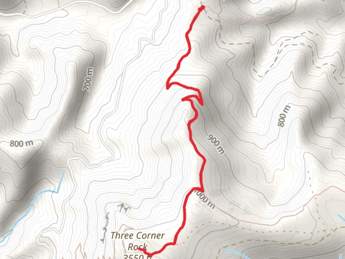
6.2 km
~1 hrs 53 min
394 m
Out and Back
“"Experience the Three Corner Rock trail’s lush forest, rich history, and breathtaking views in an invigorating 6 km hike."”
Starting near Skamania County, Washington, the Three Corner Rock via Rock Creek Pass trail is an invigorating out-and-back hike that spans approximately 6 km (3.7 miles) with an elevation gain of around 300 meters (984 feet). This trail is rated as medium difficulty, making it suitable for moderately experienced hikers.
Getting There To reach the trailhead, you can drive or use public transport. If driving, head towards Skamania County, Washington. The nearest significant landmark is the town of Stevenson, WA. From Stevenson, take the Wind River Highway north for about 15 miles until you reach the Rock Creek Pass area. For those using public transport, the nearest bus stop is in Stevenson, WA. From there, you may need to arrange a taxi or rideshare to the trailhead, as public transport options are limited in this rural area.
Trail Navigation For navigation, it is highly recommended to use the HiiKER app, which provides detailed maps and real-time updates. The trail is well-marked, but having a reliable navigation tool can be invaluable, especially in areas where the path may be less distinct.
Trail Description The hike begins with a gentle ascent through a lush forest of Douglas fir and western hemlock. The first kilometer (0.6 miles) is relatively easy, with a gradual incline that allows you to warm up. As you continue, the trail becomes steeper, gaining most of its elevation in the next 2 kilometers (1.2 miles).
Significant Landmarks Around the 2.5 km (1.5 miles) mark, you will encounter a small clearing that offers your first glimpse of the surrounding landscape. This is a great spot to take a short break and hydrate. Continuing on, the trail narrows and becomes rockier, requiring careful footing.
Flora and Fauna The area is rich in biodiversity. Keep an eye out for native plants like Oregon grape and salal. Wildlife is abundant; you might spot black-tailed deer, various bird species, and if you're lucky, a glimpse of a black bear in the distance. Always maintain a safe distance from wildlife and follow Leave No Trace principles.
Historical Significance The region around Three Corner Rock has historical significance dating back to the early 20th century when it was a popular area for logging. Remnants of old logging roads can still be seen intersecting the trail at various points. The rock itself is named for its unique triangular shape, which has made it a notable landmark for both indigenous peoples and early settlers.
Final Ascent and Views The final push to Three Corner Rock is the most challenging part of the hike, with a steep ascent over rocky terrain. Once you reach the summit, at approximately 3 km (1.85 miles) from the trailhead, you are rewarded with panoramic views of the Columbia River Gorge, Mount Hood, and on clear days, even Mount St. Helens. This is an excellent spot for photos and a well-deserved rest before heading back down the same way you came.
Safety and Preparation Ensure you are well-prepared with adequate water, snacks, and appropriate clothing. Weather can change rapidly, so layers are advisable. The trail can be muddy and slippery, especially after rain, so sturdy hiking boots are recommended. Always let someone know your hiking plans and expected return time.
This trail offers a rewarding experience with its combination of natural beauty, historical context, and moderate challenge, making it a must-visit for hikers in the Skamania County area.

What to expect?
Activity types
Comments and Reviews
User comments, reviews and discussions about the Three Corner Rock via Rock Creek Pass, Washington.
4.67
average rating out of 5
3 rating(s)