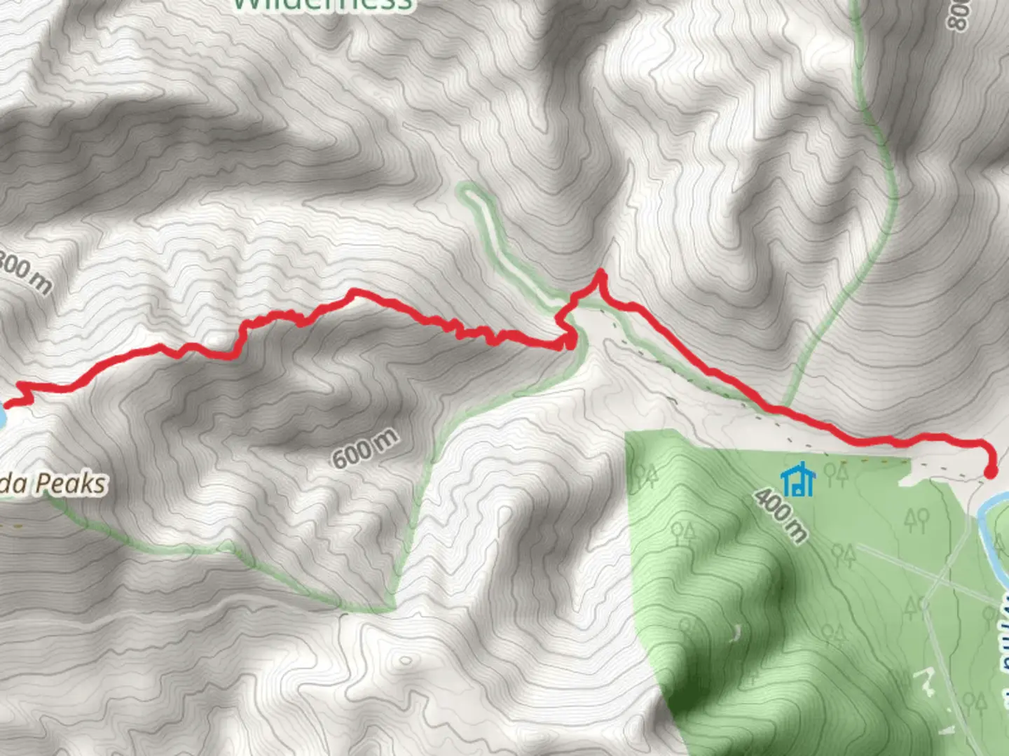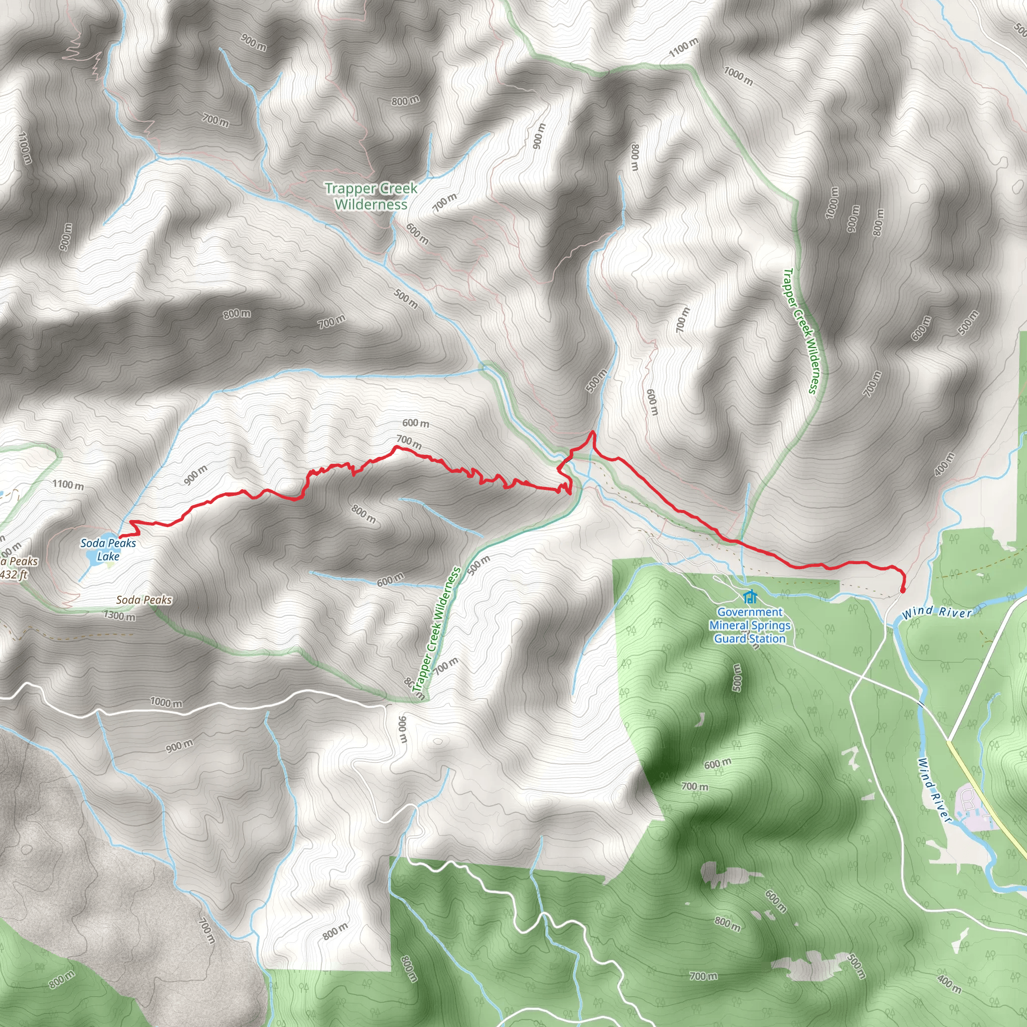
Soda Peaks Lake Trail from Little Soda Springs Road
Download
Preview
Add to list
More
15.0 km
~1 day 0 hrs
1383 m
Out and Back
“Explore Washington's Soda Peaks Lake Trail for a challenging, scenic hike rich in wildlife and history.”
Starting near Skamania County, Washington, the Soda Peaks Lake Trail from Little Soda Springs Road offers a rewarding out-and-back hike that spans approximately 15 kilometers (9.3 miles) with an elevation gain of around 1300 meters (4265 feet). This trail is rated as medium difficulty, making it suitable for moderately experienced hikers.
Getting There To reach the trailhead, you can drive or use public transport. If driving, head towards Skamania County and look for Little Soda Springs Road. The nearest significant landmark is the town of Carson, Washington. From Carson, follow Wind River Highway north for about 10 miles (16 kilometers) until you reach the turnoff for Little Soda Springs Road. Public transport options are limited, so driving is the most convenient way to access the trailhead.
Trail Overview The trail begins with a steady ascent through dense forest, characterized by towering Douglas firs and western hemlocks. The initial 3 kilometers (1.9 miles) involve a gradual climb, gaining about 300 meters (984 feet) in elevation. This section is relatively shaded, providing a cool and refreshing start to your hike.
Mid-Trail Highlights As you continue, the trail becomes steeper, with switchbacks that offer occasional glimpses of the surrounding landscape. Around the 5-kilometer (3.1-mile) mark, you'll encounter a small clearing that provides a perfect spot for a short break. Here, you can enjoy views of the Wind River Valley and the distant peaks of the Cascade Range.
Wildlife and Flora The area is rich in wildlife, so keep an eye out for black-tailed deer, black bears, and various bird species such as the northern spotted owl and pileated woodpecker. The flora is equally diverse, with seasonal wildflowers like trillium and lupine adding splashes of color to the forest floor.
Reaching Soda Peaks Lake The final push to Soda Peaks Lake is the most challenging part of the hike, with a steep ascent over the last 2 kilometers (1.2 miles), gaining approximately 400 meters (1312 feet) in elevation. The effort is well worth it as you arrive at the serene Soda Peaks Lake, nestled in a high alpine basin. The lake is surrounded by rugged cliffs and lush vegetation, making it an ideal spot for a picnic or a refreshing dip.
Historical Significance The region around Soda Peaks Lake has historical significance, particularly for the Native American tribes who once inhabited the area. The Wind River Valley was a crucial travel route and resource area for the Klickitat and Cascade tribes. Artifacts and historical sites can still be found in the region, offering a glimpse into the rich cultural heritage of the area.
Navigation and Safety Given the trail's moderate difficulty and elevation gain, it's advisable to use a reliable navigation tool like HiiKER to stay on track. The trail is well-marked, but weather conditions can change rapidly, especially at higher elevations. Always carry sufficient water, snacks, and layers of clothing to adapt to varying temperatures.
Return Journey The return journey follows the same path, allowing you to enjoy the downhill sections and revisit the scenic viewpoints. The descent can be tough on the knees, so trekking poles might be helpful.
This hike offers a blend of natural beauty, challenging terrain, and historical intrigue, making it a must-visit for those exploring the trails of Washington State.
What to expect?
Activity types
Comments and Reviews
User comments, reviews and discussions about the Soda Peaks Lake Trail from Little Soda Springs Road, Washington.
4.56
average rating out of 5
18 rating(s)
