Download
Preview
Add to list
More
20.8 km
~1 day 0 hrs
830 m
Out and Back
“Experience the diverse beauty and historical richness of the moderately challenging Alger Hill Road and Pacific Northwest Trail.”
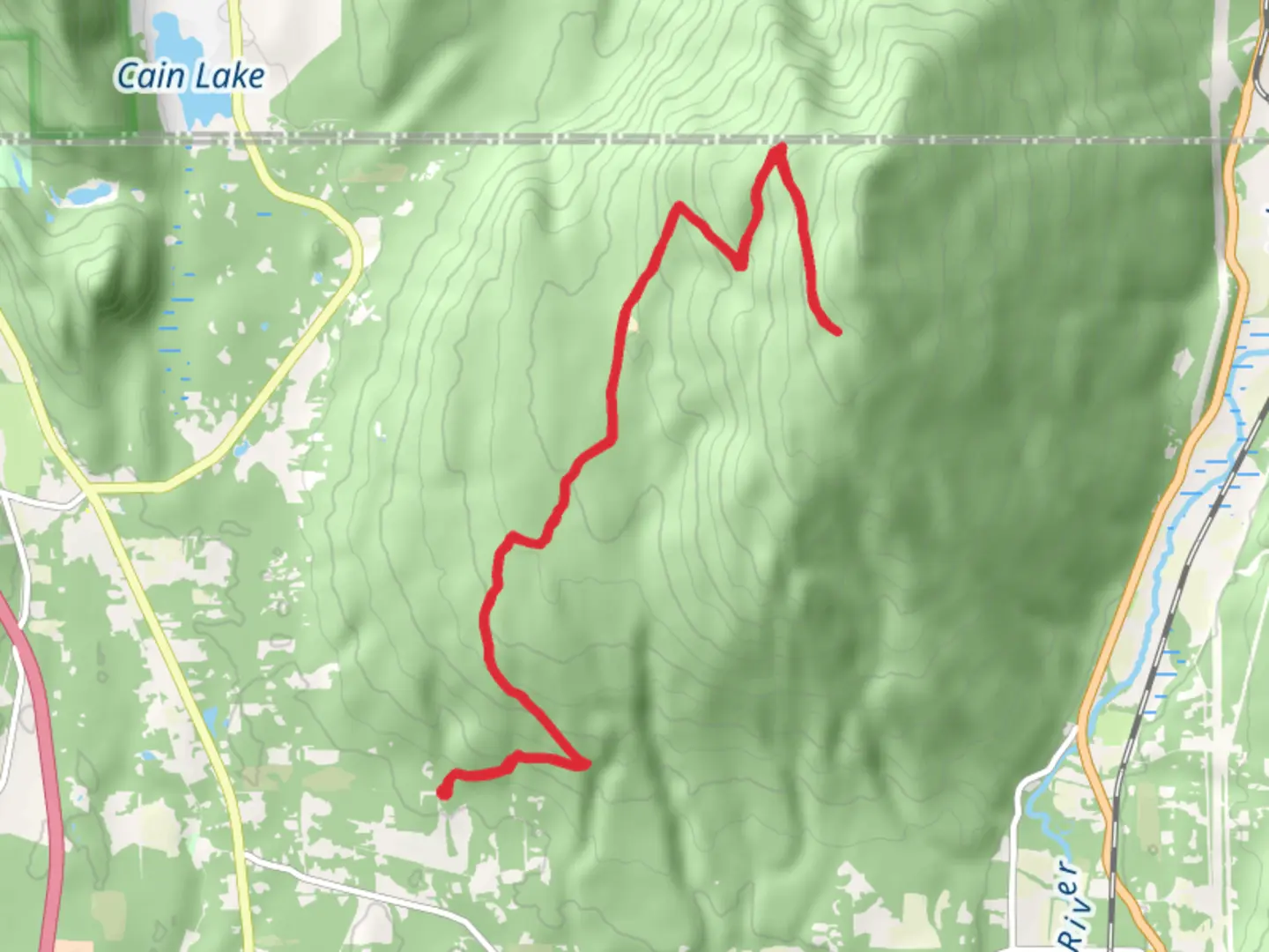
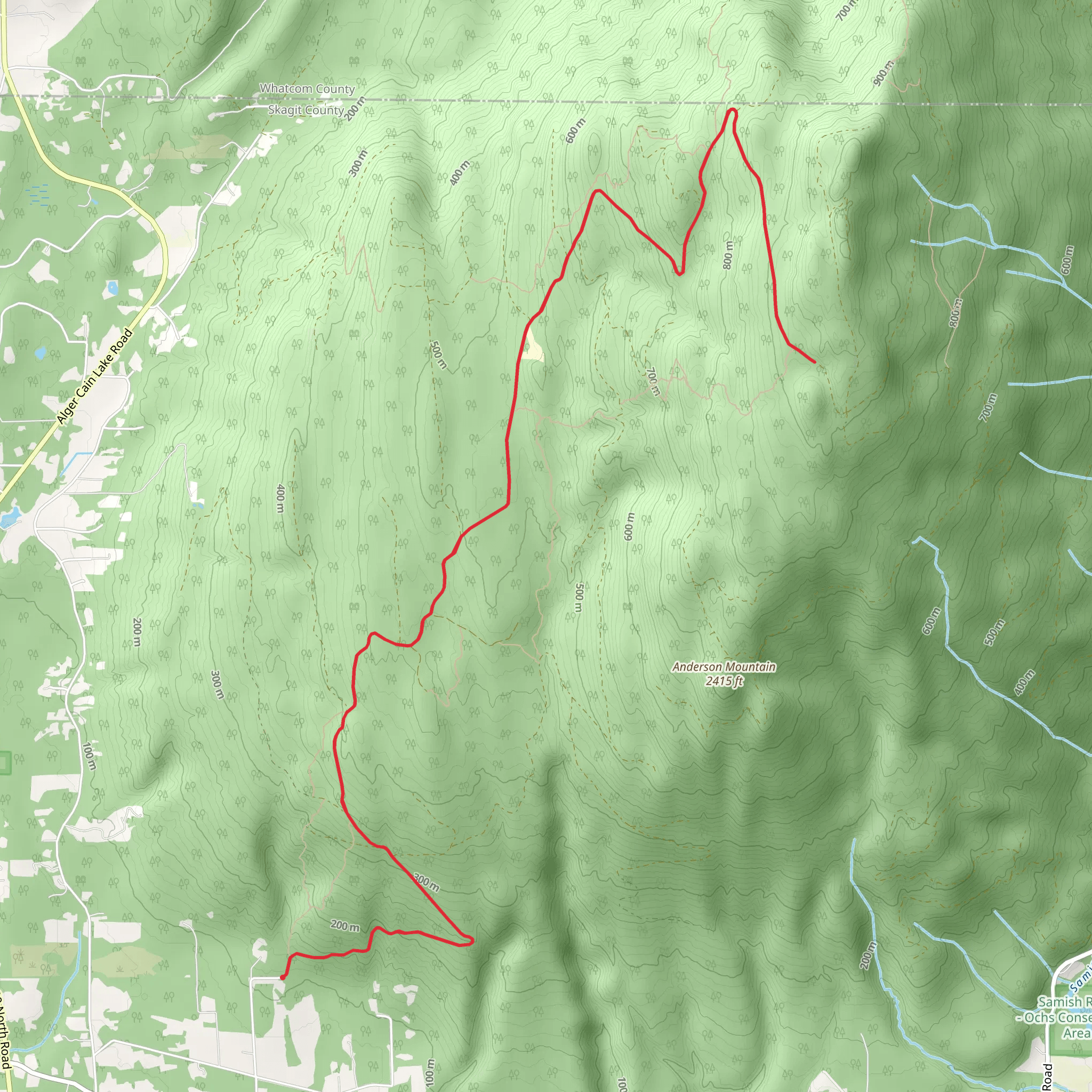
Starting near Skagit County, Washington, the Alger Hill Road and Pacific Northwest Trail offers a captivating journey through diverse landscapes. This out-and-back trail spans approximately 21 kilometers (13 miles) with an elevation gain of around 800 meters (2,625 feet), making it a moderately challenging hike suitable for those with a reasonable level of fitness.
Getting There To reach the trailhead, you can drive or use public transportation. If driving, head towards Skagit County, Washington, and look for parking near the intersection of Alger Hill Road and the Pacific Northwest Trail. For those using public transport, the nearest significant landmark is the town of Sedro-Woolley, from where you can take a local taxi or rideshare service to the trailhead.
Trail Overview The trail begins with a gentle ascent through dense forests, offering a serene start to your hike. As you progress, the path becomes steeper, and the forest canopy opens up, providing glimpses of the surrounding mountains and valleys. The first significant landmark you'll encounter is a small, picturesque creek about 3 kilometers (1.9 miles) in, which is an excellent spot for a short break.
Flora and Fauna The trail is rich in biodiversity. Keep an eye out for Douglas firs, western hemlocks, and red cedars that dominate the landscape. In spring and early summer, the forest floor is carpeted with wildflowers like trilliums and lupines. Wildlife enthusiasts might spot black-tailed deer, various bird species, and occasionally, black bears. Always maintain a safe distance from wildlife and follow Leave No Trace principles.
Historical Significance This region holds historical significance as part of the Pacific Northwest Trail, a long-distance hiking trail that stretches from the Continental Divide in Montana to the Pacific Ocean in Washington. The trail was established in 1977 and has since become a vital corridor for both recreation and conservation. The area around Skagit County also has a rich history of logging and indigenous cultures, adding layers of historical context to your hike.
Key Sections - **First Ascent (0-5 km / 0-3.1 miles):** The initial climb is steady but manageable, with an elevation gain of about 200 meters (656 feet). The trail is well-marked, but it's advisable to use HiiKER for navigation to stay on track. - **Midpoint Plateau (5-10 km / 3.1-6.2 miles):** This section levels out somewhat, offering panoramic views of the surrounding landscape. It's a great place to pause and take in the scenery. - **Final Push (10-10.5 km / 6.2-6.5 miles):** The last stretch to the turnaround point is the most challenging, with a steep ascent gaining another 400 meters (1,312 feet) in elevation. The effort is rewarded with stunning vistas at the top.
Return Journey The return journey retraces your steps, allowing you to enjoy the downhill sections and revisit any favorite spots. Be cautious on the descent, as the steep sections can be slippery, especially after rain.
Preparation Tips - **Footwear:** Sturdy hiking boots with good ankle support are recommended. - **Water:** Carry at least 2 liters (0.5 gallons) of water per person, as there are limited water sources along the trail. - **Weather:** Check the weather forecast before you go. The trail can be muddy and slippery after rain. - **Navigation:** Use HiiKER for real-time navigation and trail updates.
This trail offers a rewarding experience with its mix of natural beauty, historical significance, and moderate challenge. Whether you're a seasoned hiker or looking to push your limits, the Alger Hill Road and Pacific Northwest Trail is a fantastic choice.
What to expect?
Activity types
Comments and Reviews
User comments, reviews and discussions about the Alger Hill Road and Pacific Northwest Trail, Washington.
4.4
average rating out of 5
5 rating(s)
