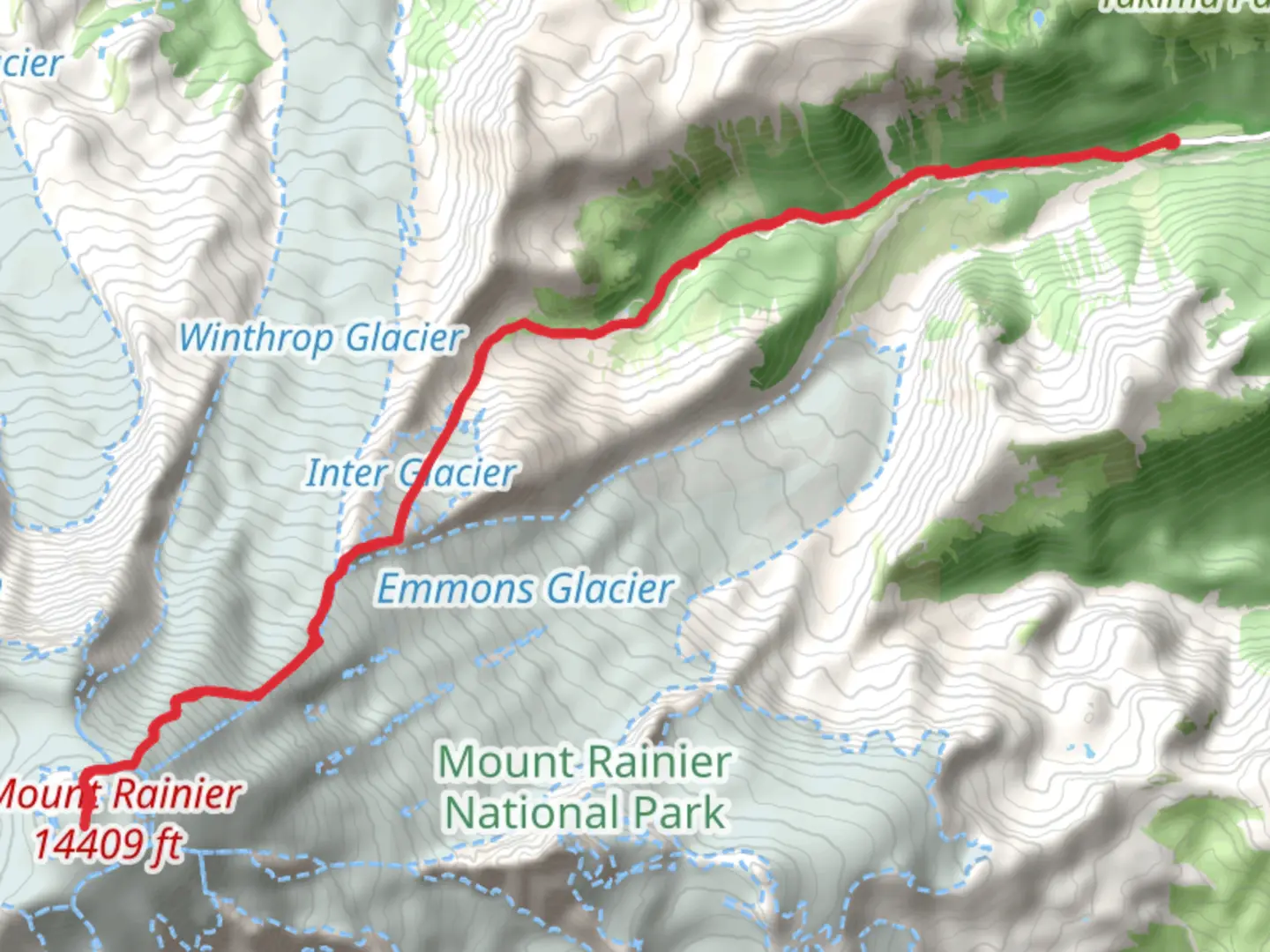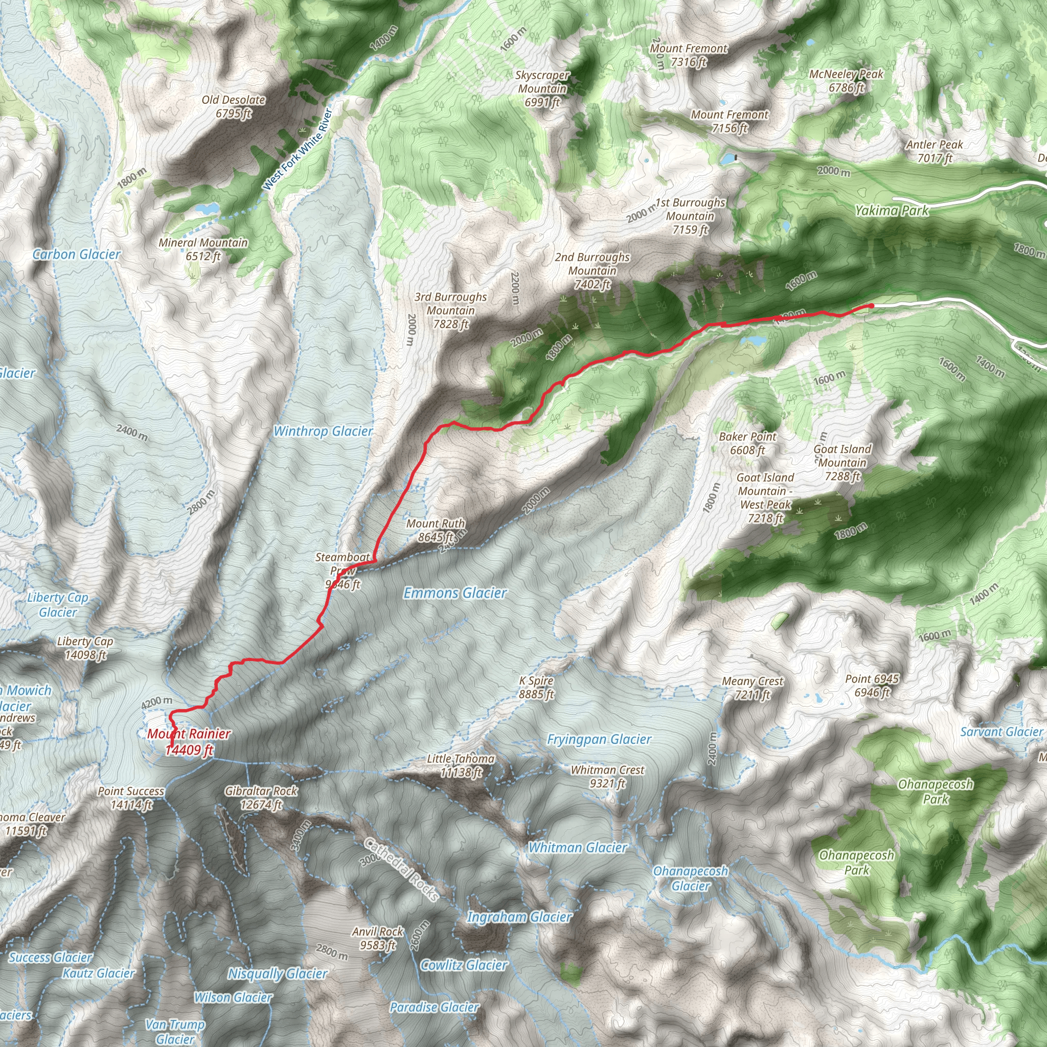
Steamboat Prow and Columbia Crest via Glacier Basin Trail
Download
Preview
Add to list
More
25.9 km
~2 day
3244 m
Out and Back
“From lush forests to breathtaking summits, this hike through Mount Rainier offers unparalleled natural beauty and history.”
Starting your adventure near Pierce County, Washington, the trailhead for this hike is conveniently located at the Glacier Basin Trailhead, which can be accessed via the Sunrise Road in Mount Rainier National Park. If you're driving, parking is available at the trailhead. For those using public transport, the nearest major city is Seattle, from where you can take a bus or shuttle service to the park entrance and then a park shuttle to the trailhead.
Initial Ascent and Glacier Basin
The journey begins with a moderate ascent through lush forested areas, offering a serene start to your hike. The first 5 km (3 miles) of the trail will take you through dense woods, where you might spot deer, marmots, and a variety of bird species. The elevation gain here is gradual, rising about 300 meters (1,000 feet), making it a pleasant warm-up for the more strenuous sections ahead.
As you approach Glacier Basin, around the 6 km (3.7 miles) mark, the forest opens up to reveal stunning alpine meadows. This area is particularly beautiful in late spring and early summer when wildflowers are in full bloom. The basin itself is a great spot for a short break, offering panoramic views of the surrounding peaks and the Inter Glacier.
Climbing to Steamboat Prow
From Glacier Basin, the trail becomes significantly steeper as you head towards Steamboat Prow. This section covers approximately 4 km (2.5 miles) with an elevation gain of about 1,200 meters (4,000 feet). The path here is rocky and can be challenging, so sturdy hiking boots and trekking poles are recommended. As you ascend, you'll traverse scree fields and may encounter patches of snow, even in summer.
Steamboat Prow, located at an elevation of around 3,200 meters (10,500 feet), offers breathtaking views of the Emmons Glacier and the surrounding peaks. This is a popular spot for mountaineers preparing to summit Mount Rainier, and you might see climbers setting up camp or practicing their skills.
Final Push to Columbia Crest
The final leg of the hike to Columbia Crest, the summit of Mount Rainier, is the most demanding. Covering about 3 km (1.9 miles) with an elevation gain of 1,700 meters (5,600 feet), this section requires careful navigation and possibly the use of crampons and an ice axe, depending on the season. The route takes you across the Emmons Glacier, where crevasses and seracs pose significant hazards. It's crucial to use a reliable navigation tool like HiiKER to stay on track and avoid dangerous areas.
Reaching Columbia Crest at 4,392 meters (14,411 feet) is a monumental achievement. The summit offers unparalleled 360-degree views of the Cascade Range, including Mount Adams, Mount St. Helens, and Mount Hood on clear days. The sense of accomplishment and the stunning vistas make the strenuous climb well worth the effort.
Descent and Return
The descent follows the same route back to the Glacier Basin Trailhead. While descending, take your time to enjoy the changing perspectives and the opportunity to spot wildlife you might have missed on the way up. The total round trip distance is approximately 26 km (16 miles), with a total elevation gain of around 3,200 meters (10,500 feet).
Historical Significance
Mount Rainier and its surrounding areas hold significant historical and cultural importance. The mountain is considered sacred by the Native American tribes of the region, including the Yakama, Puyallup, and Nisqually. The name "Rainier" was given by British explorer George Vancouver in honor of his friend, Rear Admiral Peter Rainier. The park itself was established in 1899, making it one of the oldest national parks in the United States.
This hike is not only a physical challenge but also a journey through a landscape rich in natural beauty and historical significance. Proper preparation, including physical conditioning, appropriate gear, and reliable navigation tools like HiiKER, will ensure a safe and rewarding experience.
What to expect?
Activity types
Comments and Reviews
User comments, reviews and discussions about the Steamboat Prow and Columbia Crest via Glacier Basin Trail, Washington.
4.75
average rating out of 5
16 rating(s)
