Download
Preview
Add to list
More
10.4 km
~3 hrs 10 min
655 m
Loop
“Explore the stunning Skyline and Mazama Ridge Trail loop in Mount Rainier National Park, rich with scenic vistas.”
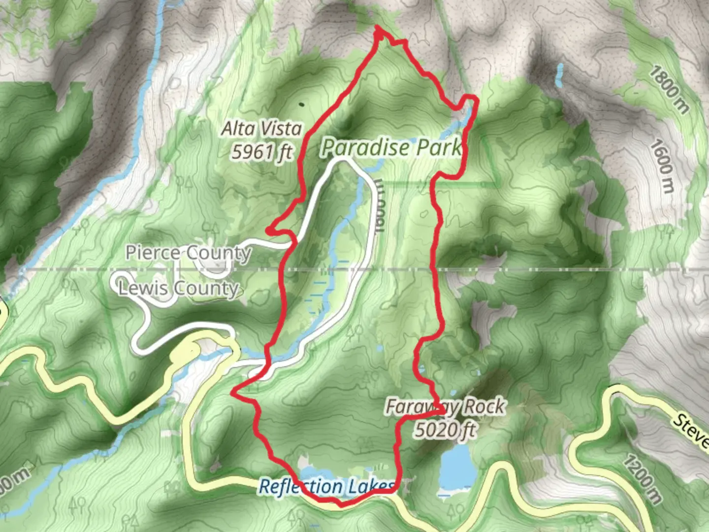
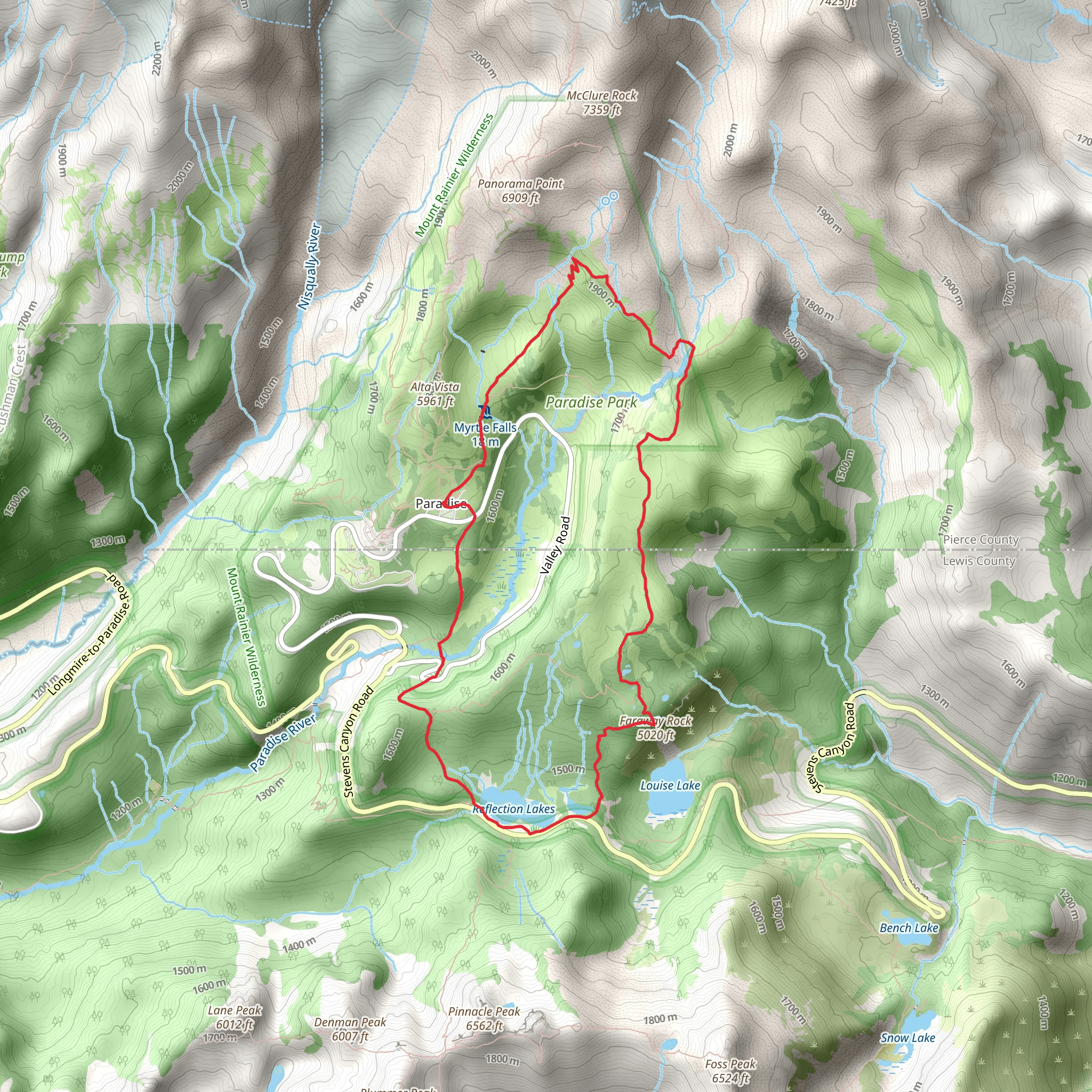
Starting your adventure near Pierce County, Washington, the Skyline Trail and Mazama Ridge Trail loop offers a captivating journey through some of the most scenic landscapes in the Pacific Northwest. This 10 km (6.2 miles) loop with an elevation gain of approximately 600 meters (1,970 feet) is rated as medium difficulty, making it accessible for most hikers with a moderate level of fitness.### Getting There To reach the trailhead, head towards the Paradise area of Mount Rainier National Park. If you're driving, set your GPS to the Paradise Visitor Center, located at 55210 238th Avenue East, Ashford, WA 98304. For those using public transport, the closest major city is Seattle. From Seattle, you can take a bus or train to Ashford and then a shuttle or taxi to the Paradise Visitor Center.### Trail Overview The loop begins at the Paradise Visitor Center, where you can find ample parking and restroom facilities. The trailhead is well-marked, and you’ll start your hike with a gradual ascent through lush meadows filled with wildflowers during the summer months. Keep an eye out for marmots and deer, which are commonly seen in this area.### Significant Landmarks and Sections
Panorama Point
About 2.5 km (1.5 miles) into the hike, you’ll reach Panorama Point, one of the most breathtaking viewpoints on the trail. At an elevation of approximately 2,100 meters (6,890 feet), this spot offers panoramic views of Mount Rainier, the Tatoosh Range, and even Mount St. Helens on a clear day. This is a great place to take a break and soak in the scenery.#### Pebble Creek Continuing from Panorama Point, the trail ascends further to Pebble Creek, located around 4 km (2.5 miles) from the start. This section can be a bit challenging due to the rocky terrain, but the views of the Nisqually Glacier make it worthwhile. The elevation here is about 2,300 meters (7,545 feet).#### Mazama Ridge As you loop back towards the starting point, you’ll traverse Mazama Ridge. This section is known for its stunning alpine meadows and vibrant fall colors. The ridge offers a more gradual descent and provides excellent opportunities for photography, especially during sunrise or sunset.### Historical Significance Mount Rainier National Park, established in 1899, is one of the oldest national parks in the United States. The area around the Skyline Trail and Mazama Ridge has a rich history, with indigenous peoples such as the Yakama, Puyallup, and Nisqually tribes having lived and hunted in these lands for centuries. The park itself is named after Mount Rainier, an active stratovolcano that stands as the highest peak in the Cascade Range.### Navigation and Safety Given the varying terrain and potential for sudden weather changes, it’s advisable to use a reliable navigation tool like HiiKER to keep track of your progress and ensure you stay on the correct path. Always check the weather forecast before heading out and be prepared for rapidly changing conditions, especially at higher elevations.### Wildlife and Flora The trail is a haven for wildlife enthusiasts. Besides marmots and deer, you might also spot black bears and mountain goats. The flora is equally impressive, with fields of lupine, Indian paintbrush, and avalanche lilies painting the landscape in vibrant colors during the summer months.### Final Stretch As you near the end of the loop, the trail descends back towards the Paradise Visitor Center. This final section offers a gentle walk through subalpine meadows, providing a serene end to your hike. Remember to pack out all trash, respect wildlife, and stay on designated trails to preserve the natural beauty of this incredible region.
What to expect?
Activity types
Comments and Reviews
User comments, reviews and discussions about the Skyline Trail and Mazama Ridge Trail, Washington.
4.58
average rating out of 5
12 rating(s)
