Molybdenite Mountain
8.7 km
~2 hrs 38 min
540 m
“Explore diverse landscapes and historical remnants on the moderately challenging Molybdenite Mountain trail in Washington.”
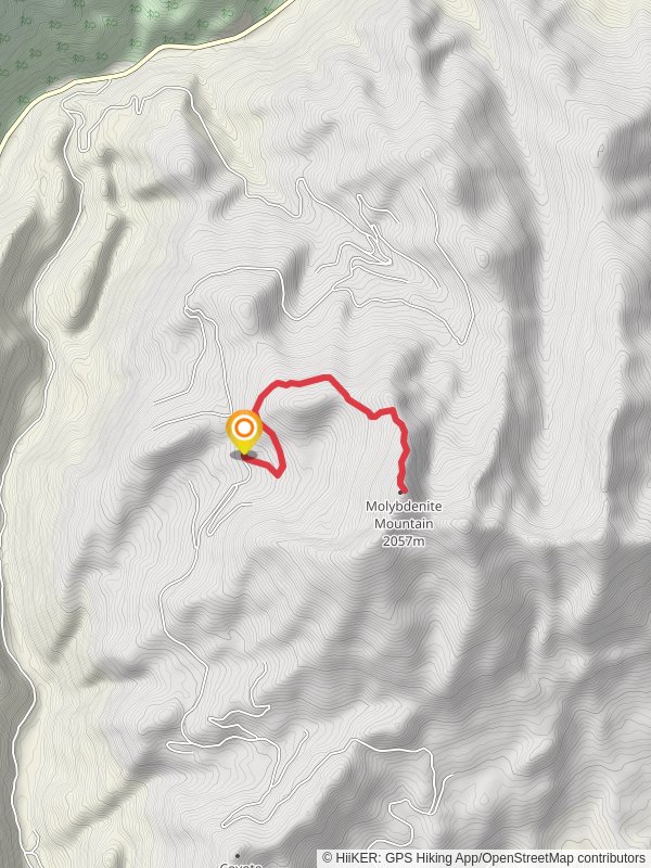
Starting your hike near Pend Oreille County, Washington, the Molybdenite Mountain trail offers an invigorating journey through diverse landscapes. This out-and-back trail spans approximately 9 kilometers (5.6 miles) with an elevation gain of around 500 meters (1,640 feet), making it a moderately challenging adventure suitable for hikers with some experience.
### Getting There To reach the trailhead, you can drive or use public transport. If driving, head towards Pend Oreille County and look for signs directing you to the trailhead near the town of Metaline Falls. For those using public transport, the nearest significant landmark is the Metaline Falls Visitor Center. From there, you may need to arrange a taxi or rideshare to the trailhead, as public transport options are limited in this rural area.
### Trail Overview The trail begins with a gentle ascent through a dense forest of Douglas fir and western red cedar. As you progress, the path becomes steeper, offering glimpses of the surrounding mountains and valleys. At approximately 2 kilometers (1.2 miles) in, you'll encounter a small creek, which can be a refreshing spot to take a short break.
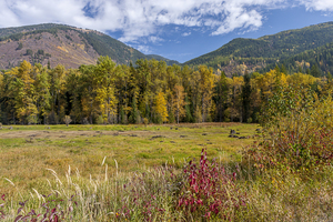
### Significant Landmarks and Nature Around the 3-kilometer (1.9-mile) mark, the trail opens up to a meadow filled with wildflowers during the spring and summer months. This area is also a prime spot for birdwatching, with species such as the mountain bluebird and the Clark's nutcracker frequently spotted.
Continuing your ascent, you'll reach a rocky outcrop at about 4 kilometers (2.5 miles) in, offering panoramic views of the Selkirk Mountains. This is an excellent spot for photography and a well-deserved rest before the final push to the summit.
### Historical Significance The region around Molybdenite Mountain has a rich mining history. In the early 20th century, the area was known for its molybdenum deposits, which were mined extensively during World War I and II. Remnants of old mining equipment and structures can still be seen along the trail, providing a glimpse into the area's industrial past.
### Wildlife and Safety As you approach the summit, be on the lookout for wildlife such as black bears, deer, and the occasional mountain goat. It's essential to carry bear spray and know how to use it. The trail can be narrow and rocky in sections, so sturdy hiking boots are recommended.
### Navigation For navigation, it's advisable to use the HiiKER app, which provides detailed maps and real-time updates on trail conditions. This can be particularly useful in the more remote sections of the trail where cell service may be limited.
### Final Ascent The final kilometer (0.6 miles) to the summit is the most challenging, with a steep incline and loose rocks. However, the effort is well worth it. Upon reaching the summit, you'll be rewarded with breathtaking 360-degree views of the surrounding landscape, including the Pend Oreille River and the distant peaks of the Selkirk Mountains.
### Return Journey After soaking in the views and perhaps enjoying a packed lunch, retrace your steps back to the trailhead. The descent offers a different perspective on the landscape and is generally easier on the legs, though still requiring caution on the steeper sections.
This trail offers a blend of natural beauty, historical intrigue, and moderate physical challenge, making it a rewarding experience for those prepared for the journey.
Reviews
User comments, reviews and discussions about the Molybdenite Mountain, Washington.
5.0
average rating out of 5
6 rating(s)


