Honeymoon Creek
Okanogan-Wenatchee National Forest · Okanogan County, Washington
16.8 km
~1 day 0 hrs
1172 m
“Embark on the Honeymoon Creek trail for a scenic 17 km trek through forests, waterfalls, and alpine meadows.”
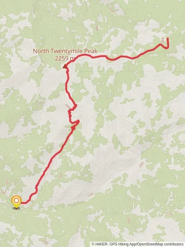
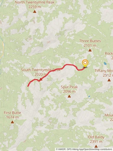
Starting your adventure near Okanogan County, Washington, the Honeymoon Creek trail offers a captivating journey through diverse landscapes. This out-and-back trail spans approximately 17 km (10.5 miles) with an elevation gain of around 1100 meters (3609 feet), making it a moderately challenging hike suitable for those with a decent level of fitness.
### Getting There To reach the trailhead, you can drive or use public transport. If driving, head towards the nearest significant landmark, which is the town of Winthrop, Washington. From Winthrop, take the West Chewuch Road north for about 15 miles until you reach the trailhead parking area. For those relying on public transport, the nearest bus stop is in Winthrop, and from there, you may need to arrange a taxi or rideshare to the trailhead.
### Trail Overview The trail begins with a gentle ascent through a dense forest of Douglas fir and ponderosa pine. As you progress, the path becomes steeper, offering glimpses of Honeymoon Creek as it meanders alongside the trail. The first 3 km (1.9 miles) are relatively easy, with an elevation gain of about 200 meters (656 feet), making it a good warm-up for the more strenuous sections ahead.
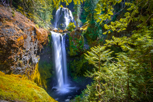
### Significant Landmarks and Nature Around the 5 km (3.1 miles) mark, you'll encounter a picturesque waterfall cascading into a serene pool. This is a great spot for a short break and some photos. Continuing on, the trail becomes rockier and steeper, with switchbacks that offer stunning views of the surrounding valleys and peaks.
At approximately 8 km (5 miles) in, you'll reach a high alpine meadow filled with wildflowers during the summer months. This area is also a prime spot for wildlife sightings, including deer, marmots, and occasionally black bears. Keep your eyes peeled and make sure to follow Leave No Trace principles to preserve the natural habitat.
### Historical Significance The region around Honeymoon Creek has a rich history. It was originally inhabited by the Methow people, a Native American tribe known for their fishing and hunting skills. In the late 19th century, the area saw an influx of settlers during the gold rush, and remnants of old mining equipment can still be found along the trail. These historical artifacts offer a glimpse into the challenging lives of the early pioneers.
### Navigation and Safety Given the trail's moderate difficulty, it's essential to come prepared. Make sure to bring plenty of water, snacks, and a first-aid kit. The weather can be unpredictable, so layers are recommended. For navigation, the HiiKER app is an excellent tool to ensure you stay on the right path and can track your progress.
### Final Stretch The final 1.5 km (0.9 miles) to the turnaround point is the most challenging, with a steep ascent that rewards you with panoramic views of the North Cascades. This section gains about 300 meters (984 feet) in elevation, so take your time and enjoy the breathtaking scenery.
Once you reach the end of the trail, take a moment to soak in the views before retracing your steps back to the trailhead. The descent offers a different perspective and is a great opportunity to spot any landmarks or wildlife you might have missed on the way up.
Reviews
User comments, reviews and discussions about the Honeymoon Creek, Washington.
5.0
average rating out of 5
8 rating(s)


