Blue Lake Ridge
5.2 km
~1 hrs 30 min
283 m
“"Explore the scenic Blue Lake Ridge trail near Packwood, offering moderate challenges, stunning views, and rich history."”
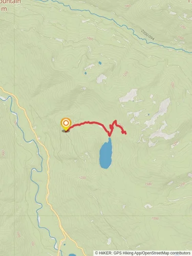
Starting your adventure near Lewis County, Washington, the Blue Lake Ridge trail offers a moderately challenging hike with a total distance of around 5 kilometers (approximately 3.1 miles) and an elevation gain of about 200 meters (656 feet). The trailhead is conveniently located near the town of Packwood, which serves as a good reference point for your journey.
### Getting There
To reach the trailhead, you can drive or use public transport. If you're driving, head towards Packwood via US-12. From Packwood, take Skate Creek Road (Forest Road 52) for about 10 miles until you reach the trailhead parking area. For those relying on public transport, the nearest bus stop is in Packwood, serviced by the Twin Transit system. From there, you may need to arrange a taxi or rideshare to the trailhead.
### Trail Overview
The Blue Lake Ridge trail is an out-and-back route, meaning you'll hike to the end point and return along the same path. The trail is well-marked and maintained, making navigation straightforward. However, it's always a good idea to have a reliable navigation tool like HiiKER to ensure you stay on track.
### What to Expect
#### Initial Ascent
The first section of the trail involves a steady ascent through dense forest. You'll gain about 100 meters (328 feet) in elevation over the first 1.5 kilometers (0.93 miles). The forest is rich with Douglas fir and western hemlock, providing ample shade and a cool environment even on warmer days. Keep an eye out for local wildlife such as deer and various bird species.
#### Mid-Trail Highlights
As you continue, the trail levels out slightly, offering a more moderate climb. Around the 2.5-kilometer (1.55-mile) mark, you'll come across a small clearing that provides a fantastic viewpoint of the surrounding Cascade Range. This is a great spot to take a break and enjoy the scenery. The elevation gain here is gradual, adding another 50 meters (164 feet) to your climb.
#### Final Stretch
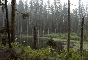
The last section of the trail involves a steeper ascent, gaining the final 50 meters (164 feet) in elevation over the next kilometer (0.62 miles). This part of the trail is rockier, so be sure to watch your footing. As you approach the ridge, the forest opens up, revealing stunning views of Blue Lake below. The lake's crystal-clear waters are a striking contrast to the lush greenery surrounding it.
### Historical Significance
The Blue Lake Ridge area has a rich history, with evidence of Native American presence dating back thousands of years. The region was historically used for hunting and gathering, and you may come across ancient petroglyphs or other artifacts if you venture slightly off the main trail. The area also played a role during the logging boom in the early 20th century, and remnants of old logging equipment can occasionally be spotted.
### Flora and Fauna
The trail is home to a diverse range of plant and animal life. In addition to the towering Douglas firs and western hemlocks, you'll find an array of wildflowers in the spring and summer months, including lupines and Indian paintbrush. Wildlife is abundant, with frequent sightings of deer, elk, and even the occasional black bear. Birdwatchers will appreciate the variety of species, from woodpeckers to hawks.
### Final Tips
Given the moderate difficulty of the trail, it's suitable for hikers of varying experience levels, though some sections may be challenging for beginners. Ensure you have sturdy hiking boots, plenty of water, and snacks. Weather can be unpredictable, so layers are advisable. Always check trail conditions before heading out, especially in the wetter months when the trail can become muddy and slippery.
Enjoy your hike on the Blue Lake Ridge trail, and take in the natural beauty and historical richness of this remarkable area.
Reviews
User comments, reviews and discussions about the Blue Lake Ridge, Washington.
5.0
average rating out of 5
10 rating(s)


