Download
Preview
Add to list
More
7.3 km
~2 hrs 11 min
437 m
Out and Back
“The Weldon Wagon Trail offers scenic views, historical artifacts, and moderate challenges for adventurous hikers.”
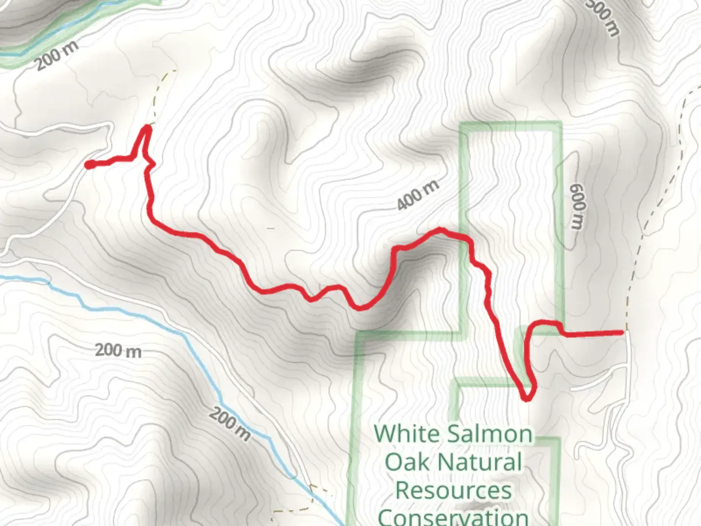
Starting near Klickitat County, Washington, the Weldon Wagon Trail is an out-and-back trail that spans approximately 7 kilometers (around 4.3 miles) with an elevation gain of about 400 meters (approximately 1,312 feet). This trail is rated as medium difficulty, making it suitable for moderately experienced hikers.### Getting There To reach the trailhead, you can drive or use public transportation. If driving, head towards Klickitat County, Washington, and look for the nearest significant landmark, which is the town of Husum. From Husum, follow local roads to the trailhead. For those using public transport, the nearest bus stop is in White Salmon, Washington. From White Salmon, you may need to arrange a taxi or rideshare to reach the trailhead.### Trail Overview The trail begins with a gentle ascent through a mixed forest of Douglas fir and Ponderosa pine. As you progress, the path becomes steeper, offering a moderate challenge. The first significant landmark is a small creek about 1 kilometer (0.6 miles) in, which is a good spot to take a short break and enjoy the serene surroundings.### Historical Significance The Weldon Wagon Trail has historical roots dating back to the late 1800s when it was used by settlers and traders. The trail was a crucial route for transporting goods and supplies between local communities. As you hike, you may notice remnants of old wagon tracks and other historical artifacts, providing a glimpse into the past.### Flora and Fauna The trail is rich in biodiversity. In the spring and summer months, you'll encounter a variety of wildflowers, including lupines and Indian paintbrush. The forested sections are home to deer, squirrels, and a variety of bird species such as woodpeckers and owls. Keep an eye out for these creatures, especially in the early morning or late afternoon.### Mid-Trail Highlights Around the 3-kilometer (1.9-mile) mark, the trail opens up to a stunning viewpoint overlooking the Klickitat River Valley. This is one of the most picturesque spots on the trail and a perfect place for a photo opportunity. The elevation gain to this point is approximately 200 meters (656 feet), making it a rewarding halfway mark.### Navigation For navigation, it is highly recommended to use the HiiKER app, which provides detailed maps and real-time updates. The trail is well-marked, but having a reliable navigation tool can enhance your hiking experience and ensure you stay on track.### Final Stretch The final stretch of the trail continues to climb, reaching the highest point at around 400 meters (1,312 feet) of elevation gain. The endpoint offers another beautiful vista, this time with panoramic views of the surrounding hills and valleys. After taking in the scenery, retrace your steps back to the trailhead.### Preparation Tips Given the moderate difficulty of the trail, it's advisable to wear sturdy hiking boots and bring plenty of water, especially during the warmer months. A lightweight jacket is also recommended as the weather can change rapidly. Always check the local weather forecast before heading out and let someone know your hiking plans.The Weldon Wagon Trail offers a blend of natural beauty, historical significance, and moderate physical challenge, making it a rewarding experience for those who venture out to explore it.
What to expect?
Activity types
Comments and Reviews
User comments, reviews and discussions about the Weldon Wagon Trail, Washington.
4.29
average rating out of 5
14 rating(s)
