Download
Preview
Add to list
More
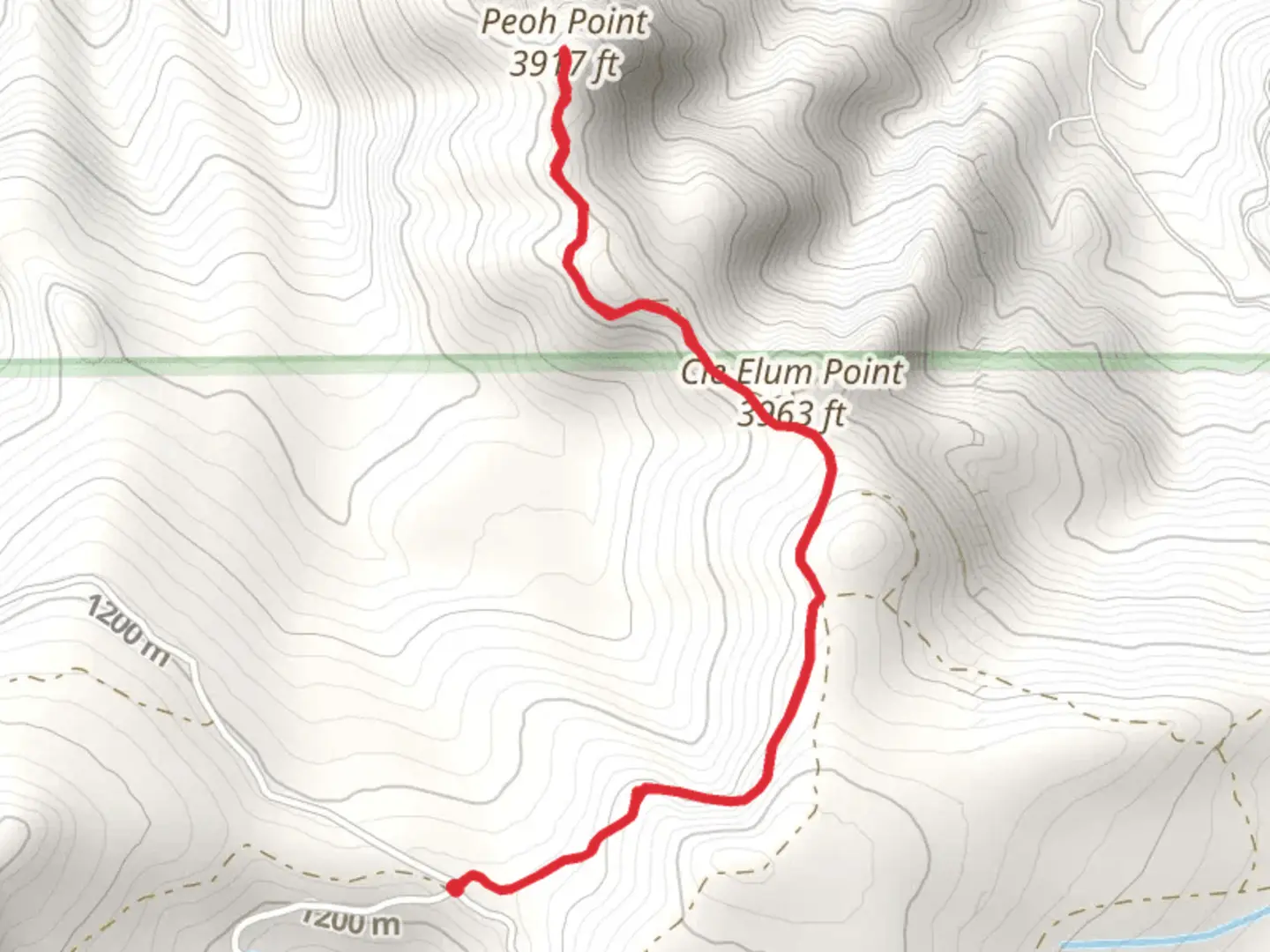
5.5 km
~1 hrs 32 min
270 m
Out and Back
“Experience the Peoh Point trail's stunning vistas, moderate challenge, and rich history in a rewarding 5-kilometer hike.”
Starting your hike near Kittitas County, Washington, the Peoh Point trail offers a rewarding out-and-back journey of approximately 5 kilometers (3.1 miles) with an elevation gain of around 200 meters (656 feet). This medium-difficulty trail is perfect for those looking to experience the natural beauty of the Pacific Northwest without committing to a full-day trek.
Getting There To reach the trailhead, you can drive or use public transport. If driving, head towards Cle Elum, Washington. From there, take South Cle Elum Way and continue onto Peoh Point Road. The trailhead is located near the end of this road. For those using public transport, the nearest significant landmark is the town of Cle Elum. From Cle Elum, you may need to arrange a taxi or rideshare to reach the trailhead, as public transport options are limited in this rural area.
Trail Overview The trail begins with a gentle ascent through a mixed forest of Douglas fir, ponderosa pine, and western hemlock. The initial section is relatively easy, making it a good warm-up for the steeper sections ahead. As you progress, the trail becomes rockier and steeper, so sturdy hiking boots are recommended.
Key Landmarks and Nature At approximately 1.5 kilometers (0.9 miles) into the hike, you'll come across a small clearing that offers your first glimpse of the expansive views to come. This is a great spot to take a short break and hydrate. Continuing on, the trail winds through a series of switchbacks, gaining elevation more rapidly. Keep an eye out for local wildlife such as deer, elk, and various bird species, including the occasional bald eagle.
Historical Significance The Peoh Point area holds historical significance as it was once a lookout point used by Native American tribes and later by early settlers. The name "Peoh" itself is derived from a Native American word meaning "high place," indicative of its strategic importance for both observation and communication.
Final Ascent and Viewpoint The final stretch of the trail involves a steeper climb, but the effort is well worth it. As you near the 2.5-kilometer (1.55-mile) mark, the forest begins to thin, and you'll be greeted with panoramic views of the Kittitas Valley and the Cascade Range. On a clear day, you can see as far as Mount Rainier to the south and Mount Stuart to the north.
Navigation and Safety Given the trail's moderate difficulty and some rocky sections, it's advisable to use a reliable navigation tool like HiiKER to stay on track. The trail is well-marked, but having a digital map can provide extra assurance. Always carry enough water, especially during the warmer months, and be prepared for sudden weather changes typical of the region.
Return Journey After soaking in the views and perhaps enjoying a packed lunch at the viewpoint, retrace your steps back to the trailhead. The descent is generally easier, but take care on the rocky sections to avoid slips and falls.
This trail offers a perfect blend of natural beauty, moderate physical challenge, and historical intrigue, making it a must-visit for hikers in the Washington area.

What to expect?
Activity types
Comments and Reviews
User comments, reviews and discussions about the Peoh Point, Washington.
4.18
average rating out of 5
11 rating(s)