Download
Preview
Add to list
More
4.6 km
~1 hrs 37 min
424 m
Out and Back
“Immerse yourself in the Pacific Northwest's natural beauty on this moderately challenging 5 km hike.”
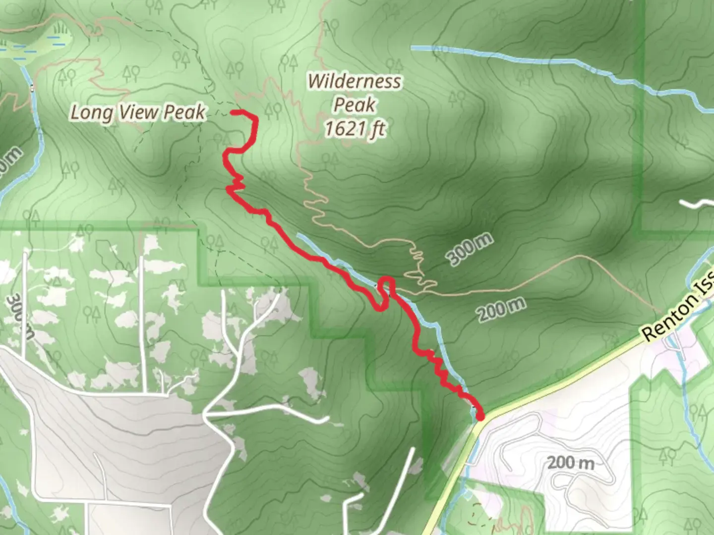
Starting near King County, Washington, the Whittaker Wilderness Creek Trail offers a moderately challenging hike with a total distance of around 5 km (approximately 3.1 miles) and an elevation gain of about 400 meters (1,312 feet). This out-and-back trail is perfect for those looking to immerse themselves in the natural beauty of the Pacific Northwest.### Getting There To reach the trailhead, you can drive or use public transportation. If driving, head towards the nearest known address, which is the intersection of SE 128th Street and 424th Avenue SE in North Bend, Washington. From there, follow the signs to the trailhead parking area. For those using public transport, take a bus to North Bend and then a short taxi or rideshare to the trailhead.### Trail Overview The trail begins with a gentle ascent through a dense forest of Douglas fir and western red cedar. The first kilometer (0.6 miles) is relatively easy, with a gradual elevation gain of about 100 meters (328 feet). As you hike, keep an eye out for the diverse flora, including ferns, mosses, and wildflowers that carpet the forest floor.### Significant Landmarks At approximately 1.5 km (0.9 miles) into the hike, you'll encounter a small, picturesque creek. This is a great spot to take a short break and enjoy the soothing sounds of flowing water. The trail then becomes steeper, gaining another 200 meters (656 feet) in elevation over the next kilometer (0.6 miles). This section can be a bit strenuous, so pace yourself and take breaks as needed.### Wildlife and Nature The Whittaker Wilderness Creek Trail is home to a variety of wildlife. Keep an eye out for black-tailed deer, raccoons, and even the occasional black bear. Birdwatchers will be delighted by the presence of species such as the Pacific wren, varied thrush, and Steller's jay. Remember to respect wildlife by keeping a safe distance and not feeding any animals.### Historical Significance This region has a rich history, with the trail named after Jim Whittaker, the first American to summit Mount Everest. The area was historically used by Native American tribes for hunting and gathering, and remnants of old logging operations can still be seen along the trail. These historical elements add an extra layer of depth to your hiking experience.### Navigation and Safety Given the moderate difficulty of the trail, it's advisable to use a reliable navigation tool like HiiKER to keep track of your progress and ensure you stay on the correct path. The trail is well-marked, but having a digital map can provide extra peace of mind.### Final Stretch The final kilometer (0.6 miles) of the trail involves a series of switchbacks that lead you to a stunning viewpoint overlooking the surrounding wilderness. This section gains the remaining 100 meters (328 feet) in elevation, bringing you to a total of 400 meters (1,312 feet) for the hike. The panoramic views from the top are well worth the effort, offering a breathtaking reward for your journey.After taking in the views, retrace your steps back to the trailhead, enjoying the descent and the opportunity to see the landscape from a different perspective.

What to expect?
Activity types
Comments and Reviews
User comments, reviews and discussions about the Whittaker Wilderness Creek Trail, Washington.
4.73
average rating out of 5
11 rating(s)