Download
Preview
Add to list
More
4.3 km
~1 hrs 7 min
158 m
Out and Back
“Explore lush forests and historical landmarks on this moderate 4 km trail near King County, Washington.”
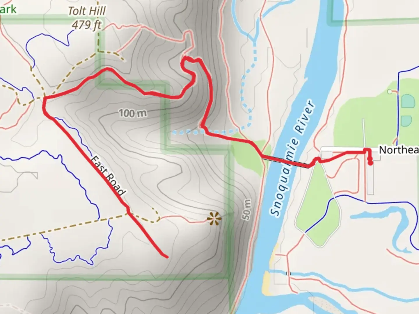
Starting near King County, Washington, this 4 km (approximately 2.5 miles) out-and-back trail offers a moderate challenge with an elevation gain of around 100 meters (328 feet). The trailhead is conveniently located near the Tolt Bridge, which can be accessed by car or public transport. If you're driving, you can park near the Tolt River-John MacDonald Park. For those using public transport, the nearest bus stop is at Carnation, WA, from where you can take a short walk to the trailhead.
Trail Overview
The trail begins with a gentle ascent, winding through a lush forest of Douglas firs and western red cedars. As you progress, the path becomes steeper, offering a moderate workout. The first significant landmark you'll encounter is the Tolt Bridge, an impressive structure that spans the Tolt River. This bridge is not only a marvel of engineering but also offers stunning views of the river below.
Flora and Fauna
As you continue, keep an eye out for the diverse wildlife that inhabits this area. Deer are commonly seen grazing near the trail, and if you're lucky, you might spot a bald eagle soaring overhead. The trail is also home to various bird species, so bringing a pair of binoculars could enhance your experience.
Historical Significance
The region around the Tolt River has a rich history. The area was originally inhabited by the Snoqualmie Tribe, who used the river for fishing and transportation. As you hike, you might notice remnants of old logging roads, a testament to the area's past in the timber industry. These historical elements add a layer of depth to your hiking experience, making it not just a physical journey but also a walk through time.
Navigation and Safety
For navigation, it's highly recommended to use the HiiKER app, which provides detailed maps and real-time updates. The trail is well-marked, but having a reliable navigation tool can help you stay on track, especially in areas where the path might be less clear.
Points of Interest
About halfway through the trail, you'll reach a scenic overlook that offers panoramic views of the surrounding landscape. This is a great spot to take a break, hydrate, and enjoy the scenery. The elevation gain to this point is roughly 50 meters (164 feet), making it a rewarding milestone.
Continuing on, the trail leads you to East Road, where the forest opens up to a more expansive view of the valley. This section of the trail is relatively flat, allowing you to catch your breath before making the return journey.
Final Stretch
The return trip retraces your steps, offering a different perspective on the same beautiful landscape. The descent is easier on the legs, allowing you to fully appreciate the natural beauty around you. As you approach the trailhead, take a moment to reflect on the diverse experiences this short but enriching trail has offered.
Whether you're a seasoned hiker or a beginner looking for a moderate challenge, this trail provides a perfect blend of natural beauty, historical significance, and physical activity.

What to expect?
Activity types
Comments and Reviews
User comments, reviews and discussions about the Tolt Bridge, Itsabitch and East Road, Washington.
4.25
average rating out of 5
4 rating(s)