Download
Preview
Add to list
More
15.2 km
~3 hrs 34 min
314 m
Point-to-Point
“Immerse yourself in the Pacific Northwest's beauty on the scenic, moderately challenging Told Pipeline Trail.”
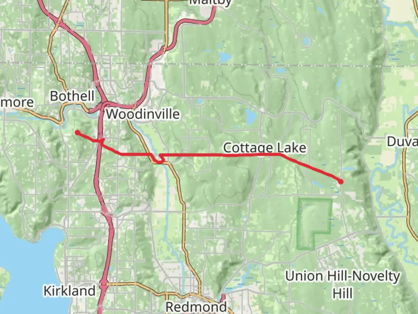
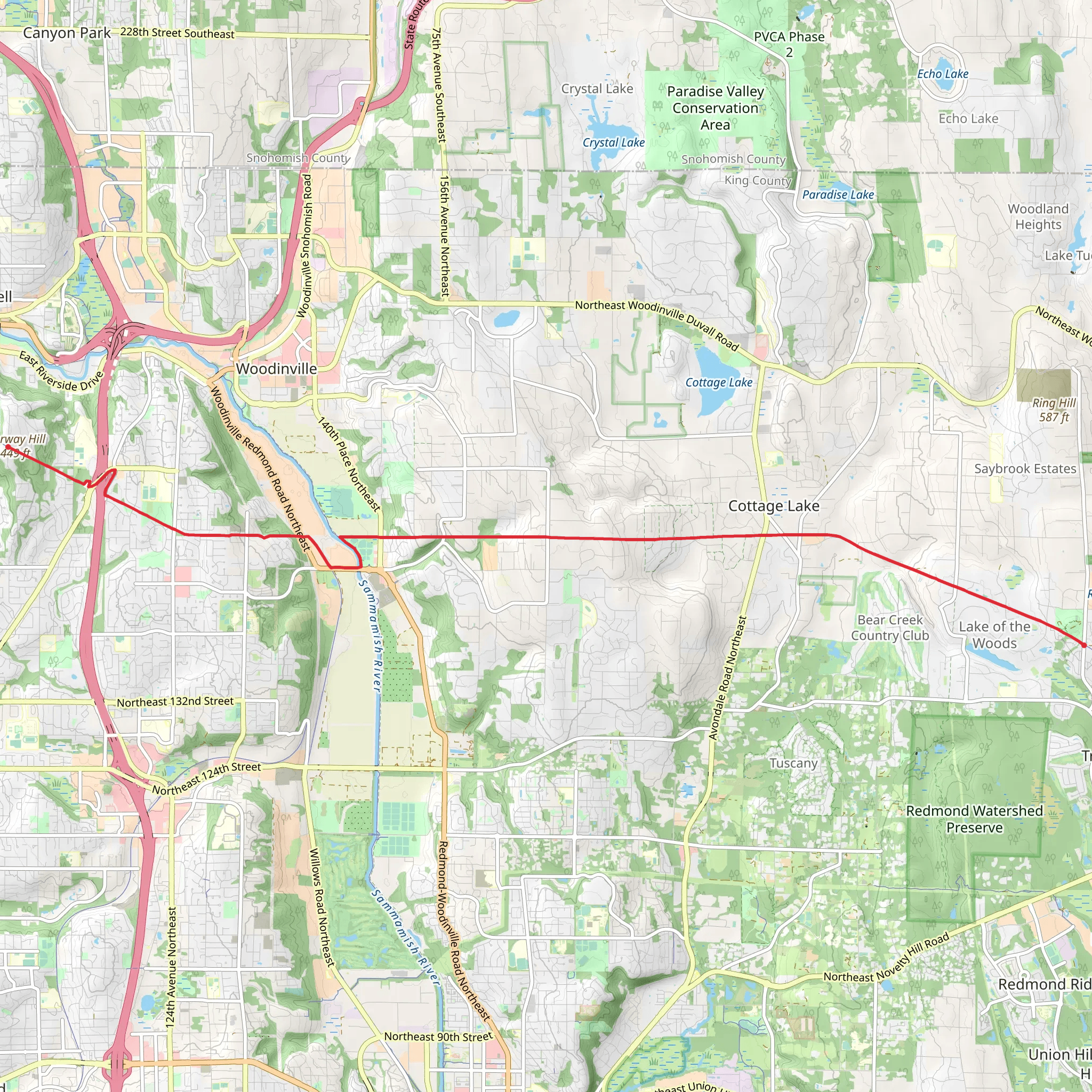
Starting near King County, Washington, the Told Pipeline Trail at Kathryn Taylor Equestrian Park offers a scenic and moderately challenging hike. Spanning approximately 15 kilometers (around 9.3 miles) with an elevation gain of about 300 meters (984 feet), this point-to-point trail is perfect for those looking to immerse themselves in the natural beauty of the Pacific Northwest.
Getting There
To reach the trailhead, you can drive or use public transportation. If driving, head towards the Kathryn Taylor Equestrian Park, which is easily accessible from major roads in King County. For those using public transport, the nearest significant landmark is the Redmond Transit Center. From there, you can take a local bus or a short taxi ride to the park.
Trail Overview
The trail begins at the Kathryn Taylor Equestrian Park, a well-known spot for equestrian activities. As you start your hike, you'll notice the well-maintained paths that are shared with horseback riders. The initial section of the trail is relatively flat, making it a good warm-up for the more challenging segments ahead.
Key Landmarks and Natural Features
1. Forested Sections: About 3 kilometers (1.9 miles) into the hike, you'll enter a dense forest area. The towering Douglas firs and Western red cedars create a canopy that provides shade and a sense of tranquility. Keep an eye out for local wildlife such as deer, raccoons, and various bird species.
2. Pipeline Viewpoint: At approximately 5 kilometers (3.1 miles), you'll reach a clearing known as the Pipeline Viewpoint. This spot offers panoramic views of the surrounding valleys and hills. It's a great place to take a break and enjoy the scenery.
3. Historical Significance: Around the 8-kilometer (5-mile) mark, you'll come across remnants of old logging equipment. This area has historical significance as it was once part of the early 20th-century logging industry that helped shape the region. Informational plaques provide context and history, making it a fascinating stop.
Elevation Changes
The trail features a gradual ascent, with the most significant elevation gain occurring between the 6 and 10-kilometer (3.7 to 6.2 miles) marks. This section can be moderately challenging, so be prepared with proper footwear and plenty of water. The total elevation gain is around 300 meters (984 feet), which is spread out enough to be manageable for most hikers.
Navigation and Safety
For navigation, it's highly recommended to use the HiiKER app, which provides detailed maps and real-time updates. The trail is well-marked, but having a reliable navigation tool can enhance your hiking experience and ensure you stay on track.
Wildlife and Flora
The trail is home to a variety of wildlife, including black-tailed deer, coyotes, and numerous bird species like the Steller's jay and the Northern flicker. The flora is equally diverse, with seasonal wildflowers adding bursts of color to the landscape. In spring and early summer, you'll find lupines, trilliums, and Indian paintbrushes in full bloom.
Final Stretch
As you approach the end of the trail, the terrain becomes more varied, with a mix of open meadows and forested sections. The final 2 kilometers (1.2 miles) offer a gentle descent, leading you to the trail's endpoint. This section is particularly beautiful in the late afternoon when the sunlight filters through the trees, casting a golden glow on the path.
Practical Tips
- Water and Snacks: Ensure you carry enough water and snacks, especially if you plan to take breaks and enjoy the viewpoints. - Footwear: Sturdy hiking boots are recommended due to the varied terrain. - Weather: Check the weather forecast before heading out, as conditions can change rapidly in this region. - Leave No Trace: Follow the Leave No Trace principles to keep the trail pristine for future hikers.
This trail offers a perfect blend of natural beauty, historical significance, and moderate physical challenge, making it a rewarding experience for hikers of all levels.
What to expect?
Activity types
Comments and Reviews
User comments, reviews and discussions about the Told Pipeline Trail - Kathryn Taylor Equestrian Park, Washington.
4.38
average rating out of 5
13 rating(s)
