Download
Preview
Add to list
More
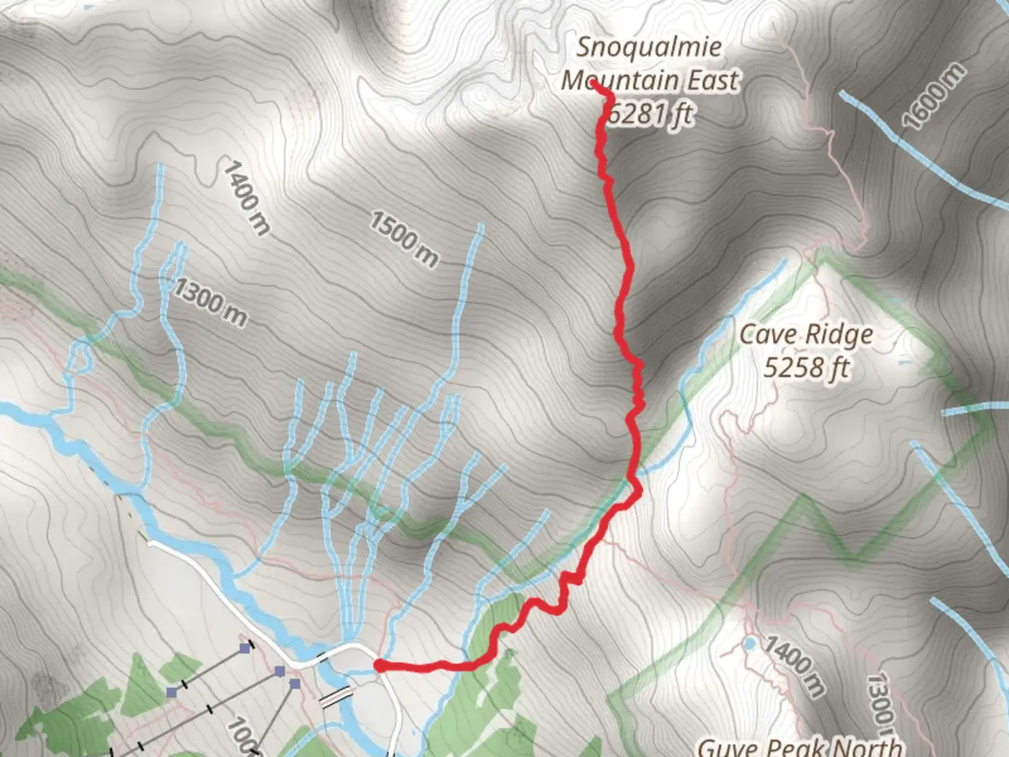
4.7 km
~2 hrs 35 min
982 m
Out and Back
“The Snoqualmie Mountain Trail offers a challenging yet rewarding 5-kilometer hike with stunning views and historical significance.”
Starting your adventure near King County, Washington, the Snoqualmie Mountain Trail offers a challenging yet rewarding hike. This out-and-back trail spans approximately 5 kilometers (3.1 miles) with an elevation gain of around 900 meters (2,953 feet). The trailhead is conveniently located near the Alpental Ski Area, making it accessible for those traveling by car or public transport.### Getting There If you're driving, head towards the Alpental Ski Area, which is well-signposted from Interstate 90. Parking is available at the ski area, but it can fill up quickly, especially on weekends. For those using public transport, you can take a bus to the North Bend Park and Ride, and from there, a taxi or rideshare service can take you the remaining 20 kilometers (12.4 miles) to the trailhead.### Trail Overview The trail begins with a steep ascent through dense forest, where you'll encounter a mix of Douglas fir, western hemlock, and cedar trees. The first 1.5 kilometers (0.9 miles) are particularly steep, gaining about 300 meters (984 feet) in elevation. This section can be slippery, especially after rain, so good hiking boots are essential.### Mid-Trail Landmarks As you continue, the forest opens up, offering stunning views of the surrounding peaks and valleys. Around the 2.5-kilometer (1.6-mile) mark, you'll reach a rocky outcrop known as "The Saddle." This is a great spot to take a break and enjoy panoramic views of the Snoqualmie Pass and the Alpental Valley below. The elevation here is approximately 1,200 meters (3,937 feet).### Flora and Fauna The trail is rich in biodiversity. Keep an eye out for mountain goats, black bears, and a variety of bird species, including the elusive northern spotted owl. In the summer months, the trail is adorned with wildflowers like lupine and Indian paintbrush, adding a splash of color to the rugged landscape.### Final Ascent The final push to the summit is the most challenging part of the hike. The trail becomes rockier and less defined, requiring careful navigation. Using a reliable navigation tool like HiiKER can be invaluable here. The last kilometer (0.6 miles) gains about 300 meters (984 feet) in elevation, bringing you to the summit at approximately 1,800 meters (5,906 feet).### Historical Significance The Snoqualmie region holds historical significance for the indigenous Snoqualmie people, who have lived in the area for thousands of years. The name "Snoqualmie" is derived from the native word "Sdob-dwahibbluh," meaning "moon." The area was also a significant site during the early logging days of Washington State, and remnants of old logging roads can still be seen along the trail.### Descent The descent follows the same path back to the trailhead. While descending, take your time to enjoy the views and be cautious on the steep sections to avoid slipping.This trail offers a mix of natural beauty, challenging terrain, and historical significance, making it a must-do for any avid hiker.

What to expect?
Activity types
Comments and Reviews
User comments, reviews and discussions about the Snoqualmie Mountain Trail, Washington.
4.33
average rating out of 5
9 rating(s)