Sylvia Creek Forestrey Trail and Lake Sylvia State Park
Download
Preview
Add to list
More
4.4 km
~1 hrs 14 min
215 m
Loop
“The Sylvia Creek Forestry Trail offers a scenic, moderately challenging hike rich in natural beauty and history.”
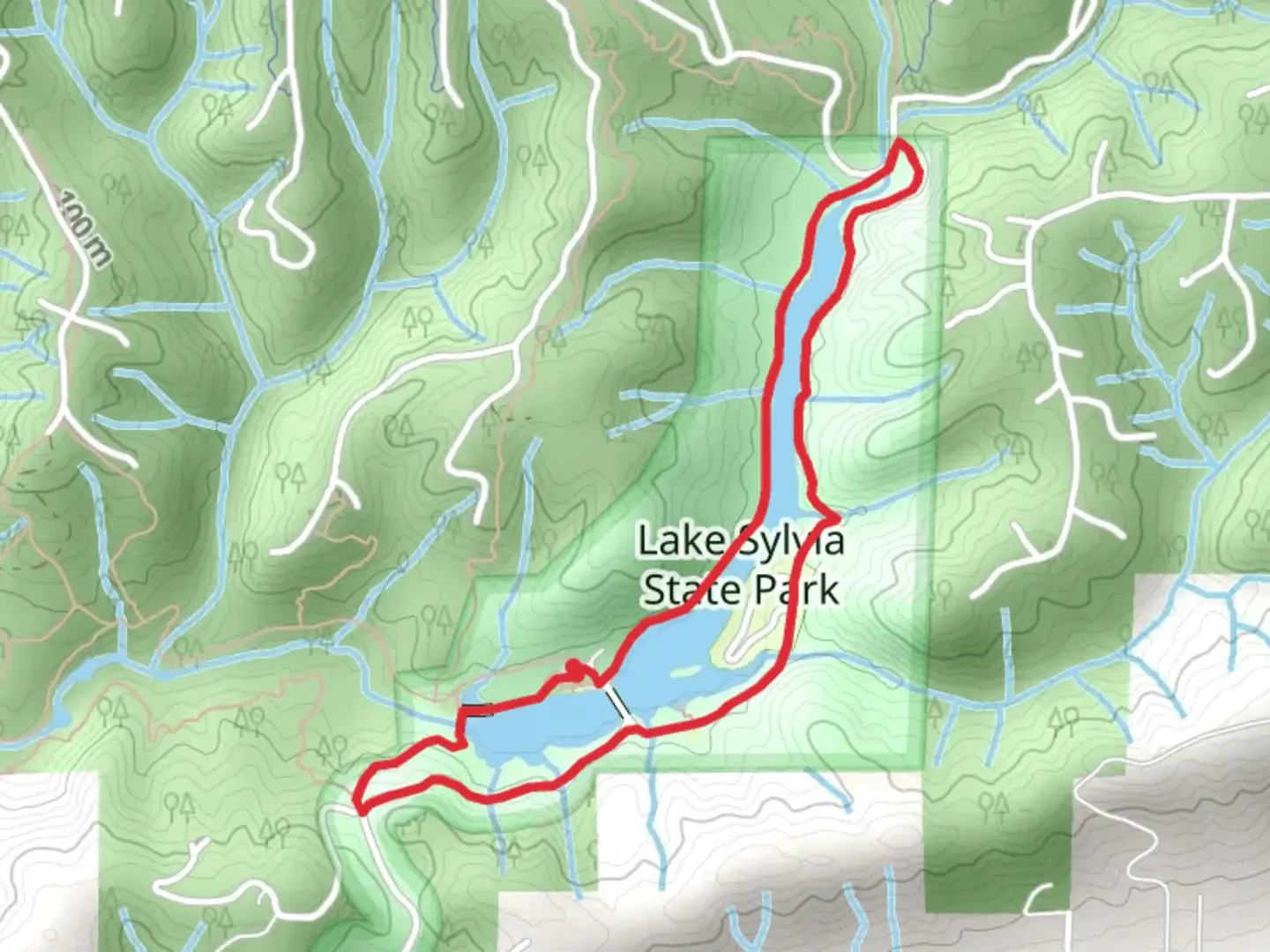
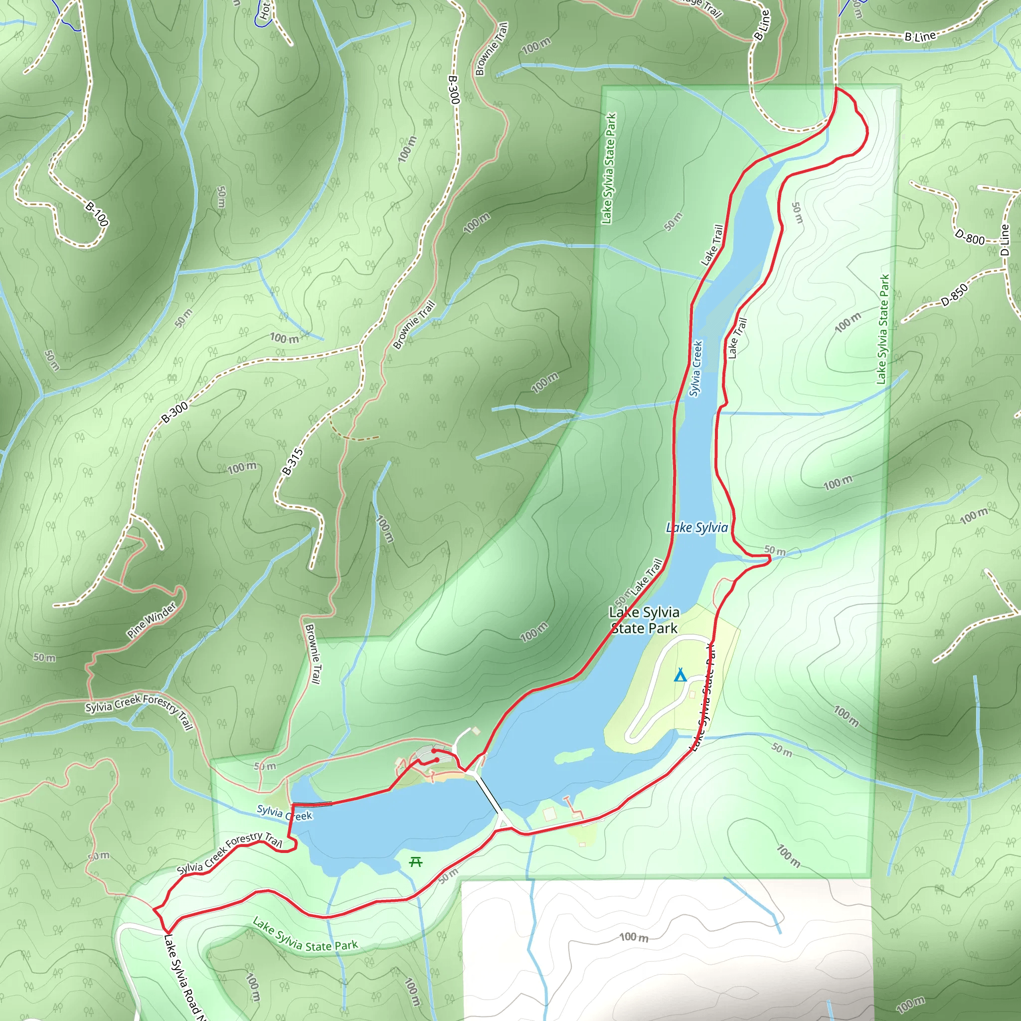
Starting near Grays Harbor County, Washington, the Sylvia Creek Forestry Trail and Lake Sylvia State Park loop spans approximately 4 km (2.5 miles) with an elevation gain of around 200 meters (656 feet). This medium-difficulty trail offers a delightful mix of natural beauty, historical significance, and diverse wildlife, making it a rewarding experience for hikers of all levels.### Getting There To reach the trailhead, you can drive to Lake Sylvia State Park, located near Montesano, WA. If you're using public transport, the nearest significant landmark is the Montesano Transit Center. From there, you can take a short taxi ride or arrange for a local shuttle service to the park.### Trail Overview The loop begins at Lake Sylvia State Park, a serene area known for its picturesque lake and lush forest surroundings. The trailhead is easily accessible from the park's main entrance, where you'll find ample parking and restroom facilities.### Key Landmarks and Points of Interest - Lake Sylvia: The trail starts by skirting the edge of Lake Sylvia, a tranquil body of water perfect for a quick photo stop or a moment of reflection. The lake is also popular for fishing and kayaking, so you might see some anglers or paddlers enjoying the water. - Sylvia Creek: As you progress, you'll follow Sylvia Creek, a gentle stream that adds a soothing soundtrack to your hike. The creek is home to various species of fish and amphibians, so keep an eye out for wildlife. - Old Growth Forest: About 1.5 km (0.9 miles) into the hike, you'll enter an area of old-growth forest. Towering Douglas firs and Western red cedars dominate this section, providing a cool, shaded environment. This part of the trail is particularly beautiful in the fall when the leaves change color. - Historical Significance: The area around Sylvia Creek has a rich history tied to the logging industry. Interpretive signs along the trail provide insights into the region's past, including the early 20th-century logging practices that shaped the landscape. - Elevation Gain: The trail's elevation gain is gradual but noticeable, especially in the second half of the loop. You'll ascend approximately 200 meters (656 feet) over the course of the hike, with some steeper sections that may require careful footing.### Flora and Fauna The trail is a haven for nature enthusiasts. In addition to the towering trees, you'll encounter a variety of ferns, mosses, and wildflowers, particularly in the spring and summer months. Wildlife sightings are common, with deer, raccoons, and various bird species frequently spotted along the trail.### Navigation and Safety For navigation, it's recommended to use the HiiKER app, which provides detailed maps and real-time updates. The trail is well-marked, but having a reliable navigation tool can enhance your experience and ensure you stay on track.### Final Stretch As you near the end of the loop, the trail descends back towards Lake Sylvia, offering a gentle cooldown before you return to the trailhead. The final stretch provides more opportunities to enjoy the lake's serene beauty and perhaps even spot some local wildlife.This trail offers a perfect blend of natural beauty, historical context, and moderate physical challenge, making it a must-visit for hikers exploring the Grays Harbor County area.
What to expect?
Activity types
Comments and Reviews
User comments, reviews and discussions about the Sylvia Creek Forestrey Trail and Lake Sylvia State Park, Washington.
4.27
average rating out of 5
11 rating(s)
