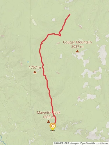
Upper Mad River and Jimmy Creek Trail
Okanogan-Wenatchee National Forest · Chelan County, Washington
13.3 km
~3 hrs 59 min
809 m
“Traverse the Upper Mad River and Jimmy Creek Trail for a scenic, medium-difficulty hike rich in history and wildlife.”
Starting near Chelan County, Washington, the Upper Mad River and Jimmy Creek Trail is an invigorating out-and-back hike that spans approximately 13 kilometers (8 miles) with an elevation gain of around 800 meters (2,625 feet). This trail is rated as medium difficulty, making it suitable for hikers with some experience and a good level of fitness.### Getting There
To reach the trailhead, you can drive or use public transport. If driving, head towards the town of Leavenworth, Washington. From there, take the Chiwawa River Road (Forest Road 6200) until you reach the trailhead near the Mad River. Public transport options are limited, so it's advisable to drive or arrange a carpool.### Trail Overview
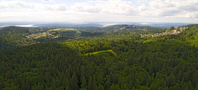
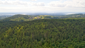
The trail begins with a gentle ascent through a dense forest of Douglas fir and western hemlock. As you progress, the path becomes steeper, offering a moderate challenge. The first significant landmark is the crossing of Jimmy Creek, approximately 3 kilometers (1.8 miles) from the trailhead. Here, you'll find a small wooden bridge that provides a perfect spot for a short break and some photos.### Flora and Fauna
The trail is rich in biodiversity. Keep an eye out for deer and the occasional black bear, especially in the early morning or late afternoon. Birdwatchers will enjoy spotting species like the American dipper and the varied thrush. The flora is equally impressive, with wildflowers such as lupines and Indian paintbrushes adding splashes of color during the spring and summer months.### Historical Significance
This region has a rich history tied to the Native American tribes who originally inhabited the area. The Upper Mad River was a significant route for trade and travel. Artifacts and remnants of old trails can sometimes be spotted, offering a glimpse into the past.### Navigation and Safety
Given the elevation gain and the sometimes rugged terrain, it's essential to be well-prepared. Use HiiKER for accurate navigation and trail details. The app will help you stay on course and provide real-time updates on trail conditions. Always carry a map and compass as a backup.### Key Points of Interest
- Jimmy Creek Crossing (3 km / 1.8 miles): A picturesque spot perfect for a break.
- Midway Viewpoint (6 km / 3.7 miles): Offers panoramic views of the surrounding mountains and valleys.
- Upper Mad River (End Point): The trail culminates at the Upper Mad River, a serene location ideal for a picnic before heading back.### Final Stretch
The return journey retraces your steps, allowing you to enjoy the scenery from a different perspective. The descent is easier on the legs but still requires caution, especially on steeper sections.This trail offers a rewarding experience with its mix of natural beauty, wildlife, and historical significance. Whether you're a seasoned hiker or looking to challenge yourself, the Upper Mad River and Jimmy Creek Trail is a fantastic choice.

Reviews
User comments, reviews and discussions about the Upper Mad River and Jimmy Creek Trail, Washington.
5.0
average rating out of 5
2 rating(s)
Loading reviews...