Download
Preview
Add to list
More
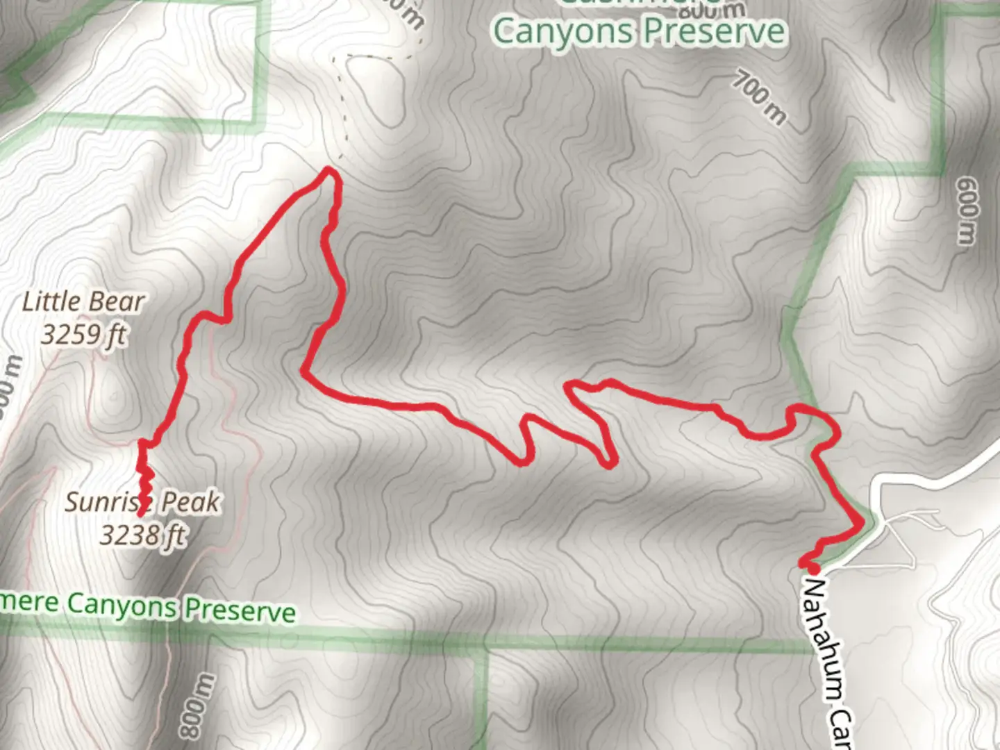
9.1 km
~2 hrs 46 min
576 m
Out and Back
“Experience the vibrant beauty and historical charm of the Pacific Northwest on the Sunrise Peak hike.”
Starting your journey near Chelan County, Washington, the Sunrise Peak via Nahahum Trail offers a rewarding out-and-back hike that spans approximately 9 kilometers (about 5.6 miles) with an elevation gain of around 500 meters (1,640 feet). This medium-difficulty trail is perfect for those looking to experience the beauty of the Pacific Northwest.### Getting ThereTo reach the trailhead, you can drive or use public transportation. If you're driving, head towards Nahahum Canyon Road, which is easily accessible from the town of Cashmere. For those relying on public transport, the nearest significant landmark is the town of Cashmere, where you can catch a local bus or arrange for a taxi to take you to the trailhead.### Trail OverviewThe trail begins with a gentle ascent through a mixed forest of pine and fir trees. As you progress, the path becomes steeper, offering a moderate challenge that will get your heart pumping. The first significant landmark you'll encounter is a small, serene creek about 2 kilometers (1.2 miles) in, which provides a perfect spot for a quick rest and hydration break.### Flora and FaunaAs you continue, keep an eye out for the diverse flora and fauna that inhabit this region. The trail is home to various species of birds, including woodpeckers and hawks. In the spring and summer months, the path is lined with wildflowers such as lupines and Indian paintbrush, adding vibrant splashes of color to your hike.### Midway PointAround the 4-kilometer (2.5-mile) mark, you'll reach a clearing that offers stunning panoramic views of the surrounding valleys and mountains. This is an excellent spot for a longer break, where you can take in the scenery and perhaps enjoy a snack. The elevation gain to this point is approximately 300 meters (984 feet), so you'll have already tackled a significant portion of the climb.### Historical SignificanceThe area around Sunrise Peak has a rich history, with Native American tribes having traversed these lands for centuries. The trail itself was used by early settlers and loggers, adding a layer of historical significance to your hike. As you ascend, imagine the footsteps of those who came before you, navigating this rugged terrain.### Final AscentThe final stretch to Sunrise Peak is the most challenging, with a steeper incline and rockier terrain. However, the effort is well worth it. Upon reaching the summit, you'll be rewarded with breathtaking views of the Cascade Range and the Wenatchee River Valley. The peak offers a 360-degree panorama that is particularly stunning at sunrise, hence the trail's name.### NavigationFor navigation, it's highly recommended to use the HiiKER app, which provides detailed maps and real-time updates to ensure you stay on track. The trail is well-marked, but having a reliable navigation tool can enhance your hiking experience and provide peace of mind.### DescentThe return journey follows the same path, allowing you to enjoy the views from a different perspective. The descent is easier on the legs but still requires caution, especially on the steeper sections.### WildlifeOn your way back, you might spot some of the local wildlife, such as deer or even the occasional black bear. Always maintain a safe distance and follow Leave No Trace principles to preserve the natural beauty of the area.This hike offers a perfect blend of natural beauty, moderate challenge, and historical context, making it a must-do for any hiking enthusiast visiting the Chelan County area.

What to expect?
Activity types
Comments and Reviews
User comments, reviews and discussions about the Sunrise Peak via Nahahum Trail, Washington.
4.45
average rating out of 5
11 rating(s)